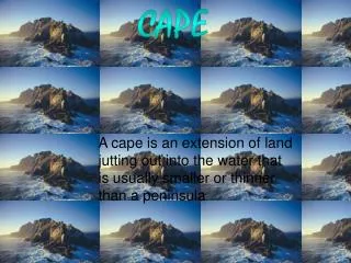
CAPE
CAPE. CARIBBEAN STUDIES IMPACTS OF GEOGRAPHICAL PHENOMENA Presented by Christopher A Humber 2010. PLATE TECTONICS. DEFINITION: The generally fully accepted theory that the solid earth’s surface or crust is divided into several segments (plates) that are in relative motion.

CAPE
E N D
Presentation Transcript
CAPE CARIBBEAN STUDIES IMPACTS OF GEOGRAPHICAL PHENOMENA Presented by Christopher A Humber 2010
DEFINITION: The generally fully accepted theory that the solid earth’s surface or crust is divided into several segments (plates) that are in relative motion.
A divergent/spreading boundary is where the tectonic plates are separating. Some spreading boundaries are places where the crust is sinking downward as it is stretched thin - like in the East Rift Valley of Africa, where the Dead Sea is located. These are places where volcanic activity is at a premium because the crust is being torn open (as in splitting and cracking, like an egg breaking open). New crust is forming when molten lava from deep down oozes out of the cracks where the plates are coming apart . Long chains of undersea mounts (the world's longest is the mid-Atlantic Ocean Ridge) and volcanic islands typically characterize these type of plate margins
The transverse boundaries are places where the two plates are just sliding past each other, like two ships passing on the water . In many of these boundaries there is a lot of tension and strain where the two plates are sliding and scraping past each other. The resulting strain from the sliding action of the plates causes cracks in the crust called faults. As the larger plates move past each other some chunks of crust and overlying rock are broken into fault blocks. When there is a big enough movement along the cracks or faults in the earth's crust we feel it in the form of earthquakes.
A converging boundary is the opposite of a spreading boundary. Typically you will see a converging boundary on a tectonic plate that is on the opposite side of a spreading boundary - of course! The two plates collide upon meeting and then the heavier one will sink or subduct into the mantle below the lighter one. This causes earthquakes and volcanoes to be formed. The N. American plate is converging with the Caribbean plate to form the L. Antilles.
SOIL EROSION The unwanted removal of soil particles from one area to another leading to negative environmental and socio-economic consequences.
GRAVITY: Caused by mass wasting processes such as landslides and soil creep downslope.
WIND: Loose particles are dislodged and carried in the air being suspended.
WATER: Particles are dislodged and carried away by moving surface water.
ICE: Moving glaciers can scrape valley surfaces removing top soil.
SHORELINE: Waves; tides and sea-level changes can redistribute soil particles.
ANTHROPOGENIC: Man through his activities can remove soil particles eg. excavating.
CAUSES Natural Factors • heavy rains on weak soil: rain drops loosen soil particles and water transports them down hill. • vegetation depleted by drought: rain drops are free to hit the soil, causing erosion during rainfall. Winds blow away the fine particles during droughts. • steep slopes: gravity 'pulls harder': water flows faster; soil creeps, slips or slumps downhill. • sudden climate change • rainfall: erosion increases unexpectedly rapidly as rainstorms become more severe. • drought: water dries up and the soil becomes a playball of winds. Soil biota die. A sudden rain causes enormous damage. • changing winds: areas previously sheltered, become exposed.
Human-induced Factors • change of land (deforestation): the land loses its cover, then its soil biota, porosity and moisture. • intensive farming: the plough, excessive fertilizers and irrigation damage the land, often permanently. • housing development: soil is bared; massive earthworks to landscape the subdivision; soil is on the loose. • road construction: roads are cut; massive earthworks, leaving scars behind. Not enough attention paid to rainwater flow and maintenance of road sides.
SOIL CONSERVATION The process whereby measures are adopted or implemented to prevent soil erosion. These measures can be: • Engineering: Altering the gradient of the land. • Agronomic: Incorporating good farming practices and vegetation. • Policy: Laws and regulations.
TERRACING Cutting the slope into steps so as to break the flow of run-off.
GABION BASKETS Using boulder-filled wire baskets to support unstable stream banks and slopes.
RIP-RAP Using loose boulders to protect the shoreline by wave/tidal impacts. The boulder helps to dissipate energy.
CONTOUR PLOUGHING Using ploughs along the contours or hill slope rather than up-down or vertical. The former breaks the flow of run-off whilst the latter produces rills to increase run-off.
NO-TILL FARMING Also known as conservation tillage, is a way of growing crops from year to year without disturbing the soil through tillage. In no-till farming the soil is left intact and crop residues are left in the fields. Variations of the conservation tillage method involve some working of the soil with attention paid to keeping soil compaction and carbon loss at a minimum. These variations include reduced tillage, in which small strips may be plowed to allow space for planting seeds. Other terms, such as incomplete tillage and minimal tillage may be used.
STRIP FARMING Strip farming is a method of farming used when a slope is too steep or too long, or when other types of farming may not prevent soil erosion. Strip farming alternates strips of closely sown crops such as hay, wheat, or other small grains with strips of row crops, such as corn, soybeans, cotton, or sugar beets. It is also known as strip cropping.
WIND BREAKS A windbreak, orshelterbelt, is usually made up of one or more rows of trees planted in such a manner as to provide shelter from the wind and to prevent soil erosion. They are commonly planted around the edges of fields on farms.
DROUGHTS A drought occurs when the average amount of precipitation for a region drops far below the normal amount resulting in adverse environmental and socio-economic effects.
CARIBBEAN 1973 and mid 80s • Bush fires eg. Approx. 50% of the Valencia/Matura forest reserve was destroyed. Loss of biota. • Pipe-borne water supply is disrupted. WASA had to regulate the normal supply. • Agricultural production decreased. Dairy industry affected by heat-stress and poor quality pastures. Farmers could not irrigate plots. • Industries suffered because of lack of water for cooling turbines etc. • Human resource affected leading to a loss in productivity (discomfort; associated diseases etc.) • Soil erosion increased. NB: 1978 Drought in Brazil caused US$ 5,700 millions in damage.
IMPACTS SOCIAL • The power of Ivan, lost homes and possessions caused emotional trauma and shock. Counseling had to be provided. • 39 killed • Looting created further disruption and prisoners escaped causing a breakdown in law and order. A state of emergency was declared with curfew. • 80-90% of houses were damaged or destroyed and up to 8,000 had to sleep in shelters. • There was loss of electricity and limited supply of potable water. Water was also contaminated. Most landline telephones were put out of service and radio transmitters were blown down. • Roads were blocked and the airport partially destroyed and closed down. • The recently built national stadium was damaged.
ECONOMIC • Estimated damage put at US$ 815 million or 200% of GDP. • Tourism sector affected. Out of 1,700 hotel rooms, only three remained in service. Cruise ship port damaged. • Nutmegs, the main farm export had 90% of the plantations destroyed. • Tax revenue was reduced . • Insurance premiums went up. • In the US offshore oil platforms were destroyed reducing outputs in production.
SOCIAL DISPLACEMENT This occurs when a population becomes fragmented or separated during a natural disaster due to evacuation and migration. • Families are broken-up. • Culture and traditions are lost. • Trauma and emotional stress occurs. • Refugees have difficulty settling in new territory (jobs; new cultures etc)
. The 1995-2004 Soufriere volcano disturbances in Montserrat saw the displacement of approx. 8,000 people or 76% of the population. The majority of them went to Britain and neighboring Antigua
CORAL REEFS FRINGING REEF:BUCCOO REEF TOBAGO.
BENEFITS • PROTECT COASTLINE: A well-developed fringing reef is a self-constructed, self-repairing breakwater, which protects the coastline and beaches from erosion. Waves loose much of their erosive power when they break on the reef. Also, much of the sand like on west coast Barbados, is derived from corals which helps to protect the coastline. • FISHING INDUSTRY: Coral reefs provide a habitat for marine life, including fish and shellfish. Species such as conch and lobster are important resources for the fishing and associated tourism industry. • RECREATION & TOURISM:Photography; scuba diving; snorkeling etc. • HERITAGE: Buccoo reef, Tobago part of the island’s pride. • SCIENCE & RESEARCH