Download

1 / 7
70 likes | 297 Vues
EAST ASIA – PHYSICAL GEOGRAPHY. Ch 11 section 1: Japan, Taiwan, China, Korea. Region Overview … . Shares latitudinal range with US, but extends farther north & south so there are some climate similarities in far N and S between E. Asia & N. America;

E N D
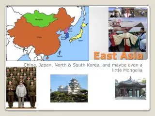
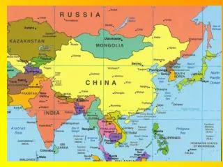
EAST ASIA – PHYSICAL GEOGRAPHY Ch 11 section 1: Japan, Taiwan, China, Korea
Region Overview… • Shares latitudinal range with US, but extends farther north & south so there are some climate similarities in far N and S between E. Asia & N. America; • Part of the region sits at the intersection of 3 tectonic plates so the area is geologically active (ie – numerous earthquakes, volcanoes); • Not mineral rich as a region, but certain areas have important mineral deposits.
JAPAN’S PHYSICAL ENVIRONMENT • Slightly smaller than California (Japan’s Pop = 128 million; California = 37 million); • Temperate climate with extremes far north and south; • Because its an island, temps also vary N/SW (Sea of Japan effect) to Pac. Coast (typhoons) • 85% mountainous + thickly wooded uplands • 2nd most heavily forested industrialized nation (mild, rainy climate + strict conservation laws) • Kanto Plain = largest lowland area- intensive ag. • One of the world’s most geologically active nations
TAIWAN’S ENVIRONMENT • Small Island (size of Md.) • Shape is similar to a large, tilted block; central & east = very rugged; west is well watered plain; • Mild winter climate; susceptible to typhoons; • Extensive forests
CHINA’S ENVIRONMENT…vast & diverse • Southern China – rugged mts./hills/lowlands. Very cold & dry in North (Daba Mts.); warm & wet south. Home of Yangtze R. so great farmland; Xi basin is densley populated; farthest south = maritime lifestyle
CHINESE ENVIRONMENTS • North of the Yangtze: climate = colder/drier but with abundant summer rainfall (except near Gobi Desert); North China Plain is large, fertile & crossed by Huang He River; overall precip. is low & desertification is a problem in places; seasonal water shortages farther north. • WESTERN CHINA: home to Loess plateau; then semiarid stretching to Tibetan Plateau. • FAR NORTHEAST: Manchuria – broad, fertile lowland between mts & lowlands; reaches to China’s border with North Korea.
KOREAN LANDSCAPES • Peninsular Korea is sep. from China by rugged mts. & rivers; Far North is like extreme northeast in USA in climate & southern tip is comparable to California. Koreas are mountainous with scattered, well-watered lowlands. South has more extensive lowlands than north which creates a big agricultural advantage for S. Korea. N. Korea has more abundant minerals, forests & hydroelectric resources. Upland S. Korea is very deforested.