Download
1 / 80
810 likes | 997 Vues
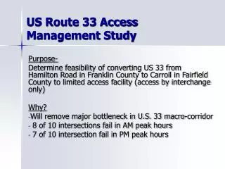
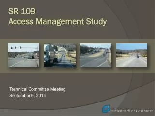
SR 109 Access Management Study. Technical Committee Meeting September 9, 2014. Agenda. Welcome and Introductions Project Management Report Technical Report Next Steps. Study Area. Study Goals and Objectives.

E N D
SR 109 Access Management Study Technical Committee Meeting September 9, 2014
Agenda • Welcome and Introductions • Project Management Report • Technical Report • Next Steps
Study Goals and Objectives • Preserve and enhance the long-term safety, efficiency, economic development, and environmental resources of the SR 109 corridor • Develop an access management plan and permitting process that defines standards and policies for the location, spacing, design and operation of: • Driveways • Street connections • Median openings • Traffic signals • Interchanges
Project Management Report • Project Schedule
Project Management Report • Public Workshops – Objectives • Establish a vision for the corridor • Discuss how access management can help achieve the vision for the corridor • Ask corridor stakeholders to identify areas of concern – opportunities and challenges
Project Management Report • Public Workshops – Agenda • Welcome & Introductions • Presentation – Setting the Context • Establishing Corridor Values and Priorities – Priority Pyramid • Locations of Concern and Opportunities – Mapping Exercise • Establishing a Corridor Vision • Adjourn
Project Management Report • Public Workshops – Location/Dates/Time • Potential locations – two meetings: • Sumner County Administration Building • Wilson County Courthouse • Potential meeting dates/time – 5:30-7:00 pm: • Wednesday and Thursday October 22 and 23 • Wednesday and Thursday October 29 and 30 • Wednesday and Thursday November 12 and 13
Project Management Report • Public Workshops – Outreach • Stakeholder database • Elected and government officials • Property owners along corridor • Other major stakeholders (civic, business, and community) • Workshop announcement • MPO media contact list • State, regional, and local partners – websites and social media
Task 3 - Existing Conditions & Trends • Existing Plans & Programs – Goals & Objectives • Environmental Features & Natural Resources • Land Use and Development Patterns • Travel Demand & Transportation System Performance • Performance Measures
Related Goals & Objectives • Maximize economic opportunity and economic competitiveness by identifying strategic development areas • Maintain the rural character of communities by encouraging development in existing community centers • Preserve environmental features by protecting natural resources • Ensure that the highway operates as a high-speed, high volume transportation facility for the movement of people and goods by managing congestion • Support all transportation modes by providing access to safe and convenient pedestrian, bicycle, and transit systems • Establish and maintain ongoing collaborative partnerships across jurisdictions and agencies by coordinating policies and standards
Analytical Framework • Five segments and fourteen sub-segments • Organized by typical cross section and context • Objective is to analyze key variables at different scales
Land Development and Environmental Constraints • Industrial uses anchor both ends of corridor and ends of Gallatin Bypass • Office, commercial and mixed use concentrations – from Hickory Ridge Rd. to US 70/Lebanon Rd. and adjacent to Gallatin bypass • Residential/rural uses and significant environmental features north of US 70 to River and from Gallatin Bypass to Portland • Strip commercial from River to Gallatin Bypass and through Portland Segment 1
Land Development and Environmental Constraints Segment 2 Segment 3
Land Development and Environmental Constraints Segment 4 Segment 5
Crash Locations • Between 2011-2013, SR 109 averaged more than 430 crashes per year • 30% of the crashes resulted in injuries, including 11 fatalities • Six of the fatalities occurred between US 70 and the Gallatin Bypass • Crashes are concentrated at or near intersections and interchanges, including: • I-40 interchange area • Long Hollow Pike • SR 25/Red River Rd. • SR 52
Crash Rates and Access Points • Crash rates on two sub-segments are twice as high as statewide averages: • I-40 interchange area • Gallatin Bypass between Nashville Pike and SR 25 • Many sub-segments are at or near statewide averages – additional development will present new challenges • Total number of access points – driveways and streets – and signalized intersections strongly impacts safety
Traffic Volumes & Speed • Traffic volumes are projected to more than double by 2040 on SR 109 between SR 840 and Portland • The percentage of truck traffic is forecasted to increase as much as fourfold over the next 25 years • As percent of free flow speed, average peak hour speeds are lowest: • Between I-40 and US 70/Lebanon Road • On the southern end of the Gallatin Bypass • South of SR 52 in Portland
Corridor Travel Time Peak period: 7 AM to 8 AM Southbound 53:45 travel time 42.3 miles per hour
SR 109 Travel Time Today • Free flow • 47 minutes, 8 seconds • Peak hour delay • 6 minutes, 43 seconds
Driveway connections and speed Less connections = more speed
Current practice One parcel = one connection (or more)
Speed guidelines TRB Access Management Manual