Download
1 / 52
550 likes | 906 Vues
Requirements for Stream Buffers and Stream Impacts. Level II: Introduction to Design Education and Certification for Persons Involved in Land Disturbing Activities. Issued May 2009. 1. Overview. What is a State Water? Who determines State Waters? How to determine State Waters

E N D
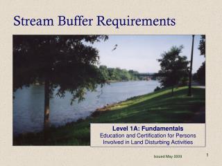
Requirements for Stream Buffers and Stream Impacts Level II: Introduction to Design Education and Certification for Persons Involved in Land Disturbing Activities Issued May 2009 1
Overview • What is a State Water? • Who determines State Waters? • How to determine State Waters • Functions of State Water buffers • What are the rules for State Waters? • GA EPD variance procedures and exemptions
What is a State Water??? • According to the GA E&S Act of 1975, “State Waters” includes any and all rivers, streams, creeks, branches, lakes, reservoirs, ponds, drainage systems, springs, wells, and other bodies of surface or subsurface water, natural or artificial, lying within or forming a part of the boundaries of the State, which are not entirely confined and retained completely upon the property of a single individual, partnership, or corporation.
Who determines State Waters? • In areas where there is a certified local issuing authority (LIA), State Waters determinations are made by the LIA. • In areas where there is not a certified issuing authority, GA EPD will confirm State Waters and buffer delineations as shown on ES&PC plans.
Field Guide for Determining The Presence of State Waters That Require a Buffer • Issued September 2006 by GA EPD • Available at www.gaepd.org and www.gaswcc.georgia.gov
Steps for Determining the Presence of State Waters and Buffer Requirements • Review the topography of the ES&PC Plan for natural or artificial features that may indicate the presence of State Waters. • Walk the site in order to identify State Waters as defined. • Begin the inspection at one end of the potential State Waters and walk the entire length of the State Waters until it exits the property.
Steps for Determining the Presence of State Waters and Buffer Requirements • Examine the drainage feature using the field guide to determine whether the feature is perennial, intermittent, or ephemeral. If the drainage feature is determined to be perennial or intermittent, then a State-mandated buffer exists. If the drainage feature appears to be ephemeral then go to Step 5 to make a final determination.
Steps for Determining the Presence of State Waters and Buffer Requirements • If evidence of base flowis present during the site inspection, the stream is either perennial or intermittent and will require a buffer. If the site is visited during a dry phase and base flows are not evident, the drainage may be ephemeral or intermittent. The ephemeral stream guidance from the field guide should be used to make the final determination as to whether the stream is ephemeral.
Steps for Determining the Presence of State Waters and Buffer Requirements • If there is still a question about base flow after Step 5 is completed, then the “North Carolina Division of Water Quality Stream Identification Method, Version 3.1” (or most current version) should be used to verify whether or not base flow is present. • The determination should be documented in writing.
Wrested Vegetation • Look for a well defined channel and places or patterns of “wrested” vegetation • vegetation wrested from channel by“normal stream flow” or “wave action” • Walking the site to determine State Waters is a must!
Normal Stream Flow Definition • Intermittent headwater streams withbase flow during any period of the yearwill retain the state mandated buffer protection • Base Flow: the discharge that enters a stream channel mainly from groundwater through the soil. Base flow also includes spring flow into stream. • ES&PC design professionals determine existence of base flow, based upon site topography, soils, and vegetation
NormalStream Flow Definition • “Normal Stream Flow,” for non-trout waters only, means any stream flow that consists solely of base flow or both base flow and direct runoff during any period to the year. • “Stream Bank” definition, Rule 391-3-7.01(w). • Applies to State Waters not classified as trout waters. • Waives stream buffer requirements for true storm water drainage features, with no base flow component.
Considerations • Ephemeral trout streams are not exempt from the State-mandated buffer requirements. • Trout (cold water) streams are delineated in the Georgia Water Quality Control Rules (391-3-6-.03). • Buffer requirements are in the NPDES State General Permits for Construction Activities. • DNR Coastal Resources Division should be contacted for marsh delineations. • State Waters may also be Waters of the U.S.
Other “Clues” for State Waters • Soils • Hydric soils • Topography • Drainage Area • Substrate in Channel • Sandy substrate • Vegetation types • “Water-loving” species
Wrested Vegetation Channel
Defined Channel Wrested Vegetation
Misconceptions in State Waters Determinations • These factors are not to be considered: • Whether a stream appears on a topographical map as a solid or dashed blue line • Whether the stream originates on the property • Whether a stream that originates on the property flows into another stream before it leaves the property • The duration of water flow in the stream
Misconceptions in State Waters Determinations • These factors are not to be considered: • The absence of observable aquatic life • Whether or not you “Get your boots wet”
Functions of Buffers • Reduces storm runoff velocities • Acts as a screen for “visual pollution” • Reduces construction noise • Improves aesthetics on the disturbed land • Filters and increases infiltration of runoff • Cools rivers and streams by providing shade
Functions of Buffers • Provides food and cover for wildlife and aquatic organisms • Aids in flood protection • Protects channel banks from scour and erosion
Review of Stream Buffer Rules • Measured horizontally from point where vegetation has been wrestedby normalstream flow or wave action • 25 Feet - Warm Water streams* • 50 Feet - Trout (cold) streams* *Local issuing authorities may require additional buffers in local ordinance!
Coastal Areas • Buffers for saltwater marshes and tidally influenced streams are measured from the marsh jurisdictional line, which is determined by the Coastal Resources Division of the GA DNR, pursuant to the Coastal Marshland Protection Act.
What if it is necessary to work in the buffer? • The minimum 25’ or 50’ (Trout Streams) undisturbed State Waters buffer shall be maintained, except where the Director of GA EPD determines to allow a variance that is at least as protective of natural resources and the environment. • Variances for the State minimum buffer may only be issued by GA EPD, not by local issuing authorities. • Check with Federal regulators to ensure compliance with Federal regulations (U.S. Army Corps of Engineers)
Activities exempt from stream buffer variance requirements: • Drainage structures on warm water streams only • Roadway drainage structures on warm water and trout streams. • Water line, sewer line crossings (within 25 degrees or perpendicular to the stream)
Drainage Structures • A device composed of a virtually nonerodible material such as concrete, steel, plastic or other such material that conveys water from one place to another by intercepting the flow and carrying it to a release point for storm water management, drainage control, or flood control purposes. O.C.G.A 12-7-3 (7)
Roadway Drainage Structures • A device such as a bridge, culvert, or ditch, composed of a virtually nonerodible material such as concrete, steel, plastic, or other such material that conveys water under a roadway by intercepting the flow on one side of a traveled roadway consisting of one or more defined lanes, with or without shoulder areas, and carrying water to a release point on the other side. O.C.G.A 12-7-3 (13)
General Variance for Trout Streams • Average annual flow less than 25 gpm. • Two methods for determination: (1) USGS unit area runoff map to determine watershed acreage (Open-File Report 82-557). (2) Hydrologic analysis by a registered engineer or geologist.
General Variance for Trout Streams • Total length on property cannot exceed 200 feet. • Downstream end of the pipe must terminate 25 feet before the property boundary. • Information must be provided to the LIA or GA EPD, as appropriate.
Buffer Variances Buffer variances will only be considered for the following ten criteria (a – j)
The project involves the construction or repair of a structure which, by its nature, must be located within the buffer: dams public water supply intake structures waste water discharges docks and boat launches stabilization areas of public access to water Buffer Variance Criteria – (a)
The project will result in the restoration or enhancementto improve water quality and/or aquatic habitat quality. Buffer Variance Criteria – (b)
Buffer Variance Criteria – (c) • Buffer intrusion is necessary to provide reasonable access to a property or properties.
The intrusion is for gravity-flow sewer lines that cannot reasonably be placed outside the buffer, and stream crossing and vegetative disturbance are minimized. Buffer Variance Criteria – (d)
Crossing for utility lines, including but not limited to: gas liquid power telephone or other pipelines (provided that the number of crossings and the amount of vegetative disturbances are minimized) Buffer Variance Criteria – (e)
Recreational foot trails and viewing areas, providing that impacts to the buffer are minimal. Buffer Variance Criteria – (f)
Buffer Variance Criteria – (g) The project involves construction of: • one single family home for residential use by the owner of the property and there is no opportunity to develop under any reasonable design configuration.
Buffer Variance Criteria – (h) Project will • require a permit from the U.S. Army Corps of Engineers (COE) for impacts to jurisdictional waters of the U.S. • the COE has approved a mitigation plan • implementation of the plan is a 404 permit condition - Applicable to non-trout waters only -
Buffer Variance Criteria - (i) Project includes a plan that shows that the completed project will maintain or improve water quality downstream of the project. This criteria requires a water quality model acceptable to GA EPD. - Applicable to non-trout waters only -
Buffer Variance Criteria - (j) Project with a buffer disturbance located: • in, or upstream and within 10 linear miles of an impaired stream segment as shown on the Georgia’s Section 303(d) list, and • includes a plan that shows that the completed project will maintain or improve water quality in the listed segment. This criteria requires a water quality model acceptable to GA EPD. - Applicable to non-trout waters only -
Variance Application Review • Applications are reviewed for completeness within 10 calendar days of receipt. • Complete applications are reviewed within 60 calendar days of receipt. • During this timeframe, review comments are forwarded to the applicant or GA EPD issues a 30-day public advisory and advises the applicant to publish a 30-day public advisory.
Application Processing Delays • Not addressing all of the checklist items which results in an incomplete plan • Delayed response to GA EPD comments during the 60-day review period • Not submitting the original tear sheet or affidavit for the applicant’s public notice
New Guidance • Mitigation guidelines for buffer variance criteria (h), (i) and (j). • Guidelines for stream bank and shore line stabilization projects. • New guidelines are currently available on the GA EPD website, www.gaepd.org.
Stream buffer variance and LDA Permits • The LIA may not issue a land disturbing permit for a project proposing to encroach into the State stream buffer until a GA EPD variance has been granted • Do not assume that since the stream buffer variance has been submitted that it will be approved • If a variance is approved, it is the local issuing authority’s responsibility to inspect and enforce for compliance • If the stream buffer variance is not acceptable to the LIA, the LIA may issue an LDA without allowing encroachment into the buffer
Summary • Buffers on state waters are valuable in protecting and conserving land and water resources. • Walk sites and gather all necessary information to determine State Waters • Some activities are exempt from stream buffer requirements • i.e. drainage structures, sewer crossings, etc. • All non-exempt activities within a state water buffer require a GA EPD stream buffer variance