Download
1 / 39
390 likes | 601 Vues
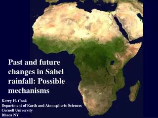
Geo- S cience based Monitoring of Flood Protection Levees: Past, Present, and Future. Southeast Louisiana Flood Protection Authority-East Nunez Community College Auditorium 3700 Fenelon St. Chalmette Dec. 15, 2011. * movie. Goals, Strategy and Execution Field Work Public Awarenes

E N D
Geo-Science based Monitoring ofFlood Protection Levees: Past, Present, and Future Southeast Louisiana Flood Protection Authority-East Nunez Community College Auditorium 3700 Fenelon St. Chalmette Dec. 15, 2011
Goals,Strategy and Execution • Field Work • Public Awarenes • Seismic lessons learned • Goals for coming year
Goals “To Monitor, Prevent and Educate” Use a predictive approach to themonitor flood protection levees that is inexpensive, complementary and involves students. ? ? Weak material? ? ? ? ? ? Weak foundation soils- peat, pressurized sand ? --NOT TO SCALE--
Strategy Geo-science Models ... Prediction based on past experience ? ? Weak material? ? ? piping ? ? ? Weak foundation soils- peat, pressurized sand ? --NOT TO SCALE--
17th St Canal Breach W E ~6m sand ~16 m N S sand ~6-9.00 a.m., Aug. 29, 2005 (Adapted from Rogers et al., 2008; Nelson, 2006)
Sedimentary Facies Saucier 1994
Geotechnical Facies (Adapted from Saucier, 1994)
Strategy Look at natural soil conditions beneath the levee: Non-invasively, quickly & cheaply: • 17th St Canal – peat (Rogers, 2008) • London Avenue Canal – sand (Nelson, 2005)
Execution In such a large system, look for a cluster of problems/ hot spots/ anomalies: How does the oil and gas industry discover oil? • Drill holes? • Systematically collect new data (geophysical, geochemical, geotechnical)? • Study the regional geology of an area?
Execution How does the oil and gas industry find oil and gas? • FIRST Study the geological context of an area/big picture ? • least expensive $1M • predictive models • Big picture • Collect data remotely ($10 M)? Get leads and run probability models • LAST Drill holes? (most expensive, $100 M) Get detailed local information to produce
Field Work • Oct. 14, Field visits and GPR with UNO • Nov 13, 2009 • Shear wave comparisons Lake Villa levee • seep (5 graduates and undergraduates) • Nov. 17, 2009 • Jan 14-15, 201017th St. Canal pseudo-walkaway tests • Seismic shear source profile at 17th St. Canal Sept. 29-Oct. 2, 2010 Breach ( D. PipkinGeol. undergraduate, J. Crane – graduate student) • December, 9, 2010 Trials of high-frequency GPR at London Avenue Canal by UNO • January, 13-15, 2011 Trials of low-frequency GPR at 17th St Avenue Canal Breach (5 undergraduates ) Seismic Microtremor Profile collected at 17th St Avenue Canal Breach (J. Crane, grad.) • May 23-26, 2011 Seismic Microtremor Profile collected along road in front of 17th St Avenue Canal Breach, and Chalmette river levee(D. Schneider, grad. , S. Atesugrad.)
Synergy • Southeast Louisiana Flood Protection Authority – West and East • National Science Foundation student support for 3 years of graduate school (Jason Hicks, M.Sc., 2011) • Chairman’s support from College of Charleston for Prof. S. Jaume time and seismological expertise. • UNO-LSU Group for monitoring group is supported with scholarships for undergraduate and graduate students by the New Orleans Geological Society, the American Petroleum Institute, Southeastern Geophysical Society (Chapter of the Society of Exploration Geophysicists)
Picture below, from left to right, Andrew Ranson, president of the UNO AAPG Student Chapter, (for M.Sc.,UNO) HiranyaSahoo (for Ph.D., UNO) and Prof. Ken Holladay (UNO) conducting a test GPR survey at the 17th St. Canal Breach on a cold January day this year.
Public Awareness • July 15, 2010 • Live display of Seismic levee monitoring equipment • at the 3rd Annual Geological Facts of Life Symposium, New Orleans. • November, 2010 • Devin Villegas* (ugrad, UNO) starts to design website • December 16, 2010 • James Crane* (for Ph.D., 2013; LSU) presents the newly developed seismic gun for seismic levee monitoring at the international meeting of the American Geophysical Union (http://www.geol.lsu.edu/jlorenzo/Abstracts/NOLA.html) • Dec. 2011: M.Sc. • Hicks, J.*, 2011 Investigation into the Cause of Earthen Embankment Instability Along the "V-line" Artificial Levee in Marrero, Louisiana, US., M.Sc., Dept. Geology and Geophysics, LSU August 30, 2011 (Download his thesis at: etd.lsu.edu/docs/available/etd-08302011-110325/). • * scholarship recipients
Seismic Lessons Learned • Two techniques are better than one: Active (traditional) source is more reliable than passive “city-noise” but are complementary Integrate seismic and borehole data. • Surface wave complements conventional reflection and refraction modes. • New tools are needed: Landstreamer works best on soft soil base is efficient.
24 “DRY” “WET” “WET” ~171 m/s
“URBAN -NOISE” Method wet dry wet dry
Shear wave source • Shear source attached to ground by steel spikes • Produces SH waves perpendicular to the line of fire
Ratio of Seismic Wave Velocities SE NW depth (m) higher saturation 200 400 600 800 1000 m
J. Hicks (2012) Master’s Thesis Conclusions • From Cone Penetration Test data and a sedimentary facies maps the “V-line” levee in made using materials with large amounts of organic clay and peat and was built upon materials with large amounts of organic clay and peat • The highest content of organic clay and peat are near the area of instability • The high content of organic clay and peat within and beneath the levee may be a cause of levee instability
Study Area Fault Pattern Dunbar 2008
Slope Failure Types Chen 2000
“V-line” Levee Cross-Section SW NE Berm Level
Goals in 2012 • Demonstrate efficiency • Run 500-m profile using active H and Z source • Integrate Ideas • IDEAL site: truck access on either side of levee, CPT data, boring descriptions • Obtain Recognition • Submit manuscript to Journal of Engineering Geology • Pursue additional funding: • from USACE (ERDC) • planning groups • insurance groups • professional societies