Download
1 / 28
280 likes | 316 Vues
This project involves developing a Soil and Water Road Condition Index to improve watershed protection. It includes literature searches, field testing, and implementation plans. Focus on road maintenance and environmental impact assessment.

E N D
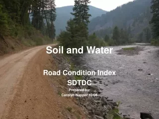
Soil and Water Road Condition Index SDTDC Prepared by: Carolyn Napper 10/06
Project Update 10-17-06 • Literature search of existing indices • Internal search of FS road data collection tools and methodologies • Development of a draft index • Field testing of index nationally
Maine S&PF BMP evaluation methodology developed by S&PF Partially funded by EPA and developed software program during beta-testing
R-5 LTBMU • Characterization of roads for public information • WEPP as comparison
R-5 Los Padres Closed road
R-5 San Bernardino STEEP hillslopes Road segmentation
R-2 Bighorn NF Existing survey by watershed Identify work, implement contracts to reduce sediment delivery to streams on all road levels.
R-2 White River Road-stream connectivity Gully formation R-2 WCP handbook Breckenridge Ski Area
R-10 Tongass Subsurface Drainage
R-9 White Mountain NF Level 2-gated URCI- Bob Eaton, process for evaluation of a road segment
R-8 Ozark-St Francis TNC &FS road inventory Trimble w/Infra and Terra Sync software 10 mi/rd per day/crew
R-8 Ouachita NF Road surveys for Roads analysis, NEPA, using WEPP, relative abundance of benthic fish tied to roads. Pursuing KV dollars for road improvement work. Infra data not reliable
Goal of SWRCI Project • Need to measure the performance of the road improvement and road maintenance programs in meeting our responsibility for protecting watersheds. • Soil and Water road condition index • Photo Guidebook to determine SWRCI • Training module
Road template/Surface Shape information • Stratify roads pre-post documentation • Focuses the reviewer on what they should anticipate from a given road • Insloped roads may have a ditch and relief culverts • Outsloped roads with drainage dips, may want to focus on road gradient, soil texture associated with that type of design. • Could be set up electronically
Colors–Numbers-Adjectives • Pavement Condition Index 0-100 to rate pavement condition • SWRCI is additive, and the higher # is the rating • Could develop a rule set if a tie • Focuses on visual indicators • Useful in the ID team setting
Page 2 of SWRCI • Environmental considerations • Causal factors for erosion and sediment transport • Site specific immediate concern issues
Performance Accountability • USDA FS Strategic Plan Goal 5 Improve Watershed Condition • Program issues for CMRD include: • Lack of road maintenance $ = degraded forest road conditions. • Negative impacts to natural resources
Key Outcome Measures of PAS • % of high clearance & stored roads incompliance with soil and water BMPs (R-10 uses RCS method)Unclear on how RCS identifies compliance and at what scale? • % of car passenger miles meeting soil and water BMPs (% of roads with no identified critical resource protection deferred maintenance needs) SWRCI can identify drainage, erosional concerns • Revised Infra 7/06 task list identifies critical resource=drainage (roadway, x-drain, erosion)
National BMP & EP • On-going effort to develop a national program for all regions. • The effectiveness protocol will meet Goal 5-2 for monitoring water quality impacts of all activities on National Forest Service system lands. • Time frame estimate 18 months
Needs or should be done… • Complete the documentation including references for each indicator. More pictures – limitation is due to • Develop a web page that would have all the existing forms being used. Showcase the forms, uses, and findings. Foster information exchange. • Form needs a software application to increase its use.
Discussion, questions, next steps Discussion & FeedbackNext Steps