Download
1 / 57
580 likes | 651 Vues
Discover the role of tree-ring research in Vermont's historical development from early settlements to present-day agricultural and tourism endeavors. Learn about key landmarks and building progression in southern Vermont and trace the settlement patterns through the centuries.

E N D
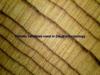
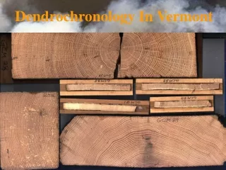
Dendrochronology In Vermont Christopher H. Baisan Laboratory of Tree-Ring Research The University of Arizona Tucson, Arizona
Dr. Andrew Ellicott Douglass of Windsor Vermont, astronomer, father of dendrochronology, examines an increment core on Mt. Lemmon outside Tucson, Arizona.
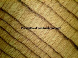
Crossdating: The Basic Principle of Dendrochronology C B A A 1920 1930 B 1900 1910 C 1850 1860 1870 1880 1890
Discovery of HH-39, the “Rosetta stone” of southwestern archaeology.
“The Secrets of the Southwest Revealed by Talkative Tree Rings” 1929 Douglass provides the first calendar dates for the construction of Anasazi ruins in the American South West.
Andrew Ellicott Douglass • Founded LTRR at the University of Arizona in 1937
Lets head up to: Vermont – a large stretch of woods (doing a passing job of obscuring an impressive number of boulders) that separates the Connecticut River from Lake Champlain.
"An accurate Map of His Majesty's Province of New-Hampshire... ...Several exact observations and measurements made by the author. Humbly presented to his Excellency Benning Wentworth Esq. his Majesty's Governor, together with the honorable his Majesty's Council, and the House of Representatives of the Province by their most obedient Servt Sam Langdon" 1756 "This Way the Indians frequently came upon the English Settlements drawn according to information given by Lieutenant John Franks a Hunter well acquainted with the woods, who was taken and carried this Way to Canada, AD 1753." "A Marble Quarry according to Mr. Evans's Plan" "This Way Captives have been carried to Canada."
"All along Connecticut River the finest Settlements might be made upon proper encouragement." "White Pines plenty"
“To the Right Honorable Charles Townshend, his Majesty’s Secretary of War…” 1761 Crown Point military road
“Choice White Pines and Good Land”
“Those towns and Parishes which are so well settled as to be able to support the Gospel among themselves, which is not Generally the case till they have at least 60 or 70 Families, have this character (b) for their Churches. But now AD 1783 the greater part of the new Towns are Settled Those without that mark are either newly granted or thinly inhabited. Many single Branches of Rivers in the ungranted parts of the country are laid down from the information of Hunters and others.” • The Falls on Rivers which obstruct • the navigation are marked thus: || • And the Double prickt Lines point • out the carrying Place.
Timeline • 1724 Ft. Dummer established • 1760 end of French and Indian Wars • Population ~a few thousand • 1777 Vermont declares itself a State • 1780s – the troubled times in Guilford • 1791 Statehood recognized • Population 85,539 • 1800 • Population 154,465
1800 –1870 industrial development • 1830s sheep boom • Settlement height ca. 1840 • 1849 Railroads • 1860-1900 population decline • 1870 - .. Dairy industry develops • 19teens – 1950 population low • Present – agriculture and tourism
Building progression in southern Vermont • 1760 -1780 1st generation buildings, log structures. • 1775 -1800 2nd generation buildings, early meeting houses and other public structures, some milled wood, timber-frame construction. • 1800 - 1860 3rd generation buildings – building boom, milled wood up-and-down sawn, timber-frame construction. • 1860 – 1920 4th generation buildings, balloon-frame construction becomes common, circular sawn milled wood.
Settlement pattern • Along Connecticut River • Hilltops • Wide valleys, hill tops (mills on creeks) • Move to valleys, hill tops slowly abandoned
West Brattleboro Apartments 925 and 929 Western Avenue
The meetinghouse in Guilford center is listed in the Guilford Town history as having been constructed in 1837 with some timbers salvaged from the old “White Meeting House” on the hill. Its bronze bell is cast with that date as well. The town history also suggests that the White Meeting House was constructed prior to 1773, the first record of a town function held in “the meeting house” being on that date. Wood samples from the structure give cutting dates of 1834, for up-and-down sawn hemlock boards, planks, and beams that appear associated with the current configuration of the structure, while pine, oak, (beech and maple) planks, boards, and timbers with evidence of re-use have cutting dates of 1787 based on matching timbers in Massachusetts. These cutting dates suggest construction in 1835 and 1788 respectively. Currently, no structure of similar size and proper age is known as a candidate for the source of the re-used timbers.
A map of the Guilford area and the locations of the meeting houses
What can be agreed upon: • The meeting house was constructed around 1837 and contains substantial recycled elements of a previous structure. • This previous structure was likely longer by one truss and perhaps a bit wider in girth. What remains unclear: • Exactly when it was constructed and • what building is it recycled from and • if it was “The White Meeting House” why the cutting dates do not appear to match the written recollections…. Perhaps, when a good deal more dendrochronology has been done in the area and a bit more digging in the written archives accomplished this will become clear…. Or perhaps not.