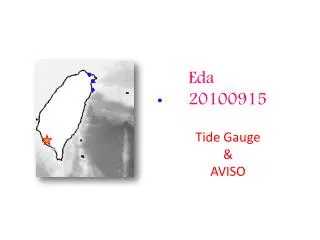
Tide Gauge
Additional data sources found: Meteorological stations in Lesser Antilles from WeatherFlow DataScope Interface. Hurricane Hugo 1989. Tide Gauge. Wind Data. Hurricane Marilyn 1995. Tide Gauge. Wind Data. Hurricane Georges 1998. Tide Gauge. Wind Data. Hurricane Lenny 1999. Tide Gauge.

Tide Gauge
E N D
Presentation Transcript
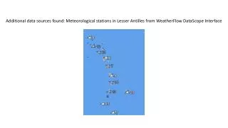
Additional data sources found: Meteorological stations in Lesser Antilles from WeatherFlowDataScope Interface
Hurricane Hugo 1989 Tide Gauge Wind Data
Hurricane Marilyn 1995 Tide Gauge Wind Data
Hurricane Georges 1998 Tide Gauge Wind Data
Hurricane Lenny 1999 Tide Gauge Wind Data
TS Isaac 2012 Tide Gauge Tide Gauge + Met CariCOOSMesonet Buoy (Wave/ADCP/Met) WaveRider
Hurricane Sandy 2012 Same data sources as for TS Isaac 2012 Oct 29 12Z 1,700 km Oct 24 00Z Oct 30 Oct 24: 19 s / 360 deg where from? Then shifted to 270 deg, from storm See Ernesto Rodriguez NWS Post-Mortem Sandy Review