Quaternary Geomorphology
420 likes | 956 Vues
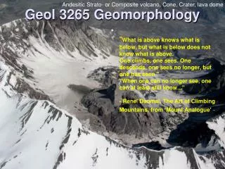
Quaternary Geomorphology. A Workshop for P.G . Candidates December 18, 2010 Dr. Don Thieme . Geochronology, Glacial Intervals, Isotopic Dating, etc... Glacial Landforms and Sedimentary Deposits Soil Classification and Paleosols Sea Level and Coastal Geomorphology.

Quaternary Geomorphology
E N D
Presentation Transcript
Quaternary Geomorphology A Workshop for P.G. Candidates December 18, 2010 Dr. Don Thieme
Geochronology, Glacial Intervals, Isotopic Dating, etc... • Glacial Landforms and Sedimentary Deposits • Soil Classification and Paleosols • Sea Level and Coastal Geomorphology
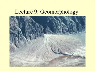
Glaciers • glaciers form where snowfall is high and temperatures low • high altitudes (alpine glaciers) • high latitudes ( ice sheets) • accumulation– addition of snow to a glacier • snowfall • rain • ablation – the loss of snow and ice from a glacier • melting • sublimation • calving
Inputs (zone of accumulation) vs. Outputs (zone of ablation) Three Possible Situations: Inputs > outputs - advancing glacier Inputs = outputs – stationary glacier Inputs < outputs – retreating glacier end moraine till plain end moraine
Ogives • “waves” or “bands” of ice • annual features useful for calculating velocity of glacial advance and retreat • also indicate glacier base and margins Ogives icefield near Juno, AK
Eskers - subglacial origin Esker fill near Plattsburgh, New York showing “openwork” (clast-supported) gravel overlying coarse sand beds
"morphosequence" of glacial and proglacial landforms • all deposits laid down as the ice stood at a mappable location on the Earth's surface. • proglacial deposits are supplied by the "dirt machine" that occurs where live ice rides up over stagnant ice.
Proglacial rivers or lakes may begin directly in front of the stagnant ice: (A = fluvial ice-contact; C = lacustrine ice-contact). Proglacial lakes may be fed by meltwater rivers (D = Fluvial lacustrine ice-contact)
Rivers may be fed by water from a proglacial lake through a spillway (F = Lacustrine fluvial ice-contact)
glaciers dam pre-existing rivers • glaciers depress the land surface, forming new lake basins • glaciers produce moderate to large volumes of water during spring thaw • continental glaciers produced particularly large volumes of water when they melted back during the late Pleistocene
Nellie Juan Glacier and terminal moraine, Prince William Sound, Alaska. (http://pubs.usgs.gov/of/2004/1216/m/m.html)
Ohio and Missouri Rivers follow ice margins Glacial Lakes occur north of both rivers No Glacial Lakes south of these rivers
Climbing ripples from an ice-contact delta in Rhode Island Varves in a Swedish glacial lake
The "channeled scablands" in Washington state were formed by outburst floods from proglacial Lake Missoula
Shelbyville Carbondale
Devensian glaciation (OIS- 2, 4) followed by the Flandrian transgression (OIS-1) in England, Wales, and Scotland