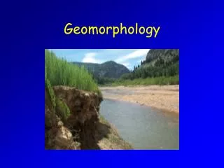
Geol 3265 Geomorphology
440 likes | 748 Vues
Andesitic Strato- or Composite volcano, Cone, Crater, lava dome. Geol 3265 Geomorphology.

Geol 3265 Geomorphology
E N D
Presentation Transcript
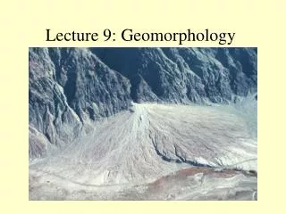
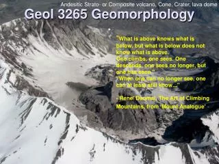
Andesitic Strato- or Composite volcano, Cone, Crater, lava dome Geol 3265 Geomorphology • "What is above knows what is below, but what is below does not know what is above. One climbs, one sees. One descends, one sees no longer, but one has seen.""When one can no longer see, one can at least still know..." - Rene' Daumal, The Art of Climbing Mountains, from 'Mount Analogue' -
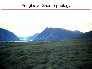
Snowfall in the zone of accumulation Course Description • Analysis of the various land forms of the Earth's surface in terms of their form, origin, and evolution. Field observations. Mathematical and experimental models. • The influence of the different geologic and climatic environments upon the development of land forms. • Map and air photo interpretation. Arête, ice cap, cirque glacier, plucking, frost wedging Some photos by John Scurlock Used with permission
Prerequisites • I assume you have • The basic skills taught in Geol 1200 Lab • A basic knowledge of: • physical geology • historical geology • including: • Plate Tectonics • Climate changes in the Cenozoic • Surface changes in the Cenozoic • and you can use basic Algebra and Trigonometry Roche moutonnée, hanging valleys, main trunk, u-shaped valley
All sciences are based on nomenclature, literacy, hypothesis and test • Nomenclature • Knowing the names of objects • Literacy • Knowing previous work • Hypothesis • Forming explanations • Test • Checking testable consequences Waterfall, v-shaped valley, plume, uplift, base level, rhyolitic, ash
Why Study Geomorphology? • Understand the present • Interpret the past • Uniformitarianism • James Hutton, Charles Lyell • Example: Charles Darwin and Atolls • http://en.wikipedia.org/wiki/Atoll http://en.wikipedia.org/wiki/Uniformitarianism_(science)
In your introductory geology class, you learned about surface features. In this class, we try to understand how and why they have their shape Sea-stack, tides, tombolo, erosion by waves
Tools of Geomorphology • Maps • Topographic • Surface Geologic • Air photos • Math Models • Experiments • Ground Truth Example: pointbar and cutbank. mid-channel bar, incised meander
Fanabosi Tsunami Chevrons, Southern Madagascar Aerial and Satellite Photos
Stereo photos The Highlands of Scotland contain many examples of the products of upland glacial erosion. This anaglyph shows typical cirques, arêtes and tarns, as well as the rugged bare rock surfaces resulting from subglacial plucking. Scale 1: 25 000.(C) 2000 Steve Drury Used according to guidelines
Godfrey Ridge East and Brodhead Creek, DWG, PA, , detail Topics of Geomorphology • Agents • “that which acts or has the power to act” • Water and ice, wind • Subsurface Modifiers • Tectonic compression, tension and shear • Processes • “progressive steps by which an end is attained” • Weathering, erosion, transport, deposition • Energy Sources • Solar, geothermal, gravitational, chemical
Rise of Geomorphic Thought • Observation and hypothesis – Herodotus 450 BC • Description – Hutton – 1700’s+ • Explanation 1800’s • Agassiz – glacial landforms • Powell (1834 -1902) – fluvial/structure • Gilbert (1843 -1918) – All surfaces • Correlation • Davis (1850 -1934) – fluvial+ • Quantification and prediction – now a common goal Geomorphology History flashcards Horn, cirque, col, rock slide, talus
Herodotus (484 - 425 B.C.) • Rocks on land in Egypt contained marine fossils. • Assumed that the Nile Delta took thousands of years to form.
Aristotle (384 - 322 B.C.) • Dry land can be submerged. • Land can be raised from beneath the ocean. • Described erosion by rivers, and deposition in deltas.
Lucretius (99-55 BC): Recognized weathering processes on rocks. • Seneca (3-65 AD): Observed erosion of valleys by running water. • Ibn-Sina (980-1037 AD): Concluded that mountains could be uplifted, and later eroded.
Renaissance Period • Leonardo DaVinci (1452-1519) found marine fossils on land • G. Bauer [“Agricola”] (1494-1555) hypothesized that mountains were sculpted by weathering and mass movements • Steno (1638-87) regarded water as the most significant agent of erosion viscosity
Landscape Creation vs.Landscape Development • Biblical interpretations hindered the proliferation of non-catastrophic landform evolution theories. • Werner (1749-1817) theorized that all mountains formed under water as layers of sediment, , and were ultimately sculpted by rapidly receding oceans.
Catastrophic Theories • Georges Cuvier: Great catastrophic floods produced unconformities, and carved Earth’s landscape.
James Hutton (1726-97) • Granites form through heat & fusion deep underground, and are later uplifted and exhumed. • Landforms are produced by slow, continuous processes. • Uniformatarianism
Hutton (continued) • Sediments are eroded from landforms, only to be deposited and later lithified into new rocks. • There is neither an apparent beginning nor end to landform development.
Hutton’s Proponents • John Playfair (1748-1819) – Illustrations of the Huttonian Theory of the Earth (1802). – Streams carve their own drainage systems. – Stream reaches and maintains equilibrium, adjusted to local gradient. CONCEPT OF “GRADED STREAM” – The Earth is very ancient; ongoing processes continue to change it. • Charles Lyell (1797 - 1875) The Principles of Geology (1833 - 1875) A strong promoter of Uniformitarian theory A vehement opponent of Catastrophism
Other Nineteenth CenturyEuropean Contributions • Venetz, and Bernardhi: Moraines and erratics prove glaciations extended from polal regions(1832) • Louis Agassiz : Recognized glacial landforms in Europe & N. Am.- introduced the concept of Ice Ages (1837) http://books.google.com/books?id=d4erqwFkgu4C&pg=PA8&lpg=PA8&dq=Bernhardi+glacier&source=bl&ots=uDleT4NQiv&sig=OracgXNC5nHLD5FtVwA5JqkvWbY&hl=en&sa=X&oi=book_result&resnum=1&ct=result#PPA8,M1
Charles Darwin • Recorded his observations during the voyage of “the Beagle.” • Suggested an origin for atolls
Grove Karl Gilbert • (1890) Recognized some Utah landscapes were formed by Pleistocene Lake Bonneville. Great Salt Lake and Bonneville salt flats are remnants • Contributed to the understanding of river incision. • Identified lunar craters as caused by impacts, and carried out early impact - cratering experiments
William Morris Davis 1850 -1934 • Davis' Cycle of erosion An example from an arid climate. Davis' idea of a peneplain
Our Goal • We wish to understand surface topography at a fundamental level. • At a course scale, the next slides show surface topography of North America classified into geomorphic provinces. • We want to understand on a much finer scale.
Concepts in Geomorphology • Systems • “an assemblage of parts forming a whole” • Fluvial, glacial, coastal, • foreland basin, collisional mountains • Climate • Determines dominant agents • Time • Reshaping = "Evolution" of landforms/landscapes • Systems can dominate large areas. • Regions summarized as Physiography Maps
Regional Physiography Topography Early geomorphologists recognized these provinces based on topography
Regional Physiography You should all be able to explain every province: Plate Tectonics, Earth History
What will our hill do if it rains? • Understanding geomorphic processes requires a little applied physics. For example, we will study mass wasting. • Geomorphologists conduct experimental determinations of friction with rock and ice when considering slope failure and glaciers. Chalkboard, resolve weight mg into components parallel and opposite Ff and N
Notice a is 90 - dip • Chalkboard: right triangle, unit circle, sine and cosine • To keep the rock from sliding, the static friction force Ff must be greater than the opposing component of gravity force Fo, that is parallel to the slope. • If the vertical makes an angle a to the slope, then this friction opposing force Fo is • Fo = mg cos a • This is the frictionforce just before the rock slips • If rain gets between the surfaces, or the rock moves friction force Ff decreases F0 mg cos a a mg
If the vertical makes an angle a to the slope, then this friction opposing force Fo is • Fo = mg cos a just before the rock slips • Just before the rock moves, all forces are in balance, so Ff = - F0 = - mg cos a • = - mg cos(90 – dip) • = - mg sin (dip) Notice a is 90 - dip F0 a
Another look Look at the lower angle b, between the weight mg, and the normal direction i.e. perpendicular to the slope. The sine of angle b = ord / hyp sin b = Fo / mg so F0 = sine b x mg slope angle F0 b For the rock to slide, Friction Ff must be less than F0
Earth material densities kg/m3 • Earth, dense 2002 • Earth, soft loose mud 1730 • Andesite, solid 2771 • Basalt, solid 3011 • Granite, solid 2691 • Dolomite, solid 2899 • Limestone, broken 1554 • Sandstone, solid 2323 • Slate, solid 2691 • Snow, freshly fallen 160 • Snow, compacted 481 • Ice, solid 919 • Water, pure 1000 • Water, sea 1026 These densities will allow you to calculate the weight, mg, of a block of soil, rock or ice with known volume. http://www.simetric.co.uk/si_materials.htm
Example for Homework • A loose piece of basalt has dimensions 1 meter x 8 m x 4 m • Calculate the volume • The density of basalt is 3011 kg/m3 Calculate the mass m in kg Calculate the weight mg in Newtons 3. The rock sits on a slope of 35o What Friction Force is necessary to keep the rock from sliding downhill?
Example for Homework • 1. 1x8x4 = 32m3 • 2. 3011 kg/m3 x 32 m3 = 96352 kg • 96352 kg x 9.81 m/sec2 = 945213.12 N • 3. The angle b is the same as the slope. • F0 = sine b x mg = sine 35 x 945213.12 N • For the rock to slide, Friction Ff must be less than F0. If it is greater or equal, it won’t slide. 54612 N
Geomorphologic Prejudices • Uniformitarianism ~ Gradualism dominates. • Orderly sequences are predominant. • Climate dominates structure. • Most landscapes are Quaternary i.e. surface shaping is fast. • There are simple explanations for most landforms. Mass wasting, slope failure and basal sliding from Ellesmere Islands
Future Labs • Earth scientists must be able to recognize and interpret surface features using topo maps and air and satellite photos. Before you head to the field, you need to know what to expect. • You must be able to recognize geomorphic features in map and side view from your prospective field area, before your field studies begin. • We will improve your skills with these tools in the laboratory portion of the course.
Homework for this class • For homework you will answer questions from the lectures and labs, and will do calculations and make observations based on lecture and lab topics. • Homework is practice for the tests • Again, your previous knowledge from Geology 1200 is assumed for all tests. If you hear something mentioned that you do not recall, look it up immediately.