Download
1 / 31
330 likes | 614 Vues
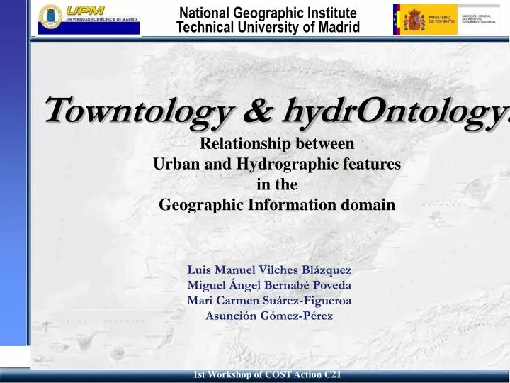
Towntology & hydrOntology: Relationship between Urban and Hydrographic features in the Geographic Information domain. Luis Manuel Vilches Blázquez Miguel Ángel Bernabé Poveda Mari Carmen Suárez-Figueroa Asunción Gómez-Pérez. Content. Relationship between Hydrography and Urbanism

E N D
Towntology & hydrOntology:Relationship between Urban and Hydrographic featuresin the Geographic Information domain Luis Manuel Vilches Blázquez Miguel Ángel Bernabé Poveda Mari Carmen Suárez-Figueroa Asunción Gómez-Pérez
Content • Relationship between Hydrography and Urbanism • Integration of Geographic Information • Problems • Semantic Differences • Ontological frameworks • hydrOntology • Criteria for structuring • Methontology • Towntology and hydrOntology • Conclusions
Relationship between Hydrography and Urbanism • Richness of the urban environment • Natural features • Artificial objects • Urban & Hydrographic features • They characterize some aspects of city planning • Urban infrastructures for: • water supply, • distribution and • clean-up
Rivers have often been a key factor in the configuration of city maps. We find retaining walls in river banks for canalization Bridges as road or passanger ways are usual River and urban infrastructures
Different type of pipe lines for differet type of services Distribution services from storing areas Supply services Clean-up services Piping: a key role
Cloaca / sewer Alcantarilla / sewer Sewer system
Integration of Geographic Information • For integrating the hydrology and the urbanism domains we used the “feature” concept. • Feature • An abstraction of a real world phenomenon with a location on the earth. • Two levels: • Feature instances • Feature types • Open GeoSpatial Consortium
Integration of Geographic Information • For integrating the hydrology and the urbanism domains we used the “feature” concept. • Feature • An abstraction of a real world phenomenon with a location on the earth. • Two levels: • Feature instances • Feature types • Open GeoSpatial Consortium
Integration of Geographic Information • For integrating the hydrology and the urbanism domains we used the “feature” concept. • Feature • An abstraction of a real world phenomenon with a location on the earth. • Two levels: • Feature instances • Feature types • Open GeoSpatial Consortium
Integration of Geographic Information • For integrating the hydrology and the urbanism domains we used the “feature” concept. • Feature • An abstraction of a real world phenomenon with a location on the earth. • Two levels: • Feature instances • Feature types • Open GeoSpatial Consortium • Feature is not fixed at only one class in one exclusive domain. It depends of the classification domain
Problems • Great variety of sources • Near 20 different producers in Spain (national and local cartographic institutions with different interest) • Various degrees of quality and structuring of information • Natural language ambiguity • Synonymy, polysemy, hyperonymy and homonymy • Scale factor (local, regional and national)
Problems • Great variety of sources • Various degrees of quality and structuring of information • ICC has 49 features classes in total • IGN has (only in hydrographic features) 40 features classes • Natural language ambiguity • Synonymy, polysemy, hyperonymy and homonymy • Scale factor (local, regional and national)
Problems • Great variety of sources • Various degrees of quality and structuring of information • Natural language ambiguity • Synonymy: Different word with the same meaning. • riverside, riber bank • Polysemy: Same word with different meanings. Bank • Bank: Financial institution • Bank: Relay upon (trust) • Hyperonymy: One word includes other. Bank and Morgan Bank • Homonymy: Same figure but different meaning Bank • Bank: Riverside • Bank: Financial institution • Scale factor (local, regional and national)
Problems • Great variety of sources • Various degrees of quality and structuring of information • Natural language ambiguity • Synonymy, polysemy, hyperonymy and homonymy • Scale factor (one village may be represented as a point X,Y or as an area XN, YN)
Semantic Differences • River: • WFD: “A body of inland water flowing for the most part on the surface of the land but which may flow underground for part of its course”. • Ordnance Survey: “Water flowing in a definitive channel towards the sea, a lake or into another river”. • NGI-S: “Natural freshwater stream”. • Harmonization has not been achieved
Ontological frameworks • Solution: A generic semantic frame • With common structure • With common semantic • (Possible in all languages?) • Two words: Fleuve, Rivière (fr) • One word: Rio (Sp, Pt), River (En), Fiume (It), Flu (German) • Enharced accessibility • Interrelated between (and valid for) different domains • Our proposition in the hydrographic domain: HydrOntology
hydrOntology • HydrOntology • A concurrent model to solve the structuring and harmonization problems for the GI community. • Its purpose is to serve as a harmonization framework among the Spanish cartographic producers, trying to disseminate it internationally, making it available to GI producers. • We intend to provide the necessary steps to obtain a better organization and management of the hydrological features. 11
Criteria for structuring • Abstracts concepts from: • Water Framework Directive • Proposed by the EU Parliament and EU Council • List of hydrographic phenomena definition • Part of the model from: • SDIGER Project (University of Zaragoza. Spain) • INSPIRE pilot project • Two river basins, two countries, two languages • Several semantic criteria from: • WordNet • Encyclopaedia Britannica • Diccionario de la Real Academia de la Lengua • Wikipedia • Several domain references • Inheritance: From various actual catalogs
Task of Methontology • Task 1: Glossary of hydrOntology terms. • Feature Catalogues of the Numerical Cartographic Database (1:25.000; 1:200.000; 1:1.000.000) • Different Feature Catalogue from other local producers. • EuroGlobalMap & EuroRegionalMap • Water Framework Directive • Alexandria Digital Library, Dewey • Thesauri (UNESCO, GEMET, Getty Thesaurus of Geographic Names, etc.) • National Geographic Gazetteer • Bibliography (Dictionary, Water, Law, etc.) • This glossary contains more than 100 concepts
Task of Methontology • Task 2 & 3 • Taxonomy of concepts. • First approach • Ontological relationship • SubclassOf (Father-Son relationship) • Disjoint-Decomposition see later • Exhaustive-Decomposition see later • Partition see later
C C2 C1 C3 ontological relationship • Disjoint-Decomposition Relationship: • Aset (C1 C2 and C3) of subclasses of C that do not have common instances and do not cover C.
C C2 C1 C3 ontological relationship • Exhaustive-Decomposition:A set (C1, C2 and C3) of subclasses of C that cover C and may have common instances and subclasses
C C2 C1 C3 ontological relationship • Partition: • A set (C1, C2 and C3) of subclasses of C that do not share common instances and totally cover C.
Task of Methontology • Task 4: Hydrographic features dictionary • Universal Features • Features with local names: Concepts about features which depend exclusively on different geographic regions • Spanish: Ibón, lavajo, chortal, lucio • English: Loch, lough, pond, lagoon, liman, tarn • Italian: Laguna, palude, etc. • Features belong to other domains • International law: “Territorial waters”, “Contiguous zone”... • Hydrogeology: “Underground currents”, “Aquifers”
Task of Methontology • Task 5: Ad-hoc relationship: Setting tailored relationship between different features to enrich ontology.
Towntology & hydrOntology Towntology HydrOntology
There are close relationships between features in both domains. • They facilitate communication between: • various urban actors (geologist, city planners, lawyers, custom) • organization (Local governements, professional associations, hydrographic institutions, • It improve management of knowledge • Person in charge of taking decision in risk situations • Politicians • In a cooperative system • In a scalar way • To be of benefit to the users
Towntology project's aims • HydrOntology helps Towntology: • To identify terms and hydro-concepts used in different urban activities. • To organize hydro-urban knowledge. • To facilitate communication between various urban actors manipulating the same hydro-concepts. • To gather urban and hydro-urban data provided by heterogeneous sources.
Conclusions • There are relationship between urban civil engineering and hydro-domain • HydrOntology allows and improve communication between urban information systems • HydrOntology is in a stage of development • Future tasks: • Enrichment with possible rules, axioms and constants • Add instances • Implementation • Spanish SDI Gazetter [www.idee.es] • LatinAmerican SDI versions • Trying/Mapping HydrOntology in other languages
Thanks Luis Manuel Vilches Blázquez lmvilches@fomento.es National Geographical Institute Miguel Ángel Bernabé Poveda ma.bernabe@upm.es Technical Unversity of Madrid