Download
1 / 13
130 likes | 180 Vues
Learn how to map and analyze socio-economic data using Google Earth. Explore the relationship between maps and statistics, and discover new techniques for presenting geo-statistical data. This presentation focuses on the principles of cartography and the importance of geographical scale and boundary conditions in data analysis.

E N D
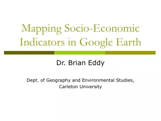
Mapping Socio-Economic Indicators in Google Earth Dr. Brian Eddy Dept. of Geography and Environmental Studies, Carleton University
Overview • Mapping Socio-Economic Data • Issues between ‘Maps’ and ‘Statistics’ • General Cartographic Principles • New Technologies, New Understandings • Multi-variate, multi-scalar presentations of geo-statistical data • Demonstration
Maps and Statistics • Often, the interest in the use of socio-economic statistics is in the ‘statistics’ themselves, and not so much the geospatial patterns of the statistics • Maps are often used to ‘augment’ statistics for geographical referencing, and are not the key source of ‘information’ that informs an analysis or decisions.
Cartography: Basic Principles Two key elements: Information (Message)(‘What’ to say) Visual Communication (Aesthetic)(‘How’ to say it) 1996 Factors: Scale, Level of Abstraction, Aspect of Reality Represented General Approach: “Make things as simple as possible, but not simpler!” Albert Einstein 2001 Source: atlas.gc.ca
Globe Nations Regions Places People An Important Principle! These principles apply not only to statistical/quantitative data; but also to qualitative data, and other forms of geographical analysis How Data is Collected/Aggregated • Descriptions and Inferences • made from geostatistics • apply only to the level at whichthey are aggregated; and are • ‘relative’ to other units at a • particular level/scale. • Inferences made about levels usingother level data are fallacies: • Lower to Higher – Overgeneralization • Higher to Lower – Ecological Fallacy
Answer: The Same Data! Issue: How we characterize and understand places, dependson ‘geographical scale’ and‘boundary conditions’. GIS allows us to look at affects of projecting different types of boundary conditions. Indicator Bad Good What do these maps have in common? Data Source: 2001 Census Maps: Eddy, B. 2006. Ph.D. Thesis.
A Domino Map B Point values Lower than area values (e.g. location ‘A’) Point values Equal with area values Point values Higher than area values (e.g. location ‘B’) Unemployment Index A Data Source: 2001 Census Map: Eddy, B. 2006. Ph.D. Thesis.
Unemployment Index (%) 0 5 10 15 25 100 A Surface Map Data Source: 2001 Census Map: Eddy, B. 2006. Ph.D. Thesis.
Demonstration Mapping Socio-Economic Indicators in Google Earth
INTERPRETATION FILTER Geo-Ontological Contingency Ontology Methodology Scale Factor* Epistemology E1.. E2.. E3.. En.. SPACE AND TIME (Context) Internal Boundary Conditions External Boundary Conditions
Conclusion • Geo-Ontological Contingency • What we say about ourselves and the world around us depends on our perspectives and perceptions about what we think there is, how it might be, internal and external boundary conditions, and the geographical scale at which we observe them. • Location Is Everything! Geography Matters! • Very few (if any) fields of formal knowledge can escape Geo-Ontological Contingency • Take it with you!