Path Planning (con’t.) and Representational Issues
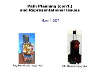
Path Planning (con’t.) and Representational Issues. March 1, 2007. Polly: Horswill vision-based robot. Toto: Mataric mapping robot. Topological Mapping – Associative Methods. Create a behavior that converts sensor observations into direction to go to reach a particular landmark

Path Planning (con’t.) and Representational Issues
E N D
Presentation Transcript
Path Planning (con’t.)and Representational Issues March 1, 2007 Polly: Horswill vision-based robot Toto: Mataric mapping robot
Topological Mapping – Associative Methods • Create a behavior that converts sensor observations into direction to go to reach a particular landmark • Assumption: location or landmark has: • Perceptual stability: views from nearby locations look similar • Perceptual distinguishability: views far away should look different • Associative methods are similar to distinctive place neighborhoods • Difference: associative methods use coarse computer vision
Visual Homing • Partition image into coarse subsections (e.g., 16) • Each section measured based on some attribute • e.g., edge density, dominant edge orientation, average intensity, etc. • Resulting measurements yield image signature • Image signature forms a pattern • If robot nearby, should be able to determine direction of motion to localize itself relative to the location • Visual homing: the use of image signatures to direct robot to specific location
QualNav – Levitt and Lawton • Basic idea: localize robot relative to particular orientation region, or patch of the world • Orientation region: • Defined by landmark pair boundaries • Similar to neighborhood • Within an orientation region, all landmarks appear in same relationship • Vehicle can directly perceive when it has entered a new orientation region
Example of Orientation Regions Topological representation as orientation regions: OR1 OR2 Metric Map:
Example of Orientation Regions (con’t.) Robot here: Robot sees: OR1 OR2 Robot here: Robot sees: OR1 OR2
Orientation Regions (con’t.) • Allows robot to create outdoor topological map as it explores the world • Allows robot to coarsely localize itself • Robot does not have to estimate range to landmarks • Using angles to each landmark, it can move to follow desired angles
Associative Methods: Advantages and Disadvantages • Advantages: • Tight coupling of sensing to homing • Robot does not need to explicitly recognize what a landmark is • Enables robots to build up maps as it explores • Disadvantages: • Require massive storage • Brittle in presence of dynamic world when landmarks may be occluded or change
Case Study I: Topological Navigation in Hybrid Architecture • Example of 1994 AAAI Mobile Robot Competition approach of Colorado School of Mines • Competition: • Given previously unavailable topological map, enable robot to navigate from room to room in test environment within 15 minutes
Path Planning Approach • Map entered with 3 node types: • Room (R) • Hall (H) • Foyer (F) • Assumed that environment is orthogonal • Edges between nodes one of: • N, S, E, W • Edges weighted: 3 for segment beginning in foyer, 2 for going from room to room, 1 otherwise • Additional node type added: • Hd: refers to hall to door connection • Path planner eliminates unneeded nodes based on start and goal nodes, then plans shortest path using Dijkstra’s single source shortest path
Abstract Navigation Behaviors • To execute path, transition table defines abstract behaviors to be activated
Navigation Scripts • Used to specify and carry out implied details of plan in a modular and reusable way • Navigate-door: switch(door) case door-not-found: // initialization phase; follow wall until find door if wall is found wallfollow to door else move-ahead to find a wall case door-found: // nominal activity phase move-thru-door(door-location)
Navigation Scripts (con’t.) • Navigate-hall: switch(hall) case not-facing-hall: // initialization phase; if starting in a FOYER if hall-not-found wallfollow until find the hall else if not facing hall turn to face hall else starting in a HALL if not facing hall turn to face hall case facing hall: // nominal activity phase hallfollow until next gateway
Navigation Scripts (con’t.) • Navigate-foyer // step 1 move-to-goal(n,dir) in direction of next foyer // step 2 wallfollow until next gateway is detected
Case Study I: Lessons Learned • Must build abstract navigation behaviors out of robust primitives • Distance values between nodes can be different if traveling in different directions • Metric distances might not be known for all nodes, making it difficult to apply Dijkstra’s algorithm
Case Study II:Topological Map Building in a Behavior-Based System • Based on work of Mataric (~1990) • Robot, Toto: • Designed using subsumption/behavior language • Sensors: • 12 sonar ranging sensors, mounted as a ring • Compass providing 4 bits of bearing
Low-Level Behaviors Correct General Boundary Following Align Avoid Convex Boundary Following Collision-Free Wandering Stroll Collision-Free Forward Motion Triggering of behaviors is mutually exclusive; no behavior arbitration needed
Dynamic Landmark Detection • Selection of landmarks: • Walls • Corridors • Junk • Idea: allow robot to dynamically extract environmental features while it moves, and build up topological map based on features detected • Landmark: • Hypothesis with high degree of confidence (based on a preset threshold) • Based only on sonar and compass readings • Example landmark: • Unilateral short sonar readings, coupled with consistent compass bearing, correspond to increased confidence in a wall landmark
Example of Landmarks Detected Over Multiple Trials RW111 RW122 RW123 RW13 RW02 RW01 RW03 RW71 RW02 RW01 RW72 Table RW83 RW41 RW32 RW33 Table
Spatial Learning • Landmarks stored in graph representation • Data structure is linked list • Connections determined based on adjacent landmarks • Decentralized map representation; each node implemented in a distributed fashion Landmark Detector Compass Sonars
Learning a Map • When landmark detected, type and compass bearing are broadcast to entire graph • Initially, list of nodes is empty • When a node receives a broadcast landmark, it compares its type, bearing, and rough position to its own • If no node reports a match, new landmark added to graph • When a node is activated, it spreads “expectation” to its neighbors in the direction of travel • If match found without “expectation”: • Either a loop has been found, or an error has occurred • Estimated position is compared to robot’s current rough position estimates • If positions match within error bounds, assume path has looped
Example of Learned Map LW LW J Robot’s starting position LW LW LW 0 Bearing measures: C 4 12 Robot’s starting position 8 Resulting topological map: C0 LW4 LW0 LW2 LW4 J LW12
Path Planning based upon Learned Topological Map • Path planning based on wave front propagation through graph • Destination node propagates call to its neighbors • Eventually, call reaches currently active node • Robot travels in direction of wavefront
Case Study II: Lessons Learned • Map building can be incorporated within subsumption methodology • Globally consistent maps can be built in a distributed manner • Useful maps do not need to be embedded in cartesian plane • Coarse position estimates are sufficient to disambiguate landmarks in naturally occurring situations • Global orientation estimates do not need to be precise or accurate, as long as they are locally consistent over time
Case Study III:USC’s Multi-Robot Mapping Based on Landmarks • Combination of metric and topological mapping • Pre-define landmarks (e.g., doorways, hall openings, etc.) • Build topological map of landmarks, connected with metric information
USC’s Mapping Approach • Example of landmarks detected:
USC’s Mapping Approach (con’t.) • Exploration Stragegy: • Follow corridors • Go to unexplored ends of nodes • Mapping Strategy: • Detect and store topological features • Correct odometry based on: • Topological matches • Orthogonality constraints
USC Mapping Results Two individual robot maps Combined Result
Summary of Topological Path Planning • Landmarks simplify the “where am I?” problem by providing orientation cues • Gateways: special cases of landmarks that allow robot to change directions • Distinctive places can be related to each other by local control strategies for traveling between them • Image signatures can be used to directly couple perception with acting
Part II: Representational Issues for Behavioral Systems • Objectives: • To understand working definitions for knowledge and knowledge use • To explore qualities of knowledge representation • To understand what types of knowledge may be representable for use within robotic systems • To determine the appropriate role of world and self-knowledge within behavior-based robotic systems • To study several representational strategies developed for use within behavior-based systems
What is Knowledge? • Knowledge (like “intelligence”): notoriously difficult to define Volume Knowledge Information Data Organization
Definitions of Knowledge • Knowledge (Turban 1992): Understanding, awareness, or familiarity acquired through education or experience. The ability to use information. • Knowledge representations (Steels 1995): Physical structures which have correlations with aspects of the environment and thus have predictive power for the system. • Environmental correlation: • Temporal durability/persistance (e.g., short term, long term) • Nature of correlational mapping (e.g., metric, relational) • Predictive power: • If no need to predict, then can rely entirely on what is sensed (i.e., reactive) Key issue: “Sensing” vs. “Representing”
Tradeoffs for Knowledge Use Battlefields Outdoor Navigation Indoor Navigation Robotic Workcell Dynamic and uncertain worlds Highly structured worlds World Predictability Utility of World Knowledge Value of Sensing Difficulty of Sensing
Considerations • When world changes rapidly, stored knowledge potentially becomes obsolete quickly • However, continuous sensing is not free (computationally); prefer to minimize sensing process • Issue: maintaining accurate correlation between robot’s position in world and its representational point of view • For spatial location, this is called localization • “Where am I?” • Purely reactive systems do not address this issue
Taxonomy of Knowledge Representations • Explicit: symbolic, discrete, manipulable knowledge representations typical of traditional AI • Implicit: knowledge that is non-explicit, but reconstructable and can be made explicit through procedural usage. • Tacit: knowledge embedded within the system that existing processes cannot reconstruct • Symbolic systems: use explicit knowledge • Sub-symbolic systems: use implicit or tacit knowledge
Symbol Grounding Problem • Symbol grounding problem: refers to the difficulty in connecting the meaning (semantics) of an arbitrary symbol to a real world entity or event. • Degeneracy is often recursive or circular (symbols used to describe symbols) • For humans (and behavior-based robots), meaning is derived from interactions with objects in the world not intrinsic to the objects themselves
Types of Knowledge • Spatial world knowledge: an understanding of the navigable space and structure surrounding the robot • Object knowledge: categories or instances of particular types of things within the world • Perceptual knowledge: information regarding how to sense the environment under various circumstances • Behavioral knowledge: an understanding of how to react in different situations • Ego knowledge: limits on the abilities of the robot’s actions within the world (e.g., speed, fuel, etc.) and on what the robot itself can perceive (e.g., sensor models) • Intentional knowledge: information regarding the agent’s goals and intended actions within the environment – a plan of action.
Another categorization: Based on Durability • Persistent knowledge: • A priori information about robot’s environment that can be considered relatively static for mission’s (or task’s) duration • Allows for pre-conceived ideas of robot’s relationship with world • E.g., object knowledge, models of free space, ego model of robot itself • Knowledge base: long-term memory (LTM) • Transitory knowledge: • Acquired dynamically as robot moves through world • Knowledge base: short-term memory (STM) • Typically forgotten (fades) as robot moves away from locale where informaiton was gathered
Time Horizon of Knowledge Transitory KnowledgePersistent Knowledge Purely reactive Sensor-acquired Maps A Priori Maps Instantaneous Short-term memory Long-term memory Time Horizon
Representational Knowledge for Behavior-Based Systems • Short-term behavioral memory • Long-term memory maps: • Sensor-derived maps • A priori map-derived representations
Short-Term Behavioral Memory • Advantages of behavioral memory: • Reduces need for frequent sensor sampling in reasonably stable environments • Provides recent information to guide robot that is outside of its sensory range • Characteristics: • Used in support of a single behavior (usually obstacle avoidance) • Representation directly feeds behavior rather than tying it to a sensor • Transitory: representations are constructed, used while the robot is in the environment, and then discarded
Behavioral Memory Response Stimulus Perceptual Process Motor Behavior Short-Term Memory Sensors
Grid Representation • Grid representation is common for behavioral memory • Grids vary in the following ways: • Resolution: amount of area each grid unit covers • Shape: most frequently square, but could also be others, such as radial sectors • Uniformity: all grid cells same size, or size may vary. • Most common variable-sized grid methodology: quadtrees (recursive decompositions of free space) Quadtree Regular grid Sector grid
Long-Term Memory Maps • Persistent information useful for advising behavioral control regime • Origin of map: • From sensors onboard robot • From information gathered independently of robot (e.g., remote sensors) • Typical encodings: • Metric: absolute measurements and coordinate systems used • Qualitative: salient features and their relationships (spatial or temporal) representated
Issues with Long-Term Memory Maps • Disadvantages: • Data may be untimely (i.e., world changed) • Localization needs to be conducted (nontrivial) • Advantage: • Can provide guidance beyond horizon of immediate sensing
Sensor-Derived Maps • Provide information directly gleaned from robot’s experiences in world • Often advantageous to use qualitative representations instead of metric representations due to: • Inherent inaccuracies in robot motion and sensor readings • Hallmark of qualitative navigational techniques: • Distinctive places: Regions of the world that have characteristics that distinguish them from their surroundings • E.g., symmetry, abrupt discontinuities in sensor readings, unusual constellations of sensor readings, point of maximum or minimum sensor reading • Once identified, can be used later for lower-level control • Can be easily integrated to behavior • E.g., “move forward until abrupt discontinuity occurs on right, then switch to a move-through-door behavior”
Examples of Distinctive Places End-of-hall (3-way symmetry) Doorway (abrupt depth discontinuity) Hallway constriction (depth minimum) Visual constellations (unique feature patterns)
Example of Qualitative Maps • Landmarks: • Derived from sonar, using features that are stable and consistent over time • E.g., right walls, left walls, corridors • Add spatial relationships connecting various landmarks via graph construction • Subsumption-style approach (Mataric 1992): Goal-Directed Navigation and Map Learning SENSORS Landmarks Landmark detection Boundary tracing Response