Download

1 / 57
570 likes | 733 Vues
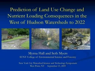
Prediction of Land Use Change and Nutrient Loading Consequences in the West of Hudson Watersheds to 2022. Myrna Hall and Seth Myers SUNY College of Environmental Science and Forestry New York City Watershed Science and Technology Symposium West Point, NY September 15, 2009.

E N D
Prediction of Land Use Change and Nutrient Loading Consequences in the West of Hudson Watersheds to 2022 Myrna Hall and Seth Myers SUNY College of Environmental Science and Forestry New York City Watershed Science and Technology Symposium West Point, NY September 15, 2009
Acknowledgements • Students • Seth Myers • Mehmet Yavuz • Prajjwal Panday • Funding • NYS DEC • Collaborators • Mary Tyrrell, Yale Univ. • Rene Germain, SUNY ESF • Data and Logistic Support • Watershed Ag. Council • NYC DEP • Catskill Ctr. for Cons. and Development • Statistical Support • Eddie Bevilacqua, SUNY ESF
Rationale for this Research Filtration facility costly alternative to natural filtration provided by forest cover and forest soils.
Rationale for this Research 75% of Land is Non-industrial Private Forest Land
Rationale for this research LaPierre & Germain 2005; Caron 2008 That change may be accelerated by parcelization trend
Comparison of 1987 and 2002 Landsat Classifications to Catskill-Delaware Tax Parcels to 1984 – 2001 Tax Parcels
Rationale for this research • Croton watershed – east of Hudson water supply catchments (80% suburbanized) with consequential water quality degradation, requiring filtration
Objectives • Understand rate of landscape change and the pattern of landscape factors that determine where land cover/land use is likely to change. • Project those patterns forward in time. • Project future water quality as a function of changing land use land cover
Major Steps • Quantify HOW MUCH change to expect based on: Determine WHERE change is likely to occur based on factors that have historical influence Project future land use under two rate scenarios • Calculate future water quality nutrient loading impacts based on our statistical model of landscape characteristics and nutrient export
I. Quantify HOW MUCH change to expect based on: • study of sample of tax parcel data (1984 and 2000) by LaPierre and Germain ( • on-the-ground visits to 137 properties, parcelized and non-parcelized • surveys of both current land owners and previous land owners who parcelized • time series analysis of remotely-sensed imagery • assessment of relation between parcelization and development rates (from 4 above) and single family new home construction permits
OBSERVED COVER DOCUMENTED USE REMOTE SENSING
10 Oct. 1975 MSS 9 May 1987 TM 20 May 1991 TM 23 Sept. 1999 TM 24 April 2002 ETM+
Tax Parcel History Based on NY State Office of Real Property Tax Parcel Data Base 1998 - 2007
Three potential futures based on 1975-2002 or 1987-2002 development or post-2002 parcelization trends
Projecting Spatial Location of Future Land Change Using GEOMOD Statistical analysis and modeling of spatial location of both: New Development Agriculture to Forest Conversion
Public Lands Excluded in Calibration in Validation1975-1987 1991 - 2002 Pre-MOA Post-MOA Candidate for Change Protected – Masked out
Signal to Calibrate (1975-1987Signal to Validate (1987-2002) 1 4 2 3 Receiver Operating Characteristic Used as the Measure of Fit
Percent of Available Land by Slope Class Developed 1987 - 2002 Slope in Degrees
Percent of Available Land by Distance from Water Bodies Developed 1987 - 2002 Distance in Meters
Final set of “Best-fit” spatially-distributed factors explaining new development 1991 - 2002
Final set of “Best-fit” spatially-distributed factors explaining forest gains 1991 - 2002
2002 Development Likelihood Map Change potential per grid cell= (Weight1*CHPOT(factor1) + Weight2* CHPOT (factor2) + Weight3*CHPOT (factor3)…..)/Sum of all weights
Projected increases in Development Acreage Using Parcelization Rate Town Total New % increase 2022 02-22 1 Andes 1472.92 188.81 14.70% 2 Ashland 739.24 125.88 20.52% 3 Bovina 995.88 157.23 18.75% 4 Colchester 207.49 0.00 0.00% 5 Conesville 734.57 207.72 39.43% 6 Delhi 2616.03 157.23 6.39% 7 Denning 235.29 44.03 23.02% 8 Deposit 28.47 0.00 0.00% 9 Fallsburg 34.69 0.00 0.00% 10 Franklin 265.98 12.68 5.00% 11 Gilboa 760.37 465.69 158.04% 12 Halcott 182.36 31.36 20.77% 13 Hamden 1635.27 182.59 12.57% 14 Hardenburgh 189.26 50.26 36.16% 15 Harpersfield 464.81 50.26 12.12% 16 Hunter 2239.74 843.32 60.39%
17 Hurley 210.92 8.54 3.89% 18 Jefferson 95.64 4.46 4.46% 19 Jewett 740.04 59.51 7.44% 20 Kortright 828.19 38.68 4.46% 21 Lexington 720.26 41.51 5.45% 22 Liberty 4.08 1.19 22.57% 23 Masonville 598.21 38.44 6.04% 24 Meredith 529.01 15.28 2.81% 25 Middletown 2334.36 151.77 6.10% 26 Neversink 849.73 66.46 7.25% 27 Olive 634.90 27.09 4.09% 28 Prattsville 473.13 36.13 7.09% 29 Rochester 4.23 0.00 0.00% 30 Roxbury 1924.24 135.52 6.58% 31 Shandaken 1308.81 101.43 7.19% 32 Sidney 63.03 3.88 5.80% 33 Stamford 1077.00 72.66 6.32% 34 Tompkins 2005.94 168.29 7.74% 35 Walton 4250.80 431.61 9.22% 36 Wawarsing 114.66 5.02 4.19% 37 Windham 2232.77 472.52 17.47% 38 Woodstock 334.93 33.14 9.00% Total 34666.19 2937.14 7.81%
Projected increases in Development Acreage Using Remote Sensing Rate Town Total New % increase 2022 02-22 1 Andes 1374.52 90.41 6.17% 2 Ashland 639.39 26.03 3.91% 3 Bovina 904.28 65.63 6.77% 4 Colchester 225.87 18.38 7.52% 5 Conesville 619.93 93.08 13.05% 6 Delhi 2650.95 192.15 6.76% 7 Denning 212.21 20.95 8.99% 8 Deposit 30.63 2.17 6.61% 9 Fallsburg 36.81 2.12 5.44% 10 Franklin 265.40 12.09 4.36% 11 Gilboa 324.63 29.96 8.45% 12 Halcott 156.40 5.39 3.33% 13 Hamden 1570.05 117.37 6.96% 14 Hardenburgh 157.44 18.45 10.49% 15 Harpersfield 430.13 15.58 3.50% 16 Hunter 1710.65 314.24 15.52% 17 Hurley 210.92 8.54 3.89%
18 Jefferson 95.64 4.46 4.46% • 19 Jewett 740.04 59.51 7.44% • 20 Kortright 828.19 38.68 4.46% • 21 Lexington 720.26 41.51 5.45% • 22 Liberty 4.08 1.19 22.57% • 23 Masonville 598.21 38.44 6.04% • 24 Meredith 529.01 15.28 2.81% • 25 Middletown 2334.36 151.77 6.10% • 26 Neversink 849.73 66.46 7.25% • 27 Olive 634.90 27.09 4.09% • 28 Prattsville 473.13 36.13 7.09% • 29 Rochester 4.23 0.00 0.00% • 30 Roxbury 1924.24 135.52 6.58% • 31 Shandaken 1308.81 101.43 7.19% • 32 Sidney 63.03 3.88 5.80% • 33 Stamford 1077.00 72.66 6.32% • 34 Tompkins 2005.94 168.29 7.74% • 35 Walton 4250.80 431.61 9.22% • 36 Wawarsing 114.66 5.02 4.19% • 37 Windham 2232.77 472.52 17.47% • 38 Woodstock 334.93 33.14 9.00% • Total 34666.19 2937.14 7.81%
Variables Retained in Export Load Regression Models and Their Explanatory Contribution
TN Change 2002 - 2022 Low Rate High Rate
TP Change 2002 - 2022 Low Rate High Rate
TDP Change 2002 - 2022 Low Rate High Rate
NO3NO2 Change 2002 - 2022 Low Rate High Rate
Summary • Some good news and some areas needing attention with respect to planning of future development. • Should be overlaid with DEP map of targeted areas of concern to assess vulnerability. • Model projections can serve as input to DEP’s GWLF forecasting.