Download
1 / 24
240 likes | 262 Vues
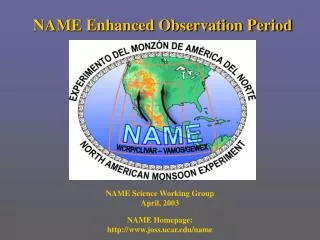
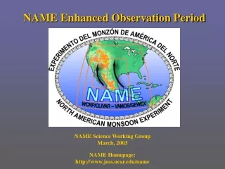
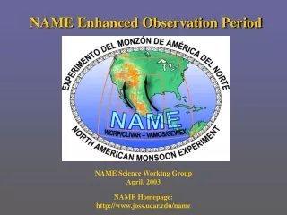
The General Observation Period (GOP) from January to December 2007 provides a comprehensive dataset for testing hypotheses and new modeling techniques in the QPF-Program. It includes observations of various precipitation types and aims to relate these results to a broader perspective. The GOP also focuses on near-real-time measurements with rigorous quality control and easy data access. It collaborates closely with COPS activities and provides coordinated observations and model output to SPP projects.

E N D
General Observation Period (GOP) Susanne Crewell & GOP Partner Meteorologisches Institut Ludwig-Maximillians-Universität (LMU) München
GOP Characteristics • General Observation Period from January to December 2007 • Comprehensive data set suitable for testing hypotheses and new modeling techniques developed within the QPF-Program. • The GOP encompasses COPS both in time and space - to provide information of all kinds of precipitation types and- to relate the COPS results to a broader perspective (longer time series and larger spatial domain)
GOP Observations • Optimized exploitation of existing instrumentation - routine measurements normally not available to the scientific community - continuous/coordinated operation of existing instrumentations suitable for statistical evaluation • Focus on measurements which are available in near real-time • Rigorous quality control, cross-checking and error estimation • Easy access to data, quicklooks and analysis • Close connection with COPS activities no funding for instrument development or upgrade near-realtime analysis + first-order model evaluation Provision of coordinatedobservations and modeloutput to SPP projects(VERIPREC, STAMPF, DAQUA, QUEST,... WG "Precipitation Process" & data management Personnel funding for observations only when instruments are moved to other locations
GOP Precipitation Observations • High resolution surface precipitation (rain gauges)DWD, various water authorities, environmental agencies and urban networks • 3-D hydrometeor distribution (weather radar)-16 C-band DWD radars- polarimetric research radars: POLDIRAD, DLR; DWD Observatory Hohenpeissenberg- C-Band radar Karlsruhe; X-Band radars Bonn & HH- operational radars in neighboring countries • Rain drop size distribution (RDSD)- network of vertical pointing Micro Rain Radar (MRR)- in situ disdrometer Joint objective of COPS WG3 & GOP Investgation of the differences of the RDSDs over flat terrain including maritime conditions on one hand and over orographically structured terrain on the other hand
GOP Organisation LE • WP-GOP-1 Rain gauges • WP-GOP-2 Weather Radar • WP-GOP-3 Drop Size Distribution DSD • WP-GOP-4 Lidar (aerosol, cloud base, mixing layer height) • WP-GOP-5 GPS water vapour column • WP-GOP-6 Lightning networks • WP-GOP-7 Satellite observations (cloud properties, water vapor, aerosol) • WP-GOP-8 Meteorological stations • WP-GOP-9 Management
GOP & COPS GOP • to provide information of all kinds of precipitation types • to identify systematic model deficits • to select case studies for specific problems • to relate the COPS results to a broader perspective (longer time series and larger spatial domain) MRR transsect will be coordinated with POLDIRAD RHI scans during COPS
GOP Network Observations IWV [kg m-2] • Integrated Water Vapor (GPS)about 180 stations within Germanyabout add. 40 in neighboring countriesprocess more french stationsset-up of 5 stations in COPS area for 6 monthsto get a better estimation in the structured terrain • Cloud and aerosol vertical information(Lidar networks) - lidar ceilometer observations from institutes & DWD > 100 in Germany- coordinated (regular scheduled) EARLINET (Hamburg, Leipzig, Munich, Garmisch, Cabauw, Neuchatel..) with a high quality standard to derive statistical aerosol properties • Lightning detection systems- Conventional lightning detection system (BLIDS)- VHF network in Northern Germany - VLF LINET system in Southern G. July & August 2004 cloud base height [m]
GOP Satellites (FUB + Nowcasting SAF) a) spatially highly resolved products (250-300 m, polar orbiters) b) temporal evolution from Meteosat Second Generation (every 15 min.)
Near real-time Radar and Satellite The Near Real Time (NRT) processing for the GOP and COPS area. The information at FU Berlin is online with a delay of 2 hours (flight mission planning; near real time assimilation,.... Statistical evaluation of water vapour, cloud and precipitation structure • extraction of station output (rain gauges, MRR, GPS, ..) togetherwith model output and online visualization • diurnal cycle on a monthly basis of all parameters time series at station and maps • convective/frontal • cell tracking • vertical structure (hydrometeor distribution) • regional characteristics • sub-grid properties
GOP Stations all Meteorological & Geographical Institutes, Research organisations & NP to contact!
GOP Preparation • Establishment of the data base-coordination with DWD and data owners- coordination with COPS campaign data how to set-up and how to get funding • Quality control of the observations- rain gauge estimates (UniBonn)- radar and satellite observations (QUEST)- joint effort of data owners • Tailoring model output to data available from GOP- definition of model domain, horizontal resolution, boundary conditions...- focus on Lokal-Modell-kürzestfrist (LMK) • - preparation of special model output (integration into NUMEX)→ time series in model time step resolution at selected stations→ selected 3D-fields at asynoptic times for satellite/radar comparisons- online visualization of statistical properties from model and observations (diurnal cycle, PDFs,..) MAP Forecast Demonstration Project • long-term evaluation • identification of case studies
Microwave radiometers IRE WVRA MICCY TROWARA MTP HATPRO MARSS Conrad Drakkar
Downwelling radiationzenith pointing Atmospheric Emission Temperature profileWater vapor profile liquid water path LWP=250 gm-2 Scattering! Czekala, H., A. Thiele, S. Crewell, and C. Simmer, 2001: Discrimination of cloud and rain liquid water path by groundbased polarized microwave radiometry. Geophysical Research Letters, 28, 267-270
Humidity and Atmospheric Profiler (HATPRO) Rain sensor Radial blower GPS • Design based on BBC results • suitable for LWP & IWVas well as humidity & (boundary layer)temperature profile • rain sensor, GPS, clock • environmental humidity, pressure and temperature Rose, T., S. Crewell, U. Löhnert and C. Simmer, 2005: A network suitable microwave radiometer for operational monitoring of the cloudy atmosphere, Atmos. Res. , 75(3), 183-200
RMS between RS & HATPROlower than 1 K below 1 km • lower inversion strength of is well detected • 6 angle retrieval performs much better than 5 Boundary layer Profiling N=48 Dry season in Benin 1.4 km 290 K Bias RMS Comparison withradiosonde and tower (dots) 300 K
90 & 150 GHz Dual Polarization Radiometer external elevation scanning to avoid polarization mixing • improved LWP • radiative transfer studies • snow crystals Breaks due to cranes in field of viewwill be operated on UFS Schneefernerhaus starting next week!
MIcrowave radiometer forCloud CarthographY Crewell, S., H. Czekala, U. Löhnert, C. Simmer, Th. Rose, R. Zimmermann, und R. Zimmermann, Microwave Radiometer for Cloud Carthography: A 22-channel ground-based microwave radiometer for atmospheric research.Radio Science, 36, 621-638, 2001.
3 GHz FMCW radar -30 dBzmin ~3 m range resolution
MIcrowave radiometer forCloud CarthographY • high spatial (1°) & temporal (1s)resolution observations • azimuth and elevation scanning • integrated water vapour (IWV)and cloud liquid water path (LWP) • temperature and humidity profile • combination with cloud radar and lidar 2 successive 30 deg azimuth scan
Vertical Hydrometeor Distribution combination of different instruments (radar, lidar, microwave radiometer, radiosonde) drizzle Cabauw, 9. Mai 2003
5 9 Looking at cloud variability:LWP time series offset