Download
1 / 52
520 likes | 634 Vues
The 5th NAME Science Working Group Meeting took place from November 5-7, 2003, focusing on critical research questions about low-level circulations, moisture transport, and precipitation dynamics in southwestern North America. Key topics discussed included the relationship between moisture and rainfall variability, the life cycle of diurnal convective rainfall, and the sources of precipitable moisture affecting the monsoon. Participants evaluated measurement protocols, data dissemination, and field coordination to enhance understanding of the monsoon's energy and water fluxes.

E N D
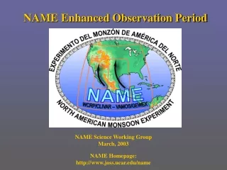
NAME Enhanced Observation Period 5th NAME Science Working Group Meeting November 5-7, 2003 NAME Homepage: http://www.joss.ucar.edu/name
http://www.joss.ucar.edu/name/catalog/mapserver/demo_init.htmlhttp://www.joss.ucar.edu/name/catalog/mapserver/demo_init.html
NAME Tier-1 Objectives • How are low-level circulations along the Gulf of California / west slopes of the Sierra Madre Occidental related to the diurnal cycle of moisture and convection? (low-level circulation) • What is the relationship between moisture transport and rainfall variability (e.g. forcing of surge events; onset of monsoon details)? (moisture transport) • What is the typical life cycle of diurnal convective rainfall? Where along the western slope of the Sierra Madre Occidental is convective development preferred? (diurnal cycle) • What are the dominant sources of precipitable moisture for monsoon precipitation over southwestern North America? (moisture sources) • What are the fluxes of energy and water from the land surface to the atmosphere across the core monsoon region, and how do these fluxes evolve in time during the warm season? (land surface)
NAME FIELD CAMPAIGN R.V. UNAM-Puma Radiosondes/PIBALS Radar/Profiling/Radiosondes Enhanced Precipitation Gauge Network ?
NAME SWG-5 Session 3 Agenda • 1300-1315 NAME EOP Awards (M. Patterson) • 1315-1325 Brief overview of the EOP • 1325-1530 Science plans for NAME EOP • Key science questions being addressed • Platform description/Measurement protocols • Data dissemination plan • Expected field coordination requirements • Expected coordination with data assim./modelers • 1530-1545 Break • 1545-1615 Unfunded activities requiring address • 1615-1730 Open discussion
(Group) • Key science questions being addressed: • Platform description/Measurement protocols: • Data dissemination plan: • Expected field coordination requirements: • Expected coordination with data assim./modelers:
(Group) • Key science questions being addressed: • Platform description/Measurement protocols: • Data dissemination plan: • Expected field coordination requirements: • Expected coordination with data assim./modelers:
(Group) • Key science questions being addressed: • Platform description/Measurement protocols: • Data dissemination plan: • Expected field coordination requirements: • Expected coordination with data assim./modelers:
(Group) • Key science questions being addressed: • Platform description/Measurement protocols: • Data dissemination plan: • Expected field coordination requirements: • Expected coordination with data assim./modelers:
(Group) • Key science questions being addressed: • Platform description/Measurement protocols: • Data dissemination plan: • Expected field coordination requirements: • Expected coordination with data assim./modelers:
(Group) • Key science questions being addressed: • Platform description/Measurement protocols: • Data dissemination plan: • Expected field coordination requirements: • Expected coordination with data assim./modelers:
(Group) • Key science questions being addressed: • Platform description/Measurement protocols: • Data dissemination plan: • Expected field coordination requirements: • Expected coordination with data assim./modelers:
(Group) • Key science questions being addressed: • Platform description/Measurement protocols: • Data dissemination plan: • Expected field coordination requirements: • Expected coordination with data assim./modelers:
(Group) • Key science questions being addressed: • Platform description/Measurement protocols: • Data dissemination plan: • Expected field coordination requirements: • Expected coordination with data assim./modelers:
(Group) • Key science questions being addressed: • Platform description/Measurement protocols: • Data dissemination plan: • Expected field coordination requirements: • Expected coordination with data assim./modelers:
(Group) • Key science questions being addressed: • Platform description/Measurement protocols: • Data dissemination plan: • Expected field coordination requirements: • Expected coordination with data assim./modelers:
(Group) • Key science questions being addressed: • Platform description/Measurement protocols: • Data dissemination plan: • Expected field coordination requirements: • Expected coordination with data assim./modelers:
(Group) • Key science questions being addressed: • Platform description/Measurement protocols: • Data dissemination plan: • Expected field coordination requirements: • Expected coordination with data assim./modelers:
(Group) • Key science questions being addressed: • Platform description/Measurement protocols: • Data dissemination plan: • Expected field coordination requirements: • Expected coordination with data assim./modelers:
Unfunded Activities • (PI) • Key science questions being addressed: • Platform description/Measurement protocols: • Data dissemination plan: • Expected field coordination requirements: • Expected coordination with data assim./modelers:
Unfunded Activities • (PI) • Key science questions being addressed: • Platform description/Measurement protocols: • Data dissemination plan: • Expected field coordination requirements: • Expected coordination with data assim./modelers:
Open Discussion • (enter new text)
Tucson Walnut Gulch Three-dimensional perspective in the NAME region looking north from Hermosillo to Tucson Soil Moisture Remote Sensing Field Experiment in NAME • Temporary in-situ soil moisture networks • Aircraft and satellite mapping • Intensive sampling concurrent with aircraft mission
Soil Moisture Remote Sensing Field Experiment in NAME Aircraft and satellite mapping • NASA P-3B should be available July 15 –August 15, 2004 • Satellite sensors: AMSR and TMI • Aircraft sensors: 2DSTAR (L band next generation ESTAR) PSR or AESMIR (AMSR simulators) • Aircraft Mission: • 15 flight dates • 5 hours per day • 50x100 km areas • Walnut Gulch • Mexican site • 4 flightlines