NAME Enhanced Observation Period
240 likes | 251 Vues
This working group focuses on enhancing observation methods and networks to improve data collection for studying weather and climate patterns in various regions. It includes the installation and maintenance of automated weather stations, raingauges, temperature and humidity sensors, flux towers, and more. Contacts and availability information provided.

NAME Enhanced Observation Period
E N D
Presentation Transcript
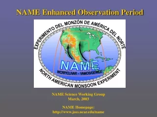
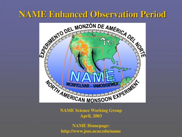
NAME Enhanced Observation Period NAME Science Working Group April, 2003 NAME Homepage: http://www.joss.ucar.edu/name
SMEX 04 Simple Raingauges Simple Raingauges Veg. Flux Site
NERN : Shuttleworth, Watts, Gochis, Garatuza • 100 Event logging, tipping bucket raingages • 6 major W-E transects traversing SMO • Major improvement in topographic and temporal sampling of precipitation • Installed 2002-2003, in operation through spring of 2006 • Not available in real-time Contacts: gochis@rap.ucar.edu, watts@fisica.uson.mx, garatuza@itson.mx
Simple Raingage Network : Higgins and Lobato • 1000 Simple accumulation gages • Covering major data sparse regions in North-central and North western Mexico • Daily accumulated rainfall • Improved spatial representation of precipitation • Maintained by IMTA • Not available in real-time Contact: Wayne.Higgins@noaa.gov rlobato@tlaloc.imta.mx
Augmentation of Southern Arizona ALERT Network: Jamison • Installation of 3 additional ALERT, automated weather stations • Improved monitoring in data-sparse border region in Southern Arizona • Temp, RH, Press., Wind speed and direction, event precipitation • Maintained by NWS • Real-time and GTS availability Contact: Austin.Jamison@noaa.gov
Augmented Surface Temperature and Humidity Measurements: A. Douglas • 16 recording temperature and humidity sensors • Deployed along SMO transects in collaboration with the NERN and CNA/SMN observatories • Will help elucidate temp/RH profile over SMO • Not available in real time Contacts: sonora@creighton.edu gochis@rap.ucar.edu
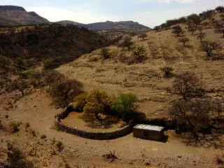
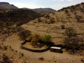
Land – Atmosphere Fluxes from the Deciduous Tropical Forest: M. Douglas • Flux tower, sounding and tethersonde measurements over a deciduous forest site in the SMO foothills • Eddy-covariance fluxes • Bare ground and canopy flux estimates • Soil moisture measurements • Additional PIBAL and surface met. stations • Not available in realtime Contacts: Michael.Douglas@noaa.gov watts@fisica.uson.mx
NAME Soil Moisture Field Campaign (SMEX04): Jackson • Two domains: Walnut Gulch, AZ & northern Sonora, MX • Multiscale measurement and validation of near surface soil moisture content • NASA-AMSRE and NASA-P3 passive microwave • Ground-based, TDR measurements • Not available in real-time SMEX 04 Contact: tjackson@hydrolab.arsusda.gov
NWS Las Vegas NWS Amarillo NWS Flagstaff NWS Albuquerque SRP Phoenix NWS Tucson NWS San Diego NWS Midland NCAR ISS NWS El Paso NWS Del Rio NCAR ISS SMN Chihuahua SMN Guaymas M. Douglas RAOB SMN Torreon NCAR GLASS NCAR ISS SMN Monterrey SMN La Paz NOAA ETL/AL SMN Zacatecas SMN Mazatlan EOP Ship RAOB
Integrated Sounding Systems: Johnson Puerto Peñasco - ISS • 3 NCAR/ISSs deployed at P. Peñasco, Kino Bay, Los Mochis • GPS soundings, 915 MHz wind profiler, RASS, sfc. met. • EOP: 2x Daily P. Peñasco, Kino Bay; 4x Los Mochis • IOP: 6x Los Mochis • 1 NCAR GLASS system deployed at Loreto, BCS • GPS sounding, sfc. met. • EOP: 4x Daily; IOP: 6x • Nominal Jul 1-Aug. 15 • GTS available Kino Bay - ISS Loreto - GLASS Los Mochis - ISS Contacts: johnson@atmos.colostate.edu
Enhanced Operational Soundings: Zhou/NWS, A. Douglas and Cortez/SMN Radiosonde photo courtesy of Vaisala, Inc. • Increased frequency of GPS soundings at 9 U.S. and 8 Mexican RAOB sites: • NWS: EOP 2x daily IOP 4x daily 20 IOP Days: Tucson, Las Vegas, San Diego,Flagstaff, Albuquerque, Midland, El Paso, Amarillo, Del Rio • SMN: EOP 2x daily (Start 6/21) IOP 6x daily 20 IOP Days: Chihuahua, Guaymas, Mazatlan, La Paz 12 IOP Days: Monterrey, Zacatecas, Torreon • DOD/Yuma: (7/1-8/15) • Most Stations GTS available Contacts: sonora@creighton.edu Jiayu.Zhou@noaa.gov mcortez@mailsmn.cna.gob.mx
Belize Costa Rica
PIBAL Soundings: Douglas • Atmospheric profiles of wind speed and direction • Instrumented balloon tracked from surface to ~ 11 km (cloud dependent) • Approx. 20 stations proposed over the NAME region • Many sites will be available in ~ 2-3hr delayed reception Contact: Michael.Douglas@noaa.gov
Precipitation and Vertical Wind Profiling: King, Williams and White • Coastal Site (40 km NW of Spol Radar) • 915 MHz vertical wind profiler w/ RASS • 449 MHz vertical wind profiler • S-band reflectivity • Surface disdrometer • Surface met. and flux • Soil moisture • Cielometer • May 28 – Sept 30, 2004 • *Partial deployment thru 2006 • Available in near real-time Coastal Site: Southern SIN Contacts: cwilliams@al.noaa.gov allen.b.white@noaa.gov, clark.king@noaa.gov
Radar Umbrella Radius: Approx. 150 km NEXRAD Midland NEXRAD Tucson NEXRAD Yuma NEXRAD El Paso NEXRAD San Angelo SMN Cd. Obregon SMN El Palmito SMN Guasabe NCAR SPOL SMN Los Cabos
SUMMARY OF NAME ‘Aircraft’ OBSERVATIONS • Budgeted flight hrs: 80 • Airborne instrument package: • Flight level T, q, Press, U, V • Dropwinsonde capable • X-band Doppler Radar • Some data available in real-time Contact: Michael.Douglas@noaa.gov cotton@atmos.colostate.edu
SUMMARY OF NAME ‘Oceanographic’ OBSERVATIONS Mex. Navy Vessel: • Surface and PBL meteorological measurements from a research vessel • Ocean-atmosphere fluxes • 915 MHz Wind profiler • Cloud ceilometer • Vaisala RS-90 rawinsondes • CTD ocean profiles • Location: 23.5 N 108 W • July 5-22 : July 26-Aug. 12
Oceanographic Measurements: CICESE and M. Douglas CICESE Vessel (R.V. Ulloa): • Multiple transects traversing the southern G. California • Pilot balloon, tethersondes and both GPS- and non-GPS radiosonde observations • Drifter deployment • Sfc. met, water temp, salinity and current mapping • Not available in real-time
NAME Enhanced Observation Period Jul. 1, 2004-Aug. 15, 2004 NAME Homepage: http://www.joss.ucar.edu/name