California Tsunami Preparedness and Hazard Mitigation Program
170 likes | 348 Vues
California Tsunami Preparedness and Hazard Mitigation Program. Jim Goltz, California Emergency Management Agency Rick Wilson, California Geological Survey National Tsunami Hazard Mitigation Program Meeting Pasadena, January 26-28, 2010. Presentation will Address.

California Tsunami Preparedness and Hazard Mitigation Program
E N D
Presentation Transcript
California Tsunami Preparedness and Hazard Mitigation Program Jim Goltz, California Emergency Management Agency Rick Wilson, California Geological Survey National Tsunami Hazard Mitigation Program Meeting Pasadena, January 26-28, 2010
Presentation will Address • Carryover work from FY 2008-09 • Accomplishments in FY 2009-10 • California Plans for FY 10-11
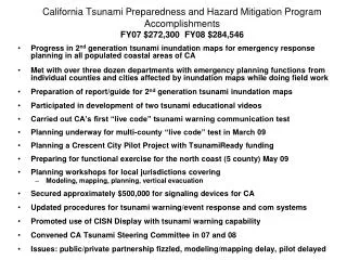
California: FY-08 GrantPeriod of Performance Extended to 7-31-10 • Total Funding Received: $284,546 • Tsunami public education program for Crescent City • Conduct a baseline survey to assess planning, mitigation and preparedness • Print 200,000 copies of Living on Shaky Ground: How to Survive Earthquakes and Tsunamis in Northern California • Incorporate 2nd generation tsunami inundation maps into My Hazards and complementary CGS website • Provide funding for tsunami signs to assist communities achieve TR status • Develop strategy to deter theft of tsunami signs • Purchase tsunami education kiosks for beach parks in CA • User friendly report documenting modeling and mapping • Provided funding for reconnaissance of the Samoa earthquake and tsunami • Issues: Furloughs 3-days per month reducing work time by 15%
Living on Shaky Ground • Developed by Dr. Lori Dengler and the Redwood Coast Tsunami Work Group • Recently revised • Printed 300,000 and distributed 280,000 in December 2009 • In demand following January 9, 2010 Eureka Earthquake
Tsunami Baseline Survey • Survey originally intended for California • Became a MES project to develop survey for use by all NTHMP partners • Rather than administer it in California • Concentrated on making a survey that could be used by all and developing an Implementation Plan
Agreed to purchase tsunami signs for coastal jurisdictions Way to promote TsunamiReady Originally to step in for Caltrans Cost reductions allowed us to buy signs for both state and local roads/streets Purchasing Tsunami Signs
California FY 2009-10 • Total Funding Received: $1.12 Million NTHMP ($944,026) • Complete 2nd generation maps, assure conformity w/established methodologies, develop repository, conduct workshops (4) • Identify information necessary to incorporate tsunami hazard into land-use planning and construction decisions • Begin work on marine off-shore safe zone for maritime communities to include strategic plan and guidance materials • Provide planning and technical assistance to coastal communities (workshops, exercises, plan review) • Develop guidance materials for local tsunami planning and mitigation (e.g. geotechnical guide for evacuation planning) • Disseminate recently developed education materials • Development of “Tsunami Awareness and Preparedness Week” • Continue work on the baseline survey for the NTHMP • Complete Crescent City Educational Pilot Project • Convene the California Tsunami Steering Committee (2 meetings per year) and fully participate in the NTHMP • Conduct a “Live Code” Tsunami Communications Test in northern California in March • Participate in other tests conducted by NOAA and maintain and update internal protocols and procedures for tsunami response including siren tests
California FY 2009-10Total Funding Received: $1.12 Million Tsunami Ready ($177,727) • Provide planning and technical assistance to local jurisdictions pursuing TsunamiReady recognition • Organize and support tsunami advocacy groups in coastal California modeled on the Redwood Coast tsunami Work Group • Provide funding for tsunami signage to promote the TsunamiReady Program • Work with the California State Parks Department to assist 122 coastal and beach parks become TsunamiReady Issues: 1) Difficulties in staffing up to accomplish all tasks in work plan; 2) Furloughs 3-days per month reducing work time by 15%; 3) Delays with subcontracts and purchases
2nd Generation Tsunami Inundation Maps • Funded primarily by National Tsunami Hazard Mitigation Program. • 2nd generation maps have higher resolution, consider more potential sources, and have better coverage than original maps from the state. • 50% of state, including 90% of southern California and 100% of San Francisco Bay Area • Maps based on 40 largest anticipated local and distant tsunami sources and inundation under Mean High Water conditions. • Collaboration between CalEMA, USC, CGS, and counties/local working groups: • CalEMA – tsunami program and funding management, final map production and distribution, and help workshop coordination • USC – source determination and numerical tsunami modeling (MOST) • CGS – science and field coordinator, source determination, data transfer and enhancement in GIS, and final inundation line determination • Counties/Working Groups – local knowledge/concerns, map implementation, and workshop coordination • Maps intended strictly for emergency response planning. California Tsunami Modeling Coverage 2008-09 Grids San Francisco Bay
Creating the Inundation Maps Sources • Model tsunamis • Enhance inundation • line location using • GIS/field work Maximum Flow Elevation (m)
Public Release of Inundation Maps www.conservation.ca.gov/cgs MyHazards.calema.ca.gov GIS layers: ArcGIS, GoogleEarth Brochures, CGS Educational Note Maps released to public at press conference December 2009 AGU meeting Panelists: Local, CalEMA, USC, CGS, and NOAA Significant media and public interest
California FY 2010-11Total Funding Received: NTHMP and TsunamiReady $1.04 Million • Continue work begun in 2009 [nearly all were multi-year tasks] • Develop and populate tsunami sources database and peer review of sources for CA 2nd generation inundation maps • Transfer of modeling and mapping files to NTHMP repository • Convene a workshop and form a working group to develop a methodology for creating tsunami hazard mitigation products for land-use planning • Strategic plan for implementing products from maritime safe zone work done in 2009-10 • Expand “Live Code” testing to additional California Counties • Disseminate guidance documents for planning, policy and geotechnical evaluation of evacuation plans • Provide funding to newly organized tsunami preparedness advocacy groups