Download
1 / 25
270 likes | 678 Vues
Biomes and Ecosystems. Human Impact and Earth Systems. Review. We have studied how the main elements of life (C, N, O, H 2 O, P) cycle through ecosystems. We have studied how energy moves through ecosystems. Now it is time to study ecosystems themselves. This Unit – Biomes and Ecosystems.

E N D
Biomes and Ecosystems Human Impact and Earth Systems
Review • We have studied how the main elements of life (C, N, O, H2O, P) cycle through ecosystems. • We have studied how energy moves through ecosystems. • Now it is time to study ecosystems themselves.
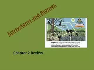
This Unit – Biomes and Ecosystems Systems thinking: • Earth systems (atmosphere, biosphere, geosphere, hydrosphere, cryosphere) • Biomes – Regions where non-living Earth systems interact to form unique conditions that foster the growth of a unique combination of organisms in the biosphere • Ecosystems – can range from macro (biome) to micro (fish bowl, under log, under arm)
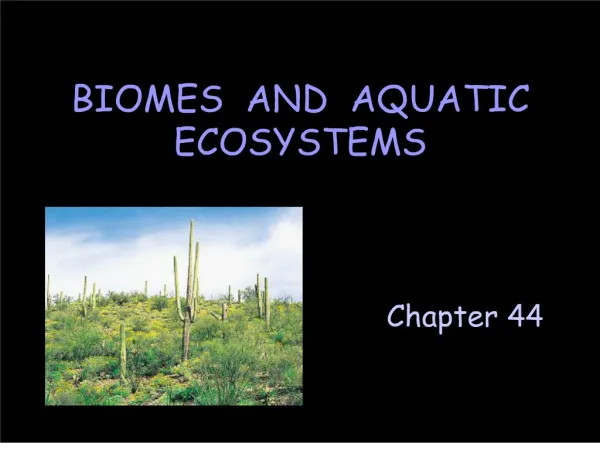
TERRESTRIAL BIOMES • Tundra • Taiga • Deciduous • Tropical rainforest • Desert • Savanna • Grasslands • Chaparral • Alpine • MARINE and AQUATIC BIOMES • Estuary • Wetland (temperate) • Swamp (tropical) • Reef • Riparian • Lake • Ocean VOCAB • Species • Individual • Population • Community • Ecosystem • Biome
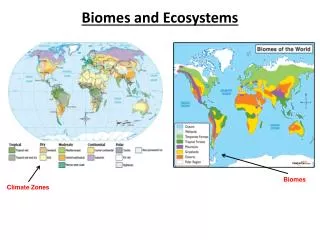
BIOMES • Characterized by climate – temperature and precipitation • Each biome has a characteristic latitude amount of direct sunlight during specific months of the year • Each biome is also determined by geographic components--coastline vs inland, elevation proximity to water moderates temperatureselevation moderates temperaturerainshadoweffect affects moisture
Hypothesize: Which city in Russia is most inland? Which city in Russia is southernmost? WHY do you think so?
Climate is represented graphically Annual temperature and rainfall can be broken down into monthly averages and graphed into what is called a CLIMATOGRAM
Assignment 1 Given: a data table of monthly precipitation and temperature* for a specific location: • Construct a climatogram • Hypothesize its geographic location • Hypothesize its biome • Justify your claims by considering slide 5 *open tempPrecipdata.docx Website that contains many climatograms…
What about L.A.? • Climatogram • Latitude, longitude, elevation, coastal/inland? • Name of Biome • Soil type – geologic history • Native plants (flora) • Native animals (fauna) • Human impact
Latitude, longitude, elevation 34° 3' 8" N / 118° 14' 34" W, 71 meters
Biome - Chaparral • Very hot and dry -- winters are mild 10 °C, summers are so hot and dry at 40 °C that fires and droughts are very common. • Plants are adapted to these conditions. Most plants have small, hard leaves which hold moisture. Examples: poison oak, scrub oak, Yucca Wiple and other shrubs, trees and cacti. • Animals are mainly grassland and desert types adapted to hot, dry weather. Examples: coyotes, jack rabbits, mule deer, alligator lizards, horned toads, praying mantis, honey bee and ladybugs.
LA Geology / Soil Los Angeles area is located over a deep sedimentary basin with hills composed of folded Miocene and Pliocene sedimentary rocks (suggesting it was once covered by water). The basin is rimmed by the crystalline rocks of the Santa Monica Mountains and the San Gabriel Mountains (suggesting volcanic origins). Excavation shows mostly sand and silt, not particularly fertile soil.
LA – Human Impact • LA River – channeled to prevent flooding • Water use – saltwater intrusion in groundwater • Paved surfaces - watershed pollution carried by runoff into ocean • Oil and gas drilling, groundwater pollution • Fossil fuels combustion – air pollution • Smog • Ground level ozone • Invasive species
Summary of Biomes - Tropical • Humid tropical regions are the most complex and biologically rich • Soil is nutrient -poor because decomposition and photosynthesis occur at an accelerated rate • Nutrients are contained in living organisms • When living organisms are removed, the biome cannot repopulate due to loss of nutrients • Tropical rainforests (and their biodiversity) are endangered due to human activity
Summary: Grasslands & Savannas • Too little rainfall to support trees • Have rich soils and are now used extensively for agriculture and grazing • Overgrazing livestock threatens native animals and plants • Monoculture threatens the multi-layered ecosystems that re-enrich soil • Human exploitation soil erosion, loss of habitat for animals
Deserts • Less than 30 cm rain per year • Plants and animals specially adapted to these conditions
Deciduous forests • Temperature ranges from -30°C to 30°C • Four seasons – lose leaves in autumn • 75-150 cm rainfall/yr • Can regenerate since decomposition and photosynthesis is slower than tropical • Extensive human exploitation loss of habitat for animals • Not ideal for agriculture, although some does take place
Coniferous forests • Boreal warmer than Taiga • Forests are mostly cone-bearing (coniferous) also called evergreens (do not lose leaves) • Needles preserve moisture, cones protect seeds • Tolerant of cold temperatures • Human exploitation has caused loss of habitat for animals
Tundra • Far northern latitudes • Cold temperatures • Short growing season • Permafrost • Migratory area for birds and sea mammals • Not threatened by human activity, but impacted by climate change
Marine • Photosynthetic organisms support the food web (mostly algae) • Vertical stratification is a key concept • Temperature, light penetration, salinity vary at different strata or Zones • Cold water holds more oxygen than warm water
Marine Ecosystems Biodiversity • Kelp forests – temperate latitudes • Coral Reefs – tropical latitudes, shallow water • Mangroves – tropical latitudes, forests and swamps growing in salt water along coastlines that stabilize and protect shorelines • Estuaries – nutrient rich bays where fresh and salt water meet and mix • Barrier islands – protect shorelines and bays All are endangered due to human activity.
Freshwater Ecosystems • Lakes also have strata or zones by light, temperature, oxygen • Centers of biodiversity because they are reliable sources of water to land animals • Aquatic ecosystems are highly impacted by phosphorus and nitrogen nutrient excess (eutrophication) • Riparian – river and banks • Wetlands – filtering system for runoff, high concentration of nutrients, plants, “nursery” for fish, amphibians, birds, etc.
Human impact • Habitat disruption by humans’ creates the most serious damage to ecosystems • Temperature deciduous forests are the most dominated by humans (lumber) • Grassland and chaparral are highly impacted (agriculture overuses soil) • Tundra and arctic biomes are least disturbed due to low productivity