Oh Canada!
Oh Canada!. The Physical Geography of Canada. Essential Questions. What are the major physical features of Canada, and where are they located? How do the factors of location, climate, access to water, and natural resources affect where Canadians choose to live and work?. Key Vocabulary.

Oh Canada!
E N D
Presentation Transcript
Oh Canada! The Physical Geography of Canada
Essential Questions • What are the major physical features of Canada, and where are they located? • How do the factors of location, climate, access to water, and natural resources affect where Canadians choose to live and work?
Key Vocabulary • Continental Divide –The Boundary that separates the rivers flowing towards opposite sides of the continent • Rain Shadow –an area on the dry, sheltered side of a mountain that receives little rain fall. • Tundra–Cold dry region in the far north covered with snow over ½ the year • Permafrost–Permanently frozen soil • Prairie–Flat rolling land covered with grasses located in areas that have humid climates • Province–A political division in Canada…much like the states in the US • Territory –An area of land; region • Alluvial –Fertile top soils deposited by rivers after a flood
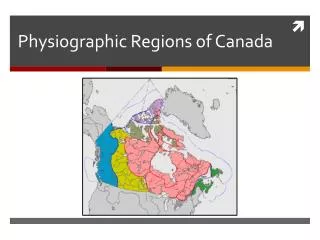
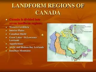
POLITICAL FEATURES: • 10 Provinces • •3 Territories • 2nd largest country in the world in land size.
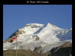
LAND •Mountains: •Rocky Mountains- Extend 3000 miles in North America (U.S. & Canada)
Canadian Shield •Covers nearly ½ of Canada’s land area •Circles Hudson Bay in eastern Canada •Area of ancient rock -Very rugged •Rich in natural resources –trees, minerals & water
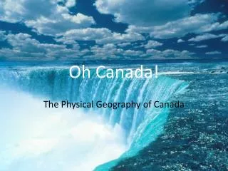
Water Oceans •Canada is bordered by three oceans •Atlantic to the east •Pacific to the west •Arctic to the north Other •Hudson Bay •Connected to both the Arctic and Atlantic Ocean •Niagara Falls •Border between Ontario and New York state
Lakes Great Lakes •5 freshwater lakes -largest in the world •Lake Huron, Ontario, Michigan, Erie, Superior (HOMES) •Formed by glaciers during the last Ice Age •4 of 5 lakes shared by both US and Canada
Rivers • St. Lawrence River (“Mother of Canada”) •Connects the Great Lakes to the Atlantic Ocean
Climate • What affects climate? • Canada has many climate zones. Much is well above the 40°latitude line so the climate is COLD!
Where do Canadians live? • About 80% of Canadians live in urban areas in southeast and central parts of Canada –roughly 100 miles from the USA-Canada border. •Available natural resources and climate •Great Lakes/St. Lawrence River •Most densely populated area –provide trade routes inland •Fertile farm land and temperate climate •Western Plains •People have settled here to harvest the rich farmlands
Trade • Canada’s trade is impacted by location, climate and natural resources. • Natural Resources include fur, fish, forestry, iron ore from the Canadian Shield, agriculture • Due to Canada’s location north of the USA, the U.S. is Canada’s major trading partner • Both countries are interdependent on each other, or they need each other to be successful economically • 80% of exports go to the USA •NAFTA was established (North American Free Trade Agreement) • Since 1994, US, Canada and Mexico have free trade between their countries