Download
1 / 25
250 likes | 468 Vues
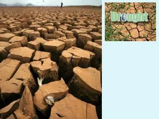
Issues in Drought Monitoring: Canadian Experiences. NASA Global Drought Monitoring Workshop Rick Lawford Silver Spring April 11, 2011. Canadian Drought Monitor Produced by AAF and EC. Draft map is produced from a subjective analysis of many variables and indices

E N D
Issues in Drought Monitoring: Canadian Experiences NASA Global Drought Monitoring Workshop Rick Lawford Silver Spring April 11, 2011
Canadian Drought Monitor Produced by AAF and EC Draft map is produced from a subjective analysis of many variables and indices which is then circulated to a community of experts that provide feedback how Well the analysis represents the conditions on the ground.
The objectives of Drought Research Initiative (DRI) are: To better understand the physical characteristics of and processes influencing Canadian Prairie droughts, and To contribute to their better prediction and to improved societal preparation Strategy: Focus on the recent severe drought that began in 1999 and largely ended in 2005 OBJECTIVES AND STRATEGY
Quantifythe physical features, flows of water and energy into and out of the region, and storage and redistribution within the region Improve the understanding of processes and feedbacks governing the formation, evolution, cessation and structure of the drought Assess and contribute to reducing uncertainties in the prediction of drought Compare the similarities and differences of current drought to previous droughts and those in other regions Apply our progress to address critical issues of importance to society DRI THEMES
Phases 500 mb height anomalies beginning phase mature phase mature phase - structure shift cessation phase (from Bonsal)
The summers of the multiyear drought were characterized by: Higher cloud bases Lower CAPE (from Henson et al., 2011)
Annual PDSI Bonsal/Wheaton
The return period for a drought at a particular location is dependent on the data source used. (1: ~1:100y, 2: ~1:50y, 3: ~1:33y, …. 39: 1:2.5y) Saskatoon – Ranked 12-month SPI • 12-month SPI based on 2001 Agricultural year (September 2000- August 2001)
Both in-situ and satellite data were used to characterize the • spatial distribution of the drought and its time evolution. From Bonsal, Wheaton) NDVI anomalies (based on 2000-08 mean) for 2000-2003 250m spatial resolution for 10-day period of July 11-20 (Yang, Wang, Trishchenko)
(from Paul Bulock) Statistically Significant Drought Index Correlations by Category AC Barrie Superb Water Supply Indices 0 3 Water Demand Indices 19 24 Water Balance Indices 14 18 Water Use Indices 7 7 Evapotranspiration provides a more accurate estimate of wheat yield and quality than precipitation and should be utilized for assessment of agricultural drought. DRI 2008 Calgary
Maps by D.T. Price, M. Siltanen & D. McKenney from Canadian gridded monthly climate (interpolations based on ANUSPLIN) Hogg
Annual Evapotranspiration 1999 to 2006(adjusted by ~ +15% for energy-balance closure) Aspen (393 ± 80) Black Spruce (374 ± 33) Jack Pine (303 ± 21) Drought Amiro & Barr
Duck Lake SK Observation wells: water levels, 1964-2006 [Source: SK Watershed Authority, www.swa.ca] Jan-66 Jan-68 Jan-70 Jan-76 Jan-78 Jan-80 Jan-82 Jan-84 Jan-86 Jan-88 Jan-90 Jan-92 Jan-94 Jan-96 Jan-98 Jan-00 Jan-02 Jan-04 Jan-06 Jan-08 Jan-64 Jan-72 Jan-74 0.000 Duck Lake #2 Duck Lake #1 Duck Lake 1 Depth below ground level (m) 1.000 Aquifer 34 m Water table depth (m) 2.000 Aquitard 3.000 118 m 4.000 Aquifer 134 m Aquitard (Van der Kamp)
Passive Microwave Derived SWE 1998 2001 2004 1999 2002 2005 2000 2003 Derksen & Brown
Surface Hydrology monthly low flow that occurred only 10 percent of the time (Q10) was selected as the threshold
Heavy human impactfrom irrigation, dams, cities, tar sands, especially in Southern Alberta, overlaying tend to obscure natural hydrology. (Jeannine-Marie St. Jacques and David Sauchyn) South Saskatchewan at Medicine Hat Difference between naturalized and actual flows Difference between the two Naturalized record courtesy of
Socioeconomic Impacts of this drought in Canada were largest in 2001-2002 • Total Canadian agricultural production loss was ~$3.6B • Gross Domestic Product fell ~$5.8B • Employment losses > 41,000 • Worst year was 2002 • Alberta and Saskatchewan were hit hardest Wheaton et al. 2008
Responses to drought in some years can increase vulnerability to drought in later years. According to Agriculture Canada, the Oldman river region receives 400-450mm per year of precipitation and has a net moisture deficit of about 350 mm of water per annum.
NADM Continental Drought Indicators • The NADM drought conditions in US, MX, CN are determined independently based on different data, indices, & analyses within each country. This process ensure regional inputs but introduces some non-uniformity in the product for analysis purposes. • Drought indices covering entire region are needed • Same indices, same analysis period, same methodologies to allow intercomparisons • This consistency is needed for depiction across international boundaries and • for capability between locations. A global framework is needed to incorporate a diversity of information and impacts.
Summary Indices for dealing with meteorological drought are well developed for the warm seasons. However, more work is needed to define the best Indices for agricultural and hydrological drought and their relationship to meteorological drought. While many satellite products can provide guidance on a global basis their use is limited by the regional uniqueness of drought and the socio-economic and governance frameworks for dealing with it. A global framework is needed that facilitates the production and application of global products and allows for regional expertise and circumstances to be incorporated into the assessment of drought and the management of its impacts.