HPC Medium Range Grid Improvements
This document outlines the significant improvements made to the Medium Range Grids at HPC by forecasters Mike Schichtel, Chris Bailey, Keith Brill, and David Novak. Key upgrades include refined temperature, probability of precipitation (PoP), dew point, and sky cover grids, utilizing an international guidance suite and downscaled models. The changes focus on enhancing forecast accuracy, especially in cool seasons, and involve the introduction of a novel Precipitation Likelihood Index. This comprehensive overview details operational methodologies, verification comparisons, and collaborative efforts in atmospheric research.

HPC Medium Range Grid Improvements
E N D
Presentation Transcript
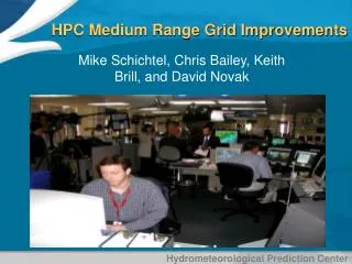
HPC Medium Range Grid Improvements Mike Schichtel, Chris Bailey, Keith Brill, and David Novak
Medium Range Desk Temps/PoP Pressure/Fronts • Staffed 1030-1930 UTC by two forecasters • -Temperatures/Pop Desk • Max/MinT and PoP Grids • -Pressure/Fronts Desk • Winds Grids • Sky, Dewpoint, and Wx derived • Preliminary grids issued by 1415 UTC (15 UTC deadline) • -including 00 UTC ECMWF ensemble • Final grids usually issued by 18 UTC (20 UTC deadline) • -incorporating 12 UTC guidance suite without ECMWF
HPCGuide Medium Range 5 km Grids MIN TEMPS MAX TEMPS WINDS 12 HOUR POPS DEWPOINTS CLOUD COVER WEATHER TYPE
Day 7 Skill 2008 = Day 5 Skill 2001! _ _ _ _ _ _ _ _
Anomaly correlation die-off scores of Model and Ensemble Mean Forecasts
Primary Medium Range Models/Ensembles at HPC Total: 288 individual runs per day!
Medium Range Data GEFS Member ECMWF Member Full International Guidance Suite including ECMWF deterministic and ensemble and bias-corrected NAEFS 90 Ensemble members CMC Member ECMWF Mean NAEFS Mean GEFS Mean GFS ECMWF
Forecast Process • Forecaster compares an international guidance suite, GFS MOS, climatology, and HPC and NDFD (NWS) continuity • Forecaster chooses blends and weights Maximum Temps vs. GFS MOS HPC Continuity NDFD Continuity ECMWF Ens Blender Final Product GFS ECMWF MSC DGEX ICT HPC
Improvements MadeTd and Sky • April 15, 2010: Methods to derive Dew Point and Sky Changed. MAE improved up to 20%. • Dew Point: Model guidance weighted according to forecaster’s Max/MinT blends. Downscaled by using a GDAS-RTMA difference accumulated by applying a decaying weight through time. • Sky: Model guidance weighted according to forecaster’s PoP blends. No downscaling. Better in Cool Season Testing Feb 2010 (green = new) Testing June 09 – Jan 2010 (green = new)
Improvements MadeTd Comparison Before • MDL Verification Comparison of April-Sept (00 UTC cycle) HPC (green) highest medium range MAE
Improvements MadeTd Comparison After Change • MDL Verification Comparison April-Sept (00 UTC cycle) HPC (green) now lowest MAE Given longer history verification shown in slide #9, HPC skill should be better during cool season
Latest Improvements Operational as of November 2: Increased use of model guidance downscaled using RTMA instead of PRISM. New Day 7 skill equals = Old method Day 5.5 _ _ _ _ _ _ _ _ This new HPC DS_FNL score does not yet reflect additional benefits from bias corrections and forecaster modifications
New Day 7 skill equals = Old method Day 5.5 _ _ _ _ _ _ _ _ _ This new HPC DS_FNL score does not yet reflect additional benefits from bias corrections and forecaster modifications
Other Elements Wind Speed HPC similar to NDFD Jul ‘09 – Jul ‘10
Other Elements 12 h PoP HPC better than MOS and similar to NDFD Jul ‘09 – Jul ‘10
Improvements Prototyped6 hFloating Pop • 6 h statistical PoPs generated from international model suite • The 6 h period with the higher PoP is set to the HPC 12 h PoP (consistent with floating PoP principles) • The remaining 6 h period is assigned the statistical 6 h PoP value • Renamed “Precipitation Likelihood Index” to avoid public confusion. • Real-time prototyped images available at: http://www.hpc.ncep.noaa.gov/5km_grids/5km_gridsbody_newparms.html • Which can be compared to the operational suite at:http://www.hpc.ncep.noaa.gov/5km_grids/5km_gridsbody.html
Improvements PrototypedWeather Grid Enhancements • Time resolution increased from 12 h to 6 hourly • Precipitation Type Algorithm improved (top-down approach) • Slight chance, chance, and likely qualifiers added (based on HPC PoP) • Real-time prototyped images available at: http://www.hpc.ncep.noaa.gov/5km_grids/5km_gridsbody_newparms.html • Which can be compared to the operational suite at:http://www.hpc.ncep.noaa.gov/5km_grids/5km_gridsbody.html
Collaboration Academia / Publications Conferences (like NROW) CSTAR Rossby Wave Packets etc. EMC / THORPEX Adaptive Observations Targeting Observation Program WFOs/RFCs 12Planet Chatroom and coordination calls
Summary • HPC uses full suite of international model guidance • Given limited forecaster resources, increasingly relying on forecaster blending input coupled with post processing • Improvements to Td and Sky have been made • Improvements to PoP and Wx grids prototyped • Improvements to Max/MinTemps November 2010 (now!) • Open to suggestions • for improvement

