### Status Update and Validation Process for National Geospatial Data Set Assets - December 2009 Meeting ###
This document provides a comprehensive overview of the National Geospatial Data Set Assets' validation process as discussed in the Coordination Group meeting held in December 2009. Key topics include agency support for the validation of datasets, proposed survey design for federal-wide data assessment, and planned timelines for stakeholder engagement and public comment. The meeting emphasized the need for a consistent approach and collaboration among various agencies, including federal, tribal, state, and local entities, to ensure the effective use of geospatial data in decision-making. ###

### Status Update and Validation Process for National Geospatial Data Set Assets - December 2009 Meeting ###
E N D
Presentation Transcript
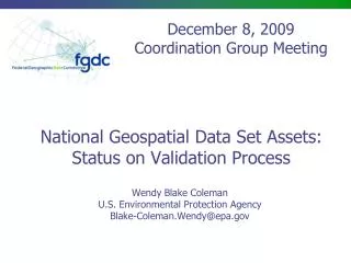
December 8, 2009 Coordination Group Meeting National Geospatial Data Set Assets:Status on Validation Process Wendy Blake Coleman U.S. Environmental Protection Agency Blake-Coleman.Wendy@epa.gov
Validation Process • Ascertain Agency Support for National Geospatial Dataset Assets and A-16 portfolio process • Response still needed from agencies- December 2009 • OMB concurs with concept wants more specificity in A-16 Supplemental Guidance -12/03/09 • Meet with CG/LMW to discuss validation tool and overall process 11/05/09 Identified need to: • Clean up of 2008 data results-November/December 2009 • Meet with statistician to discuss design and post survey analysis approach-ongoing • Finalize survey design and approach-January 2010 • Discuss concepts and process with Executive Steering Committee- By early January 2010
Validation Process, Cont’d. • Identified needs, cont’d. • Federal-wide Survey- January/February 2010 • Initial proposal no later than early March 2010 • Consider broader stakeholder involvement through options such as • “National Forum” session (s) on proposed National Geospatial Data Set Assets- Spring 2010 • Key NGOs (representing States, Tribes, local governments, private sector) • States and Tribes • Public • A public comment period on survey results –Spring 2010 • Linkage to themes • Continue to refine theme definitions on parallel track – By February 2010 • Work with Stakeholders to “associate” appropriate groupings of National Geospatial Dataset Asserts to themes –after validation of data sets
Validation Process - Survey SURVEY GOAL: Obtain an understanding of how data sets support business and the breath of use to inform decision on list of National Geospatial Data Assets • Key Questions Addressed at the 11/05/09 Meeting • Which Survey questions should be asked to meet the survey objective? • How wide a distribution/who should be the recipients as all Agencies are organized differently?
Validation Process – Survey Questions • Nine potential survey questions posed to the CG/LWM group on 11/05/09 • Group recommended fewer and simpler questions than originally proposed • Does your agency use this dataset? (Yes, No) • If no, skip dataset • If yes, is it critical to your business? • If yes, for what initiative area do you use the dataset? • If yes, does your agency invest in this dataset? • If no, skip question below • If yes, dollars or in-kind, etc. • If yes, do you have non-federal agency partners who use this?
Validation Process – Survey Questions, Cont’d. • Issues • Need for consistency to make assessment • Need for direct linkage to FEA and specific presidential initiatives particularly after conversations on 12/01-03, 2009 • Actions • Initiated discussion with EPA statistician on survey goals, correct questions top reach goals, and result analysis • Will work with GSA GC member on usability design • Request to schedule discussion with Executive Steering Committee for their input
Validation Process - Distribution • Distribution Target • Federal Government • send to all 32 FGDC member agencies • sense agencies know their geospatial data users/producers who should answer • Outside Federal government • Consensus not reached • Some thoughts • states/tribes need to be involved early on • use current theme leads to vet with their communities • survey the membership of various non-Federal groups • publish the results for public comment as a later part of the validation process • Convene a spring National Geospatial Forum around the list
Validation Process – Distribution, Cont’d. • Issues • For Federal consistency, should request be made for input from enterprise EA and GEO groups? • How is a consistent business view ensured? • Need to vet approach with the Executive Steering Committee • Actions • For Federal consistency, should request be made for input from enterprise EA and GEO groups? • How is a consistent business view ensured? • Need to vet approach with the Executive Steering Committee
Proposed Process for Validation • Finalize data clean-up package and Send to agencies 12/04/09 • Convene 2 Technical Assistance Sessions- Weeks of 12/07/09 and 12/13/09 • Review Results – By 1/15/10 • Follow-on with agencies as necessary • Share list with CG for last review • Finalize questions and distribution approach for Validation Survey- By 1/20/10 • Discussions with • Statisticians • Survey designers • Executive Steering Committee • OMB? • Final review and approval by CG, Executive Steering Committee, OMB(?), NGAC?
Proposed Process for Validation, Cont’d. • Send Survey to targeted audience for 2-3 week response- By 1/25/09 • Convene 2-3 Technical Assistance Sessions- 1/25-30/10 • Review and analyze results -2/10 • Follow-on with agencies as necessary • CG subgroup assess data with approach suggested by statistician • Recommended list produced • Review and concurrence by CG, executive Steering Committee, OMB, and Steering Committee-By 3/10 • Involve broader Stakeholder community in review of proposed list- By 4/10
Wendy Blake Coleman U.S. Environmental Protection Agency Blake-Coleman.Wendy@epa.gov