Download
1 / 1
10 likes | 171 Vues
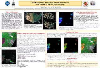
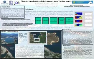
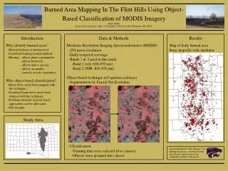
Study Area. Burned Area Mapping In The Flint Hills Using Object- Based Classification of MODIS Imagery. Rhett Mohler Kansas State University, Dept. of Geography, 118 Seaton Hall, Manhattan, KS, 66506. Introduction. Data & Methods. Results. Why identify burned areas?

E N D
Study Area Burned Area Mapping In The Flint Hills Using Object- Based Classification of MODIS Imagery Rhett Mohler Kansas State University, Dept. of Geography, 118 Seaton Hall, Manhattan, KS, 66506 Introduction Data & Methods Results Why identify burned areas? -Burn prevalence is misreported -Grassland burning is understudied -Burning : affects plant communities : affects livestock : affects native species : affects air quality : controls woody vegetation Why object-based classification? -Burns have rarely been mapped with the technique -Grassland burns have never been mapped with the technique -Problems inherent in pixel-based approaches can be alleviated -GIS friendly Moderate Resolution Imaging Spectroradiometer (MODIS) -250 meter resolution -Daily temporal coverage -Bands 1 & 2 used in this study -Band 1 (red: 620-670 nm) -Band 2 (NIR: 841-876 nm) Object-based technique (eCognition software) -Segmentation by Fractal Net Evolution Map of daily burned area Burn shapefile with attributes -Classification -Training data were selected (five classes) -Objects were grouped into classes Acknowledgements: EPA (Region 7) for funding this project, and Doug Goodin, Eric Bowles, and Dave Koch for comments to improve this poster.