Download
1 / 16
160 likes | 172 Vues
Investigating impacts of urbanization on stream ecosystems. Study examines ecological responses to urban development, identifying manageable factors. Comparison of urbanization effects across regions to find commonalities. Methodology includes landscape data analysis and biological, physical, and chemical data collection. Correcting inaccuracies in satellite data crucial. Stream ecosystem responses observed include changes in invertebrate communities, increased nutrient, chloride, and pesticide levels, reduced habitat quality. Landscape variables influencing stream ecology identified.

E N D
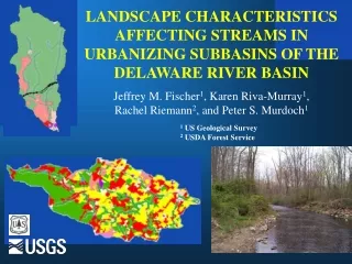
LANDSCAPE CHARACTERISTICS AFFECTING STREAMS IN URBANIZING SUBBASINS OF THE DELAWARE RIVER BASIN Jeffrey M. Fischer1, Karen Riva-Murray1, Rachel Riemann2, and Peter S. Murdoch1 1 US Geological Survey 2 USDA Forest Service
Major questions: What are the major effects of urbanization? What aspects of urbanization cause ecological responses? Which of these are ‘managable’? How do these aspects compare among regions? What are the national commonalities?
Approach • Control for natural variation among sites • Establish an apriori urbanization index based on available landscape data • Select sites so they are well-distributed along this gradient • Collect biological, physical, chemical data
Photo- interpreted NLCD 2000 NLCD 1992 Urb For Agr Common problem: Landscape data issues (Timeliness, accuracy, detail, availability)
EPT richness: number of different: Mayflies: Ephemeroptera Stoneflies: Plecoptera Caddisflies: Trichoptera Implications of NLCD inaccuracies Developed a region wide method to correct for inaccuracies in satellite NLCD data using road density
c o b b t a c o w y o m s h a b m i l l d a r f l n e s c r u m v a l l p i n e e b r c d i n g t o m s r i d l p i g e r a y m m a c o p i c k Station m a r s t o b y w b b r l h g o e b b r f r e n Piedmont sites p i d c s a w k Poconos sites h a y c v a n d b r o d l b u s f l a t 0 5 1 0 1 5 2 0 Road density (road miles/ sq. mi. basin) Site selection for urban intensity gradient 43 sites 10-60 sq. mi. basins Riffle/pool channels Point sources avoided Riemann and Riva-Murray, in process
Data collection elements *subset of sites
Chloride (mg/l) Chloride Chloride (mg/l) Pesticides Habitat Nutrients What stream ecosystem responses have we seen? Sensitive biota
Results - Detrended Correspondence Analysis Light grey to black shading indicates percentage of invertebrate species that would be considered tolerant of pollution, habitat degradation, and other disturbance. Note the increasing tolerance of the invertebrate community with increasing urbanization along Axis 1.
What landscape variables are related to stream ecological responses? Spearman rho >0.60, p<0.05
Algal Communities • Trees increase shading which reduce algal growth • Nutrients shift algal community composition to more eutrophic types
Results – Examples of landscape variables that contribute to 2-variable model of disturbance gradient(based on Multiple Linear Regression using ranked data)
Summary • Stream responses to urbanization include: • Invertebrate commmunity change; reduced # of sensitive taxa • Increased nutrients, chloride, pesticide concentrations • Decreased habitat quality • Potentially important types of landscape variables include: • Amount of forest or disturbed land in the watershed • Type of disturbed land in the watershed • Amount of forested buffer zone. • Patchiness of the landscape