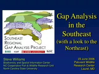
Gap Analysis in the Southeast (with a look to the Northeast)
Gap Analysis in the Southeast (with a look to the Northeast) Steve Williams Biodiversity and Spatial Information Center NC Cooperative Fish & Wildlife Research Unit North Carolina State University 23 June 2006 Patuxent Wildlife Research Center Laurel, MD Project Goals


Gap Analysis in the Southeast (with a look to the Northeast)
E N D
Presentation Transcript
Gap Analysis in the Southeast (with a look to the Northeast) Steve Williams Biodiversity and Spatial Information Center NC Cooperative Fish & Wildlife Research Unit North Carolina State University 23 June 2006 Patuxent Wildlife Research Center Laurel, MD
Project Goals • Create consistent and current land cover products for the Southeast • Create consistent presence/absence models for 600+ native terrestrial vertebrates • Incorporate GAP data with ongoing conservation planning efforts • North American Bird Conservation Initiative • USFWS Refuges, Ecological Services, and CCP Planning Process • State Comprehensive Wildlife Conservation Plans • More…
SE-GAP’s contribution to the National Land Cover Datasets Seven mapping zones 21 Land Cover classes Impervious Surface (0 -100%) Canopy Closure (0 -100%)
SE-GAP Detailed Land Cover Dataset Based on Ecological Systems - NatureServe Eleven mapping zones 135+ Land Cover classes
Ancillary Data Development • Ecological System Range Maps • Landform Modeling • Riparian Models • Aerial Photo Reference Data Collection • National Wetland Inventory Data Digitization
Vertebrate Data • 608 Species (terrestrial) • Known Range • Predicted Habitat Models • Presence/Absence Distribution Maps • Knowledge Based Information
SE-GAP Known Range Maps Northern Parula Parula americana Seepage Salamander Desmognathus aeneus
SE-GAP Pres./Abs. Distribution Model Prothonotary Warbler Protonotaria citrea
SE-GAP Deliverables • 2001 NLCD level land cover (20 classes) • 2001 GAP level land cover based on NatureServe Systems (135+ classes) • Digital photo library (30,000+) • Ancillary data sets (NHD, NED, NWI, landform) used in spatial modeling • Vertebrate database • Taxonomic information • Protection status • Habitat relationships • Textual descriptions of habitat • Spatial modeling criteria • Citations • 600+ vertebrate species known range maps and distribution models (presence/absence)
Pres/Abs Habitat Models High Definition Land Cover Habitat Modeling Expertise Ancillary Data Habitat Productivity Models Biological Expertise • Quantify habitat productivity • Expert opinion/Literature • Deductive & Inductive Models • Clearly state assumptions • Establish monitoring to test SE-GAP and USFWS Modeling SE-GAP USFWS
Pilot Project Objectives • Knowledge-based Habitat Suitability Maps • Ranking of model parameters for habitat suitability by expert opinion
Pilot Project Objectives • Knowledge-based Habitat Suitability Maps • Ranking of model parameters for habitat suitability by expert opinion • Sensitivity Analysis • Determine the influence of model inputs on prediction areas • Little impact – but is it critical to the species? • Big impact - assess reliability and focus on refinement • Management implications • Distance to water: protect riparian habitat. • Open grassland land cover type: implement fire management
Pilot Project Objectives • Knowledge-based Habitat Suitability Maps • Ranking of model parameters for habitat suitability by expert opinion • Sensitivity Analysis • Determine the influence of model inputs on prediction areas • Data-driven Habitat Suitability Maps • Develop habitat suitability classification with existing observation datasets and a variety of statistical approaches (CART, DOMAIN, MaxEnt, etc.)
Pilot Project Objectives • Knowledge-based Habitat Suitability Maps • Ranking of model parameters for habitat suitability by expert opinion • Sensitivity Analysis • Determine the influence of model inputs on prediction areas • Data-driven Habitat Suitability Maps • Develop habitat suitability classification with existing observation datasets and a variety of statistical approaches (CART, DOMAIN, MaxEnt, etc.) • Develop Population Linkages to Habitat Suitability • Provides the numbers needed for conservation assessments
Consolidating / Updating GAP Data in the Northeastern US • Vertebrate Data – similar approach to SE-GAP effort • Land Cover Data – modified approach due to available data (i.e. FIA) and integration with other ongoing efforts • Stewardship Data – compile and update boundary and GAP status for region
ANALYSES AND APPLICATIONS • How can we better serve GAP data for ongoing conservation planning efforts (i.e. Wildlife Action Plans, HCPs, others)? • Develop a web-based interactive decision support tool based on the functionality of the GAP Ecosystem Data Explorer Tool GAP regional datasets.
LAND COVER MAPPING • Map Ecological Systems of the Chesapeake Bay, Central Appalachian Region (Zones 60 and 61), Southern Alleghany Plateau and to complete the maps for West Virginia and Ohio (Zone 62 and 52). • Study the application of pattern recognition in image classification for mapping herbaceous Ecological Systems and anthropogenic cover types. • Study the application of Light Detection and Radar (LiDAR) data for enhancing land cover data with sub-canopy structural information. • Land cover mapping for zones 63, 64, 65, and 66 (New England) to support the creation of a seamless mosaic of detailed land cover for the entire Eastern United States.
VERTREBRATE MODELING • Deductive modeling of vertebrate species habitat for Northeast (ME, NH, VT, MA, RI, CT, NY, PA, NJ, MD, DE, and OH). • This effort in combination with the models for the Southeastern Region will provide a seamless dataset for the Eastern United States. • Inductive habitat suitability modeling for priority bird species in selected Bird Conservation Regions of the Eastern United States.
LAND STEWARDSHIP • Analyze the distribution and pattern of conservation lands throughout the Southeastern U.S. • Develop prototype analyses and applications for land trusts whose primary interests include natural resource conservation.
Research Staff 2 Remote Sensing Analysts / Plant Community Ecologists 3 Database-GIS Analysts / Vertebrate Ecologists 2 GIS Analysts 3 Postdocs (Applications, Avian Modeling, SSP-Ecosystem Goals) Programmer (online dss tool) Students PhD (vertebrate modeling) MS (pattern recognition) MS (lidar) 2 MLS (stewardship) Personnel Resources