Download

1 / 38
530 likes | 1.91k Vues
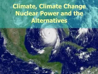
Chapter 13 Atmosphere and Climate Change Section 1: Climate and Climate Change. Climate. Climate is the average weather conditions in an area over a long period of time. Climate is determined by a variety of factors that include: latitude atmospheric circulation patterns

E N D
Chapter 13 Atmosphere and Climate Change Section 1: Climate and Climate Change
Climate • Climateis the average weather conditions in an area over a long period of time. • Climate is determined by a variety of factors that include: • latitude • atmospheric circulation patterns • oceanic circulation patterns • local geography of an area • solar activity • volcanic activity • The most important of these factors is distance from the equator.
Latitude • Latitudeis the distance north or south from the equator and is expressed in degrees. • 0° latitude = equator • 90° north = North Pole, most northerly • 90° south = South Pole, most southerly • Latitude strongly affects climate because the amount of solar energy an area of the Earth receives depends on its latitude.
Low Latitudes • More solar energy falls on areas near the equator than on areas closer to the poles. • The incoming solar energy is concentrated on a small surface at the equator. • In regions near the equator, night and day are both about 12 hours long throughout the year. • In addition, temperatures are high year-round, and there are no summers or winters.
High Latitudes • In regions closer the poles, the sun is lower in the sky, reducing the amount of energy arriving at the surface. • In the northern and southern latitudes, sunlight hits the Earth at an oblique angle and spreads over a larger surface area than it does at the equator. • Yearly average temperatures near the poles are therefore lower than they are at the equator.
High Latitudes • The hours of daylight also vary. • At 45° north and south latitude, there is as much as 16 hours of daylight each day during the summer and as little as 8 hours of sunlight each day in the winter. • Near the poles, the sun sets for only a few hours each day during the summer and rises for only a few hours each day during the winter. • Thus, the yearly temperature range near the poles is very large.
Summary Check #1 How is the amount of energy received in northern and southern latitudes different from the amount received at the equator?
Answer: In northern latitudes and southern latitudes, the amount of energy arriving at Earth’s surface is less than the amount received at the equator.
Atmospheric Circulation • Three important properties of air illustrate how air circulation affects climate. • Cold air sinks because it is denser than warm air. As the air sinks, it compresses and warms. • Warm air rises. It expands and cools as it rises. • Warm air can hold more water vapor than cold air can. • When warm air cools, the water vapor it contains may condense into liquid water to form rain, snow, or fog.
Atmospheric Circulation • Solar energy heats the ground, which warms the air above it. • This warm air rises, and cooler air moves in to replace it. • Movement of air within the atmosphere is called wind. • Because the Earth rotates, and because different latitudes receive different amounts of solar energy, a pattern of global atmospheric circulation results. • This circulation pattern determines Earth’s precipitation patterns.
Atmospheric Circulation • For example, the intense solar energy striking the Earth’s surface at the equator causes the surface as well as the air above the equator to become very warm. • This warm air can hold large amounts of water vapor. • But as this warm air rises and cools, its ability to hold water is reduced. • As a result, areas near the equator receive large amounts of rain.
Prevailing Winds • Winds that blow predominantly in one direction throughout the year are called prevailing winds. • Because of the rotation of the Earth, these winds do not blow directly northward or southward. • Instead, they are deflected to the right in the Northern Hemisphere and to the leftin the Southern Hemisphere.
Prevailing Winds • Belts of prevailing winds are produced in both hemispheres between 30º north and south latitude and the equator. • These belts of winds are called the trade winds. • The trade winds blow from the northeast in the Northern Hemisphere and from the southeast in the Southern Hemisphere.
Prevailing Winds • Prevailing winds known as the westerlies are produced between 30º and 60º north latitude and 30º and 60º south latitude. • In the Northern Hemisphere, these westerlies are southwest winds, and in the Southern Hemisphere, these winds are northwest winds. • The polar easterlies blow from the poles to 60º north and south latitude.
Oceanic Circulation • Ocean currents have a great effect on climate because water holds large amounts of heat. • The movement of surface ocean currents is caused mostly by winds and the rotation of the Earth. • These surface currents redistribute warm and cool masses of water around the world and in doing so, they affect the climate in many parts of the world.
El Niño–Southern Oscillation • El Niñois the warm phase of the El Niño–Southern Oscillation. • It is the periodic occurrence in the eastern Pacific Ocean in which the surface-water temperature becomes unusually warm. • During El Niño, winds in the western Pacific Ocean, which are usually weak, strengthen and push warm water eastward. • Rainfall follows this warm water eastward and produces increased rainfall in the southern half on the U.S., but drought in Australia.
El Nino Patterns Videohttps://www.youtube.com/watch?v=7FVZrw7bk1w&feature=player_embedded
El Niño–Southern Oscillation • La Niñais the cool phase of the El Niño–Southern oscillation. • It is the periodic occurrence in the eastern Pacific Ocean in which the surface water temperature becomes unusually cool. • El Niño and La Niña are opposite phases of the El Niño–Southern Oscillation (ENSO) cycle.
Global Circulation Patterns • Air descending at the 30º north and 30º south latitude either moves toward the equator or flows toward the poles. • Air moving toward the equator warms while it is near the Earth’s surface. • At about 60º north and 60º south latitudes, this air collides with cold air traveling from the poles. • The warm air rises, and most of this uplifted air is forced toward the poles. • Cold, dry air descends at the poles, which are essentially very cold deserts.
Global Circulation Patterns • Cool air normally sinks, but cool air over the equator cannot descend because hot air is rising up below it. • This cool air is forced away from the equators toward the North and South Poles where it accumulates at about 30º north latitude and 30º south latitude. • Some of the air sinks back to the Earth’s surface and becomes warmer as it descends. • This warm, dry air then moves across the surface and causes water to evaporatefrom the land below, creating dry conditions.
Pacific Decadal Oscillation • The Pacific Decadal Oscillation (PDO) is a long-term, 20 to 30 year change in the location of warm and cold water masses in the Pacific Ocean. • PDO influences the climate in the northern Pacific Ocean and North America. • It affects ocean surface temperatures, air temperatures, and precipitation patterns.
Topography • Height above sea level (elevation) has an important effect on climate. Temperatures fall by about 6°C (about 11°F) for every 1,000 m increase in elevation. • Mountain ranges also influence the distribution of precipitation. • For example, warm air from the ocean blows east, hits the mountains, and rises. • As the air rises, it cools, causing it to rain on the western side of the mountain. When the air reaches the eastern side of the mountain it is dry. • This effect is known as a rain shadow.
Other Influences on Earth’s Climate • Both the sun and volcanic eruptions influence Earth’s climate. • At a solar maximum, the sun emits an increased amount of ultraviolet (UV) radiation. • UV radiation produces more ozone, which warms the stratosphere. Most produced at the equator. Why? • The increased solar radiation can also warm the lower atmosphere and surface of the Earth a little.
Other Influences on Earth’s Climate • In large-scale volcanic eruptions, sulfur dioxide (SO2) gas can reach the upper atmosphere. • The sulfur dioxide, which can remain in the atmosphere for up to 3 years, reacts with smaller amounts of water vapor and dust in the stratosphere. • This reaction forms a bright layer of haze(sulfuric acid) that reflects enough sunlight to cause the global temperature to decrease.
Seasonal Changes in Climate • The seasons result from the tilt of the Earth’s axis, which is about 23.5° relative to the plane of its orbit. • Because of this tilt the angle at which the sun’s rays strike the Earth changes as the Earth moves around the sun.
Seasonal Changes in Climate • During summer in the Northern Hemisphere, the Northern Hemisphere tilts toward the sun and receives direct sunlight. • The number of hours of daylight is greatest in the summer. • Therefore, the amount of time available for the sun to heat the Earth becomes greater. • During summer in the Northern Hemisphere, the Southern Hemisphere tilts away from the sun and receives less direct sunlight. • But, during the summer in the Southern Hemisphere, the situation is reversed.
Earth’s Seasons • Earth’s Tilt 1 – The Reason for the Seasons • Earth’s Tilt 2 – Land of the Midnight Sun
Checkpoint • How do large-scale volcanic eruptions influence Earth’s climate? Think about what water vapor, carbon dioxide, sulfur dioxide and ash do to the atmosphere.
Answer: • Volcanic eruptions can decrease global temperatures by creating a haze that reflects sunlight.