Download
1 / 25
250 likes | 466 Vues
Surprise Snow Storm December 28 th 2012. Ben Miller Meteorologist National Weather Service – St. Louis, Missouri. Overview. My Midnight Shift Forecast Model Forecast Data from 00Z December 28 th 2012 HPC Snow Forecast My Snowfall Forecast What Happened? Radar Imagery

E N D
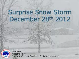
Surprise Snow Storm December 28th 2012 Ben Miller Meteorologist National Weather Service – St. Louis, Missouri
Overview • My Midnight Shift Forecast • Model Forecast Data from 00Z December 28th 2012 • HPC Snow Forecast • My Snowfall Forecast • What Happened? • Radar Imagery • Total Snowfall Map • Where Did The Forecast Go Wrong? • Satellite Imagery • Synoptic Analysis • An Ageostrophic Response • Banded Snowfall Potential
00Z FCST 12/28/12
12Z FCST 12/28/12
00Z FCST 12/29/12
500 mbVorticity Maximum from the 00Z forecast on 12/28/12 ECMWF GFS x x x x NAM x x 12Z 12/29 SREF x WRF x x x x x 00Z 12/29 x x GEM x x x x 00Z 12/28 x x x x 12Z 12/28
So What Happened? Surprise!
00Z 12/28/12 24 HR FCST of 295K Mixing Ratio and Ageostrophic Wind
00Z 12/29/12 00 HR FCST of 295K Mixing Ratio and Ageostrophic Wind
12Z NAM FCST on 12/28/12 KFAM Red: Omega Yellow: Elevated CAPE
Summary • Shortwave was a little stronger and took on a slightly negative tilt • Coupled jet developed • Ageostrophic flow brought richer moisture farther north/northwest • Limited instability allowed for banded precipitation