Download
1 / 12
120 likes | 356 Vues
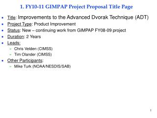
1. FY10-11 GIMPAP Project Proposal Title Page. Title : Improved use of GOES tropical cyclone intensity change and formation Project Type : Product Improvement and GOES Utilization Status : New Duration : 2 years Leads: John Knaff NESDIS/StAR/RAMMB Mark DeMaria NESDIS/StAR/RAMMB

E N D
1. FY10-11 GIMPAP Project Proposal Title Page • Title: Improved use of GOES tropical cyclone intensity change and formation • Project Type: Product Improvement and GOES Utilization • Status: New • Duration: 2 years • Leads: • John Knaff NESDIS/StAR/RAMMB • Mark DeMaria NESDIS/StAR/RAMMB • Other Participants: • Andrea Schumacher CIRA/Texas A&M • Jack Dostalek CIRA/CSU
2. Project Summary • Tropical Cyclone Intensity Change • Improve forecasting of Tropical Cyclone to Extra-Tropical Cyclone Transition (ET) using GOES data and environmental conditions • Improve forecasting of Rapid Weakening (RW) not associated with landfall using GOES & environmental conditions • Tropical Cyclone Formation • Improve the probability of detection and decrease the false alarm ratio using GOES image processing techniques.
3. Motivation/Justification • Supports NOAA Mission Goal(s): Weather and Water • Tropical Cyclone (TC) forecasts affect risk mitigation activities of industry, public and governmental sectors • Improving TC intensity forecast is a top NOAA/DOD priority • Better understanding of ET and RW cases will result in improved intensity forecasts. • Operational techniques for non-landfalling RW TCs currently do not exist • There are no operational guidance tools for identifying when a storm has completed ET. Existing forecasts/determination are subjective. This is important as other agencies can take over warnings/forecasts. • Forecasts of TC formation remains a difficult problem • Forecasts of TC formation are an operational requirement • Many sectors (e.g., US Navy) need long leads to mitigate TC events.
4. Methodology Extra-tropical transition (ET) - Warm-Core Symmetric cyclone to Cold-Core Asymmetric cyclone • Use GOES imagery and GFS-based environmental predictors • Discriminate the phases TC, ET, Mid-latitude Cyclone (MC) (define what constitutes ET) • Asymmetries-environment/imagery • Build on Hart and Evans (2003) • Determine precursors of ET – When will ET begin/end? Probabilities of? • Determine precursors of weakening & intensification during ET • Adapt the Statistical Hurricane Prediction Scheme (SHIPS) to better account for ET. Courtesy of Prof .Bob Hart, FSU
4. Methodology Rapid Weakening (RW) • Use GOES Infrared in combination with environmental predictors • Define RW in terms of intensity change per day. • Identify the climatological, environmental and convective conditions associated with RW. • Develop a tool to discriminate between TCs that will and will not experience RW • Develop Screening • Discriminant Analysis • Probability product • Develop predictors that help SHIPS improve forecasting of RW TCs. Hurricane Lili 2002 125 to 80 kt in 18 hours
4. Methodology Improvement of the GOES Tropical Cyclone Formation Product. • Improved the current GOES TC formation product that uses average quantities (Water Vapor imagery, environmental factors) in 5ox 5o fixed boxes • Improve detection and tracking using advanced image processing • Gradients of brightness temperature provide (Pineros et al. 2008) • The degree of symmetry/organization • The relative TC intensity • This would help identify • Small systems • Systems forming in complex environments • Systems with multiple centers Courtesy of Prof. Liz Ritchie, U. of Arizona
5. Expected Outcomes • If successful, methods to predicted ET and RW will pursue PSDI or Joint Hurricane Testbed funding for implementation within the existing operational SHIPS model run at NCEP/TPC • Potential stand-alone ET probability product • Potential stand-alone RW probability product • If successful, new methods to improve the utilization GOES imagery using gradient symmetry/intensity calculations will pursue PSDI funding to apply them to the current operational product.
6. FY10-11 Milestones FY10 Milestones • Identify ET and RW cases • Construct imagery and environmental databases associated with ET • Construct imagery and environmental database associated with RW • Begin code development that creates image gradient calculations (edge detection) with GOES imagery • Begin examination of how edge detection tracking may improve TC formation probabilities
6. FY10-11 Milestones FY11 Milestones • Analysis of ET • Statistical (regression, discriminant) analysis • Adapt results to SHIPS database & possible stand-alone index • Test & document • Analysis of RW • Statistical (regression, discriminant) analysis • Adapt results to SHIPS database & possible stand-alone index • Test & document • Continue the examination of how edge detection tracking may improve TC formation probabilities • Adapt to existing product • Test & document
9. Expected Purchase Items FY10 • FY10 $85,000 Total Project Budget • Grants $78,700 • CIRA $78,700 • Contracts – NONE • Federal Travel -$3,000 • J. Knaff, Savannah, GA, Interdepartmental Hurricane Conference – $1,600 • J. Knaff, Camp Springs, MD, SPSRB presentation/IPB interaction – $1,400 • Federal Publication Charges - $3,300 • J. Knaff, “An Evaluation of Dvorak Technique-Based Tropical Cyclone Intensity Estimates” - $3,300 • Federal Equipment -NONE • Transfers to other agencies – NONE • Other -NONE
8. Expected Purchase Items FY11 • FY11 $85,000 Total Project Budget • Grants $78,700 • CIRA $78,700 • Contracts – NONE • Federal Travel -$3,000 • J. Knaff, TBD, Interdepartmental Hurricane Conference – $1,600 • J. Knaff, Miami, FL, Visit AOML/NHC – $1,400 • Federal Publication Charges - $3,300 • J. Knaff, Rapid Weakening - $3,300 • Federal Equipment -NONE • Transfers to other agencies – NONE • Other - NONE