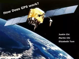
How Does GPS work?
How Does GPS work?. Justin Chi Martin Chi Elizabeth Tom. What is GPS?. GPS = Global Positioning System Satellite Navigation System 27 Satellites (24 in use, 3 for emergency). Applications:. Military Navigation Surveying Visually Impaired Geocaching Airplanes Time.

How Does GPS work?
E N D
Presentation Transcript
How Does GPS work? Justin Chi Martin Chi Elizabeth Tom
What is GPS? GPS = Global Positioning System Satellite Navigation System 27 Satellites (24 in use, 3 for emergency)
Applications: • Military • Navigation • Surveying • Visually Impaired • Geocaching • Airplanes • Time
Types: • Differential GPS (DGPS) • Wide Area Augmentation System (WAAS) • Local Area Augmentation System (LAAS) • Exploitation of DGPS for Guidance Enhancement (EDGE) • Carrier Phase Enhancement (CPGPS) • Wide Area GPS Enhancement (WAGE) • Relative Kinematic Position (RKP)
Simplified GPS: • Using 4 satellites • (actual GPS uses 4+ satellites and least squares method) • xyz-coordinate system • Earth is the origin • A position can be expressed as (x, y, z) can be translated into longitude and latitude • In this system, a point at sea level is: x2 + y2 + z2 = 1 • Speed of light is about .047 (units of earth radii per millisecond)
Ship Example: Let: (x, y, z) = ship’s position t = time when signals arrive
Calculating distance for Satellite 1: d = .047(t – 19.9) AND d = (x – 1)2 + (y – 2)2 + z2 = .0472(t – 19.9)2
(x– 1)2 + (y – 2)2 + z2 = .0472(t – 19.9)2 2x + 4y – 2(.0472)(19.9)t = 12 + 22 - .0472(19.9)2 + x2 + y2 + z2 - .0472t2 We can do this for the rest of the satellites… 2x + 4y + 0z – 2(.0472)(19.9)t = 12 + 22 + 02 - .0472(19.9)2 + x2 + y2 + z2- .0472t2 4x + 0y + 4z – 2(.0472)(2.4)t = 22 + 02 + 22 - .0472(2.4)2 + x2 + y2 + z2 - .0472t2 2x + 2y+ 2z – 2(.0472)(32.6)t = 12 + 12 + 12 - .0472(32.6)2 + x2 + y2+ z2 - .0472t2 4x + 2y+ 0z – 2(.0472)(19.9)t = 22 + 12 + 02 - .0472(19.9)2 + x2 + y2+ z2 - .0472t2
2x – 4y + 4z + 2(.0472)(17.5)t = 8 – 5 + .0472(19.92 - 2.42) 0x – 2y + 2z - 2(.0472)(12.7)t = 3 – 5 + .0472(19.92 - 2.42) 2x – 2y + 0z + 2(.0472)(0)t = 5– 5 + .0472(19.92 – 19.92)
x = 5.41 - .095t, y = 5.41 - .095t, z = 3.67 - .067t t is free (5.41 - .095t – 1)2 + (5.41 - .095t – 2)2 + (3.67 - .067t)2 = .0472(t – 19.9)2 .02t2- 1.88t + 43.56 = 0 2 answers: t = 43.1 t = 50.0
t = 43.1 (x, y, z) = (1.317, 1.317, .790) d is about 2 Since the units are Earth radii this means that the point is about 4000 miles above the surface of the Earth
t = 50.0 (x, y, z) = (.667, .667, .332) d is about .9997 Since the units are Earth radii this means the point is on the surface of the Earth. We can convert this into longitude and latitude
Wide Area Augmentation System: • Improves upon GPS • Uses a combination of satellites and ground based stations to send correction signals to the receiver • Can improve accuracy up to 5 times