Download

1 / 32
340 likes | 487 Vues
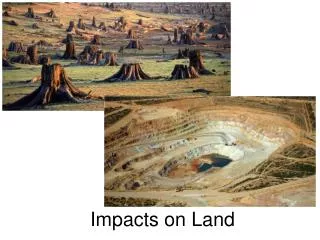
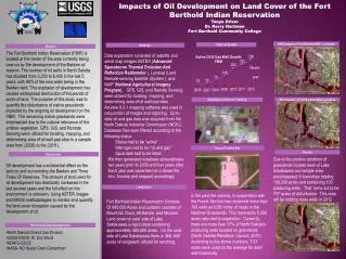
Impacts on Land Cover from Oil and Gas Development on the Fort Berthold Indian Reservation. By: Tanya Driver Mentors: Dr. Kerry Hartman Eric Woods, USGS EROS. Objectives. (1) produce digital maps and associated databases for actual land cover.

E N D
Impacts on Land Cover from Oil and Gas Development on the Fort Berthold Indian Reservation By: Tanya Driver Mentors: Dr. Kerry Hartman Eric Woods, USGS EROS
Objectives • (1) produce digital maps and associated databases for actual land cover. • (2) describe the distribution of natural land cover categories and identify elements that currently are not represented or are underrepresented in areas managed for long-term maintenance of biodiversity • (3) quantify the disturbance of native grasslands impacted by the ongoing oil development on the FBIR • (4) use of information so that institutions, agencies, and private landowners may be more effective preserving FBIIR’s natural resources
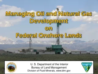
Fort bertholdindian reservation • The construction of Garrison Dam on tribal land resulted in the taking of 152,360 acres. Over 25 percent of the reservation’s total land base was deluged by the dam’s reservoir , Lake Sakakawea .
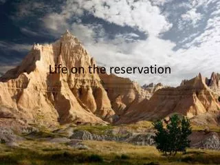
Location • The Fort Berthold Reservation is situated in western North Dakota. The reservation occupies sections of six counties: Mountrail, McLean, Dunn, McKenzie, Mercer, and Ward. The Reservation is currently divided into six segments referred to as: Mandaree (West Segment), New Town (North Segment), Lucky-Mound-Parshall (Northeastern Segment), Twin Buttes (Southern Segment), White Shield (Eastern Segment) and the Four Bears Segment.
Topography • The topography of the west and south segments is rough grassland and badlands which was primarily utilized for livestock production. The north and east segments are generally cropland. The Reservation’s economic base was almost entirely agricultural until the oil and gas exploration/development. Land use on east side of Lake Sakakawea is Agriculture containing approximately 460,800 acres. On the west side of Lake Sakakawea there is 368, 640 acres of rangeland utilized for ranching.
Methods • The remaining native grasslands were emphasized due to the cultural relevance of this pristine vegetation. GPS, GIS, and Remote Sensing were utilized for locating, mapping, and determining area of oil well pad sites in our sample area from (2008) to the (2012). • Our sample area was located west of Lake Sakakawea consisted of 44 tribal range units. It encompasses 8 sections totaling 5,120 acres and contained 130 producing wells at the time of study.
Phase I • Supervised Classification of ASTR images • Digitizing • Ground truthing • Historical Land Use/Land Cover • Sample site identified
discussion • The west segment of the FBIR had 22% of land disturbance on the range units alone. There are 44 range units located here; according to average figures from previous research, there has been 910 acres being utilized for well pads along with 52 miles of access roads that have been built. Through this research it has proved that the grasslands are more at risk due to the Bakken oil reserve. Flaring is also occurring in this area with great magnitude, there is more MCF of gas venting off in the west segment as there is anyplace else on the reservation. Natural ecological processes have been greatly modified or eliminated by changes in the of the landscape and the composition of the biota. The disruption of natural ecological processes is so great that temperate prairies may be North America’s most endangered biome. (ND Gap Analysis)