Download
1 / 1
10 likes | 96 Vues
Impacts of Oil Development on Land Cover of the Fort Berthold Indian Reservation Tanya Driver Dr. Kerry Hartman Fort Berthold Community College. 2006 Imagery of Fort Berthold Well Locations. Chart of Growth. Methods. Abstract.

E N D
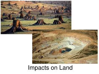
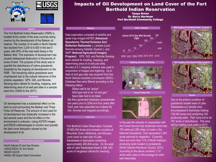
Impacts of Oil Development on Land Cover of the Fort Berthold Indian Reservation Tanya Driver Dr. Kerry Hartman Fort Berthold Community College 2006 Imagery of Fort Berthold Well Locations Chart of Growth Methods Abstract The Fort Berthold Indian Reservation (FBIR) is located at the center of the area currently being overrun by the development of the Bakken oil reserve. The number of oil wells in North Dakota has doubled from 3,200 to 6,400 in the last 5 years, with 90% of the new wells being in the Bakken field. This explosion of development has caused widespread destruction of thousands of acres of land. The purpose of this study was to quantify the disturbance of native grasslands impacted by the ongoing oil development on the FBIR. The remaining native grasslands were emphasized due to the cultural relevance of this pristine vegetation. GPS, GIS, and Remote Sensing were utilized for locating, mapping, and determining area of oil well pad sites in a sample area from (2008) to the (2011). • Data exploration consisted of satellite and aerial map images ASTER (Advanced Spaceborne Thermal Emission And Reflection Radiometer ), Landsat (Land Remote-sensing Satellite (System ), and NAIP (National Agricultural Imagery Program). GPS, GIS, and Remote Sensing were utilized for locating, mapping, and determining area of oil well pad sites. Arcview 9.3.1 mapping software was used in conjunction of images and digitizing. Up to date oil and gas data was acquired from the North Dakota Industrial Commission (NDIC). Database files were filtered according to the following status: • Status had to be “active” • Well type had to be “oil and gas” • Spud date had to be listed • We then generated database spreadsheets two years prior to 2008 and four years after. Each year was separated as a dbase file into Arcview and mapped accordingly. • . Digitizing and Ground Truthing 2011 Imagery of Fort Berthold Well Locations Ground Truthed Site Results Introduction . Due to the pristine condition of grasslands located west of Lake Sakakawea our sample area encompassed 6 townships totaling 138,240 acres and containing 100 producing wells. That turns out to be 757 acres of disturbance. This area will be holding more wells in 2012. Oil development has a substantial effect on the land on and surrounding the Bakken and Three Forks Oil Reserves. The amount of land used for oil development has drastically increased in the last several years and the full effect on the environment is unknown. Using ASTER images and EROS methodologies to monitor and quantify the land cover disruption caused by the development of oil. Land Cover . In the past the industry in cooperation with the Forest Service has reclaimed more than 700 wells and 280 miles of roads in the National Grasslands. This represents 5,300 acres returned to vegetation. Currently, there are more than 17% of North Dakota’s producing wells located on grasslands. (North Dakota Petroleum Council, 2010) According to the above numbers, 7.57 acres were used on the average for each well historically. Fort Berthold Indian Reservation Consists Of 980,000 Acres and contains counties of Mountrail, Dunn, McKenzie, and McLean. Land cover on east side of Lake Sakakawea is Agriculture containing approximately 460,800 acres. On the west side of Lake Sakakawea there is 368, 640 acres of rangeland utilized for ranching. References/Acknowledgements • North Dakota Oil and Gas Division • USGS EROS- Dr. Eric Wood • NDATC-GCCE • NASA- ND Space Grant Consortium