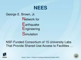
NEES
NEES. overview. Three websites are provided that will guide students through an investigation of earthquakes. All students will have a background in plate tectonics. Each student will work individually or in pairs to investigate the three websites provided.


NEES
E N D
Presentation Transcript
overview • Three websites are provided that will guide students through an investigation of earthquakes. All students will have a background in plate tectonics. • Each student will work individually or in pairs to investigate the three websites provided. • Students keep track of their progress with a checklist. • Final activity will be to analyze seismograms from three recording stations and determine the magnitude and latitude and longitude of an earthquake event.
Website 1 • Iris Seismic Monitor- select activity 4 • Select Rapid Earthquake Monitor • Activities Available • 1. Earthquake Damage • 2. Faults • 3. Earthquake Patterns • 4. Seismic Waves • 5. A whole lot of shaking going on • 6. Landslides, liquefaction, and structural failure • 7. Examine all the factors
Website 1 • Activity 1: create a chart of earthquake location, magnitude and evidence of occurrence • Activity 2: look at faults in California and 48 states • Activity 3: Examine the cyclic nature at Parkfieldand pattern of reccurence at the Hayward fault • Activity 4: Look at shake tables from CalTechthen predict wave damage. • Activity 5: Compare 1906 and 1986 earthquakes in San Francisco. Determine intensity by analyzing data from new Madrid and S. Calif. • Activity 6: Factors that cause liquefaction; computer simulation to determine the best bridge structure • Activity 7: Determine the best location for your home from 5 locations : Palo Alto, San Francisco, Antiock, Pittsburg or Rohnert Park.
Website 2 • Go to http://www.explorelearning.com • Under Earth and Space Science, select Earth’s surface and interior, select the following and complete questions as directed by your teacher. • Earthquake: Recording Station • Earthquake: Determination of Epicenter
Website 3 • IRIS Seismic Monitor • Click on Educational Links • Click on IRIS Earthquake Browser, click on Help in the upper left hand corner. It will be necessary to download all of the proper tools as listed in the help section. • The students could then form a hypothesis and use the tools on the right to collect data and form conclusions. • Example: how many earthquakes in the year 2010 in the world? What depth was the most frequent? What area of the world had the most earthquakes? How many earthquakes of magnitude 4 and greater?