Broadband Capacity Indicators Interactive Map
200 likes | 224 Vues
Explore supply-side broadband network indicators and statistics by region. Validate and access transmission network data with the ITU TIES validation framework. Stay informed and provide feedback for updated information.

Broadband Capacity Indicators Interactive Map
E N D
Presentation Transcript
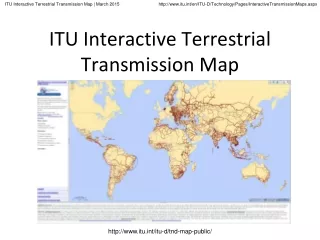
ITU Interactive Terrestrial Transmission Map http://www.itu.int/itu-d/tnd-map-public/
Broadband Transmission Capacity IndicatorsUnderneath the map is a database, containing records of each individual link. The following indicators are either compiled or calculated from this database: Indicator 1: Transmission network length (Route kilometres)Indicator 2: Node locationsIndicator 3: Equipment type of terrestrial transmission networkIndicator 4: Network capacity (bit rate)Indicator 5: Number of optical fibres within the cableIndicator 6: Operational status of the transmission networkIndicator 7a: Percentage of population within reach of transmission networksIndicator 7b: Percentage of area within reach of transmission networks Introduction 1) Purpose: To quantify supply-side indicators for the reach of broadband networks. 2) Research: Desk research, primary research in conjunction with ITU Regional Offices, and working with partner organisations.3) Validation: The map is validated by network operators and administrations through the ITU Regional Offices and recorded in the Validation Framework. 4) Outputs: Broadband Capacity Indicators. http://www.itu.int/itu-d/tnd-map-public/
ITU Interactive Transmission Map Research Status: March 2015 Region CIS ARB AFR ASP LAC EUR Total Operators34234865 5848 276 Links 1,995 8832,6154,9383,2472,817 16,495 Nodes1,1246572,0573,170 2,5011,885 11,394 Route Kms294,330120,209217,846550,526 279,710241,846 1,704,467 Total Kms846,248272,776329,624 11,109,733 7187,886849,580 14,195,847 Population within range of operational fibre node (millions), Dec 2014 10-km 96.672.2158.3574.4176.862.8 1,141,123.8 25-km181.8168.2328.81,479.6363.2111.0 2,632,601.3 50-km229.2241.1508.1 2,488.6467.0142.7 4,076,667.8 http://www.itu.int/itu-d/tnd-map-public/
Validation – TIES Password Protected Map and Validation Framework Click this map layer to show the Validation Status of each network operator. And these tabs to show the legend, validation framework and so on http://www.itu.int/itu-d/tnd-map-public/
Validation – TIES Password Protected Map and Validation Framework Click this link here to open the Validation Framework, or go to https://www.itu.int/itu-d/tnd-map/validation/ http://www.itu.int/itu-d/tnd-map-public/
Validation – TIES Password Protected Map and Validation Framework Type the name of operator or country into the search box Navigate by country Navigate by Validation Status Or navigate by Region http://www.itu.int/itu-d/tnd-map-public/
Validation – TIES Password Protected Map and Validation Framework Click the small image of the source material which appears in order to go directly to the homepage for this network operator in the validation framework Hover your mouse over a link, and the technical details of that link appear in the toolbar on the left http://www.itu.int/itu-d/tnd-map-public/
To validate the information shown in the map, leave a comment or any other feedback, just click the Leave a Reply link. http://www.itu.int/itu-d/tnd-map-public/
Validation – TIES Password Protected Map and Validation Framework Each link in the map is given a validation status. We use a simple traffic light system: Red:Information was sourced from a restricted document (for example on TIES), a potentially unreliable publicly available source (such as a third party), may contain information which is confidential or regarded as sensitive by the network operator, and/or is very old and could be out of date (if it is more than 3-5 years old). Information must be validated by network operator or stakeholder to provide clearance that the information is correct, up-to-date, and is not confidential. Amber: Information was not taken from a publicly available source, may be unreliable because of difficulties reading or interpreting the source material, and/or may be old and out of date. Operator is asked to provide clearance that the information is correct, up-to-date, and is not confidential. Green:Information was sourced from an authentic, reliable publicly available source (such as a company website, annual report, presentation, or other publication), and has been deliberately put into the public domain by the network operator or administration (it is therefore not confidential). The information is current and correct, and there is no reason why a public version could not be put into the public domain. Public:Information has been actively checked and validated by stakeholder through the TIES interactive web map platform, specifically granting permission for this information to be put into the public domain. http://www.itu.int/itu-d/tnd-map-public/
Indicators http://www.itu.int/itu-d/tnd-map-public/
Indicators http://www.itu.int/itu-d/tnd-map-public/
Indicators http://www.itu.int/itu-d/tnd-map-public/
Indicators The Research Status table is updated at the end of each month Click link here to go through to the operators homepage http://www.itu.int/itu-d/tnd-map-public/
Use the magnifying glass to zoom into a particular area of the map http://www.itu.int/itu-d/tnd-map-public/
Hover your mouse over a link, and the details of that link appear in the pane on the left http://www.itu.int/itu-d/tnd-map-public/
Thank you We value your feedback and contributions. Please log in using your ITU TIES username and password, to submit comments, feedback and to validate the information shown in the map through the Validation Framework. Project homepage http://www.itu.int/en/ITU-D/Technology/Pages/InteractiveTransmissionMaps.aspx ITU Interactive Terrestrial Transmission Map https://www.itu.int/itu-d/tnd-map-public/ ITU TIES Interactive Terrestrial Transmission Map https://www.itu.int/itu-d/tnd-map/ ITU TIES Validation Framework https://www.itu.int/itu-d/tnd-map/validation/ http://www.itu.int/itu-d/tnd-map-public/