Introduction to RS & Applications
320 likes | 502 Vues
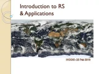
Introduction to RS & Applications. MODIS : 25 Feb 2010. Outline. Introduction What is remote sensing? รีโมทเซ็นซิ่งคืออะไร Electromagnetic Energy พลังงานคลื่นแม่เหล็กไฟฟ้า Sensors & Platforms คุณสมบัติและประเภทของดาวเทียม Applications Earth Observations สำรวจทรัพยากร

Introduction to RS & Applications
E N D
Presentation Transcript
Introduction to RS& Applications MODIS : 25 Feb 2010
Outline Introduction What is remote sensing? รีโมทเซ็นซิ่งคืออะไร Electromagnetic Energy พลังงานคลื่นแม่เหล็กไฟฟ้า Sensors & Platforms คุณสมบัติและประเภทของดาวเทียม Applications Earth Observations สำรวจทรัพยากร Weather Forecast พยากรณ์อากาศ Global Changes การเปลี่ยนแปลงของโลก Disaster management การจัดการภัยพิบัติ Engineering วิศวกรรม
What is remote sensing? Remote Sensing (RS) ≠ In-situ sensing In-situ sensing devices are in contact with the medium they are sensing (การวัดซึ่งสัมผัสโดยตรงกับตัวกลางที่ต้องการวัด) Remote sensing (RS) is the acquisition of data, “remotely” การวัดหรือได้มาซึ่งข้อมูลโดยใช้การวัดจากระยะไกล ซึ่งไม่สัมผัสกับสิ่งที่ต้องการวัดโดยตรง โดยทั่วไปแล้วเมื่อกล่าวถึง RS จะใช้กับดาวเทียมแต่ก็อาจจะใช้กับแพลทฟอร์มอื่นๆได้เช่น เครื่องบิน หรือ เฮลิคอปเตอร์
Why remote sensing??? Cover a large scale ครอบคลุมพื้นที่กว้าง Less time consuming ประหยัดเวลา Cost Effective ประหยัดค่าใช้จ่าย Repetitivecoverage & Consistencyสามารถสำรวจได้บ่อยครั้งและได้ข้อมูลที่มีมาตรฐาน Accessibility เข้าถึงจุดที่ยากต่อการสำรวจ
2 types of Remote Sensing Optical images - Stratford, UK, Worldview 2, 0.5 m. Spatial resolution Lidar images - Aerial Photo of World Trade Centre (Credit NOAA)
Electromagnetic Energy(EM)(1/2)พลังงานคลื่นแม่เหล็กไฟฟ้า พลังงานคลื่นแม่เหล็กไฟฟ้าเป็นพลังงานต่อเนื่องโดยมีความเร็วเป็นความเร็วแสง ความยาวคลื่นจะแปรผกผันกับความถี่ คลื่นที่มีความถี่มากจะมีพลังงานมาก ช่วงความถี่ที่มนุษย์มองเห็นจะเป็นช่วง (visible wavelength) 400-700 นาโนเมตร ในการวัดค่าพลังงานนั้นจะวัดค่าพลังงาน EM ที่สะท้อนกลับจากวัตถุที่สนใจ โดยวัสดุแต่ละชนิดจะมีต่าสะท้อนในแต่ละช่วงของคลื่นความถี่แตกต่างกันออกไปขึ้นอยู่กับคุณลักษณะเฉพาะ (properties)ของวัตถุนั้นๆ
Electromagnetic Energy(EM)(2/2)พลังงานคลื่นแม่เหล็กไฟฟ้า ช่วงพลังงานบางช่วงจะถูกดูดซับโดยบรรยากาศจึงทำให้พลังงานบางส่วนของบางความยาวคลื่นมาไม่ถึงพื้นดิน / ผิวโลก กฎอนุรักษ์พลังงาน Energy Conservative Incoming Radiation = Absorbed + Transmitted + Reflected พลังงานที่เข้ามาดูดซับ ส่งผ่าน สะท้อน
Band / Spectral Reflectance Signatureแถบการสะท้อน
NDVI Example • พืชสีเขียว จะมีคุณลักษณะพิเศษคือ มีค่าการดูดซับพลังงานในช่วงความยาวคลื่น VIS(สีแดง) และ สะท้อนคลื่นในช่วงความยาวคลื่น NIR(อินฟราเรด) • Normalized Difference Vegetation Index (NDVI). • มีค่าระหว่าง -1 – 1 • 0 = ไม่มีพืชใบเขียว/ดิน • 0.8-0.9 = พืชใบเขียวหนาแน่น • <0 = ผิวน้ำ
Sensors & Platforms Orbits and swaths วิถีโคจร และ พื้นที่การกวาดของดาวเทียม Spatial resolution พื้นที่เล็กสุดบนภาคพื้นดินที่สามารถบันทึกได้ในหนึ่งพิกเซล Temporal resolution ความถี่วงโคจร(repeat cycle)(เวลาที่ดาวเทียมใช้ในการมาครบรอบ สัมพันธ์กับ พื้นที่การกวาดของดาวเทียม) Spectral resolution จำนวนช่วงคลื่นความถี่ (แบนด์) ที่เซนเซอร์สามารถบันทึกได้
Sensors & Platforms Orbits and swaths วิถีโคจร และ พื้นที่การกวาดของดาวเทียม 1)Geostationary Orbit 2) Near Polar Orbit ส่องพื้นที่เดิมตลอดเวลาโดยเคลื่อนที่ตามโลก เคลื่อนที่ตามแนวเหนือใต้
Sensors & Platforms Spatial resolution พื้นที่เล็กสุดบนภาคพื้นดินที่สามารถบันทึกได้ในหนึ่งพิกเซล
Sensors & Platforms Temporal resolution ความถี่วงโคจร(repeat cycle)(เวลาที่ดาวเทียมใช้ในการมาครบรอบ สัมพันธ์กับ พื้นที่การกวาดของดาวเทียม) High temporal resolution: < 24 hours - 3 daysMedium temporal resolution: 4 - 16 daysLow temporal resolution: > 16 days
Sensors & Platforms Spectral resolution จำนวนช่วงคลื่นความถี่ (แบนด์) ที่เซนเซอร์สามารถบันทึกได้ High spectral resolution: - 220 bandsMedium spectral resolution: 3 - 15 bandsLow spectral resolution: - 3 bands Landsat – 7 bands
http://www.gistda.or.th/gistda_n/ THEOS (THai Earth Observation System) Spectral resolution จำนวนช่วงคลื่นความถี่ (แบนด์) Panchromatic - ภาพขาวดำ – ละเอียด - การทำแผนที่ การใช้พื้นที่ 2) Multispectral – ภาพหลายแถบสี – ไม่ละเอียด – เกษตรกรรม ป่าไม้ ทรัพยากร
THEOS (THai Earth Observation System) C:\Users\chanin\Desktop\Remote Sensing\Principles of RS\THEOS.ppt
Applications Earth Observations สำรวจทรัพยากร Weather Forecast พยากรณ์อากาศ Global Changes การเปลี่ยนแปลงของโลก Disaster management การจัดการภัยพิบัติ Engineering วิศวกรรม
Applications The active fire in the Wallow fire Arizona, 2011 Landsat 5 image Taken on June 15, 2011 In this image the Wallow Fire burn scar is red, ongoing fires are very bright red, smoke is blue, water is black and dark blue and bare ground is tan. Earth Observations สำรวจทรัพยากร http://landsat.gsfc.nasa.gov/images/archive/e0030.html
Applications MODIS, Bopha Typhoon, December 10, 2012 Philippines Weather Forecast พยากรณ์อากาศ http://earthobservatory.nasa.gov/NaturalHazards/view.php?id=79959
Applications Global Changesการเปลี่ยนแปลงของโลก Sensor: Terra – MODIS April 18, 2000 - ติดตามผลกระทบภาวะโลกร้อน เช่นการเปลี่ยนแปลงของนำแข็งขั้วโลก - ติดตามการเปลี่ยนแปลงของอุณหภูมิของน้ำทะเล
Applications December 12, 2011 December 9, 2010 Disaster Management บริหารจัดการภัยภิบัติ MODIS, 36 Bands, Spatial Resolution= 500m, 1km Temporal Resolution = Daily, 8-Day, 16-Day
Applications July, 2009 Disaster Management บริหารจัดการภัยภิบัติ July, 2010 Drought July, 2011 Flood July, 2012 Drought Namibia, Africa, Near Sahara MODIS, 36 Bands, Spatial Resolution= 500m, 1km Temporal Resolution = Daily, 8-Day, 16-Day
Applications Engineering วิศวกรรม Airborne มีความละเอียดสูง ถึงระดับ เซนติเมตร-มิลลิเมตร สำหรับงาน survey RaDARสร้างแผนที่ความสูง DEM LiDARสร้างแผนที่ความสูง DEM เทคโนโลยีใหม่ใช้การวัดการสะท้อนของแสง
Applications Synthetic Aperture Radar Interferometry (InSAR) เป็นการบันทึกข้อมูลคลื่นเรดาร์ที่ถ่ายลงในพื้นที่เดียวกันในระยะเวลาใกล้เคียงกัน โดยการนำภาพ เรดาร์ 2 ภาพที่บันทึกต่างเวลากันมาหาระยะทางที่แผ่นดินบริเวณนั้นเคลื่อนตัวไปอันเนื่องมาจากภัยพิบัติธรรมชาติหลายอย่าง เช่น แผ่นดินไหว แผ่นดินถล่ม Engineering วิศวกรรม