Download
1 / 17
170 likes | 265 Vues
Discover the significance of QuikSCAT winds data for marine weather forecasting, warning, and modeling. Learn about the challenges and successes in utilizing this valuable resource to enhance coastal forecasts and incident support.

E N D
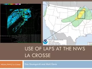
Use of QuikSCAT Winds at NWS Field Offices Andrew Haner Forecaster/Incident Meteorologist NWS Seattle, WA
Overall Marine Forecast Challenge (From a white paper on Marine Observation Requirements.) “Of vital importance to marine weather forecasting, warning, and modeling is an awareness of current oceanic and atmospheric elements…achieved through continuous, real-time monitoring of ocean and atmospheric elements.”
Coastal WFO Responsibilities • CWF with wind speed and direction to 5 days and updated every 6 hours • Wind speed at 5 kt increments; 12 hour period • Direction on 8-point compass • 0-60 nmi from coastline • SCA, Gales and Storm (21kt, 34kt, and 50kt) are primary focus of verification
Much talk on national center use, but what about WFO’s? • Informal Survey of forecasters at Seattle, Portland and Juneau reveals good news and bad news:
First the Bad News… • Only about half of forecasters use QuikSCAT at least occasionally, ie. once every week or two during fall/winter • Reasons cited for lack of use: • Availability of hourly near-shore data (buoys, C-Mans, Coast Guard stations, etc.) versus two satellite passes per day • Lack of QuikSCAT data over inland channels/ waterways and within 30 km of shore • Never became a regular part of forecasting “routine” • ACCESSIBILITY and DISPLAY
…The Bad News (continued) • Accessibility: • Took until 2004 for QuikSCAT to become a national AWIPS baseline product • Until recently, WR supported a back-door way to get QuikSCAT data onto the AWIPS WAN, but data stream was inconsistent and experienced frequent interruptions • Some forecasters think it’s inconvenient to look for “operational” data on the web
…The Bad News (continued) • Display: • Nearly every forecaster cited poor visual display, one calling it “uninviting” • There are not time stamps for individual satellite passes • Needs to be available as a gridded data set with better zooming and contour capabilities • Needs to be a capability to initialize IFPS grids with latest QuikSCAT data from the “outer” coastal waters
Now the Good News… • Every forecaster questioned had heard of QuikSCAT and recognized its potential usefulness • None thought it should go away • Of those who use it, nearly all described it as a valuable data source • One forecaster indicated QuikSCAT data had made the difference in deciding whether to issue Gale and Storm Warnings
…The Good News (continued) • Forecasters indicated greatest usefulness is for situations when Gale or Storm force winds are forecast within 0-2 days (this is where we make our money!) • Used for model validation, extrapolation of close upstream features, and determining location of quasi-stationary features (eg. gap winds)
Other considerations: • Dollars are now being diverted from replacing coastal weather buoys to fixing open-ocean tsunami detection buoys • Even when dollars are not tight, buoys that go adrift are sometimes not fixed for several months • QuikSCAT is quite useful in filling in these gaps
Other uses: • Anticipating Southern Hemisphere swell on southern California beaches up to one week in advance • Incident support
Incident Support M/V Selendang Ayu related Oil Spill near Dutch Harbor, AK
The Challenges • Data Sparse environment with several broken buoys • Harsh wintertime Aleutian weather • Lives, big-dollar recovery decisions, and the environment at risk
Incident Support – A Success Story • Incident Meteorologist Jim Prange noted that QuikSCAT was the only non-land-based observational data available there • He and Incident Planners checked on QuikSCAT data 4-6 times daily • Was very useful in forecasting wind waves and swell • On one day, QuikSCAT showed 40-knot winds while a model initialization showed 70 knots just to their southwest, invalidating the model initialization • QuikSCAT wind data were included in every briefing
Incident Support – A Success Story • NOAA Hazmat personnel at incident say they now want this kind of weather support/data at every large incident
In Summary… • QuikSCAT has not been widely embraced at local NWS field offices but has proven useful at times • Accessibility and display need significant improvement, especially in the AWIPS environment • Tightening budgets for buoy maintenance will make QuikSCAT data even more critical to near-shore forecasting • QuikSCAT data has been vital to ongoing oil spill recovery efforts in the Aleutians
Questions? Andrew Haner Forecaster/Incident Meteorologist National Weather Service, Seattle