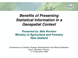
Benefits of Presenting Statistical Information in a Geospatial Context
Explore the advantages of using Geographic Information System (GIS) to present statistical information, with a focus on the Ministry of Agriculture and Forestry in New Zealand. Topics include building spatial data, sample spatial analysis, and sector-specific statistics.

Benefits of Presenting Statistical Information in a Geospatial Context
E N D
Presentation Transcript
Benefits of PresentingStatistical Information in aGeospatial ContextPresented by: Matt WoottonMinistry of Agriculture and ForestryNew ZealandConference on Climate Change, Development and Official StatisticsSeoul, Republic of Korea, 11-12 December 2008
How What Where Why Who When
Presentation Overview • Geographic Information System(GIS) usage at the Ministry of Agriculture and Forestry(MAF) • Building Spatial Data • Sector-specific statistics used at MAF • Sample Spatial Analysis
GIS @ MAF • Structure • GIS Responsibilities at MAF • GIS Focal Points at MAF
Data Building – Issues and Opportunities • Does breakdown of land match scale of statistics? • Do tabular attributes link to spatial layer’s attributes? Soil Type zKe 20 Ha zTo 25 Ha zKw 55 Ha • Existing spatial layer that properly represents your data? (i.e. matching log export statistics to a specific port or region) • Add attributes to data from spatial data based on location?
5 1,000 5,000 Statistics Example 1a: Using agricultural statistics to calculate stock unit density... 1,000 5,000 5.0 Stock Units per Ha
7.1 700 5,000 Statistics in a GIS Example 1b: Using agricultural statistics ina GIS to calculate stock unit density… 7.1 Stock Units per Ha
Basic Point Data – what you can do witha set of numbers • Weather Data • Widely used • Well funded and valued • Generally understood
Basic Point Data – how far can you take it? • Location of the weather stations • Apply a colour scheme • Interpolate results/ • create surface
Data Issues Points to consider… • Continuous/Discrete Data - when to use which type? • Time Series Data - backwards compatibility • Metadata
Agriculture Production Survey/Census • Includes Agriculture and Forestry sectors • Government funded product • Data collection • Levels of Geography • Data Suppression • http://www.stats.govt.nz/datasets/primary-production/agriculture-production.htm
National Exotic Forest Description • What is it? • Data Collection • Highly valued • Usage • Government funded product
Statistics/Data used in sample analysis • Land Resource Inventory • Agribase • Land Cover Database 2 • Excluded lands • Department of Conservation • Forested lands (2 types)
Data used in sample analysis – Land Resource Inventory • Land Resource Inventory… • Three main data themes • vegetation • land use capability • Soil (permeability shown) LUC classes 1 to 5 -flat to gradually sloping land -highly productive soil (orange areas)
Statistics used in sample analysis – Agribase • Agribase… • Commercial product • Contains contact info, farm type, stock numbers, farm composition Farm types not suitable for expansion were excluded. (fish farms, vineyards, zoos) (purple areas)
Ensure all suitable lands included -all low and high production grasslands were added (yellow areas) Data used in sample analysis – Land Cover Database 2 • Land Cover Database 2 • Classifications based on 2001-2003 Landsat 7 • National coverage • Highly used/valued data layer in NZ
Data used in sample analysis – Screening Layers • Department of Conservation • Indigenous Forest • Exotic Forest Refuges, stewardships, covenants, parks Native forest - off limits to development Predominantly Radiata Pine for harvest DoC, indigenous and exotic forest lands were eliminated from selection (green areas)
Data used in sample analysis – Processing • Remove land parcels currently in the • expanding land use type • Intersect suitable lands with land parcels • Isolate suitable parcels • Randomly select parcels throughout NZ until • threshold value is reached
Farming Operation Growthfor a Given Scenario Economic Drivers Environmental Considerations Social Factors
Summary Statistics within a GIS adds value Data linkages, visual clarity Provides versatility
Thank you Questions? matt.wootton@maf.govt.nz