Understanding Types of Data Reduction Techniques in GIS
100 likes | 197 Vues
Explore various types of data forms in GIS such as points, polygons, polylines, rasters, and volumes, along with methods like clustering and gridding to reduce data size while preserving vital information. Learn about file formats, software, and tools for effective data management.

Understanding Types of Data Reduction Techniques in GIS
E N D
Presentation Transcript
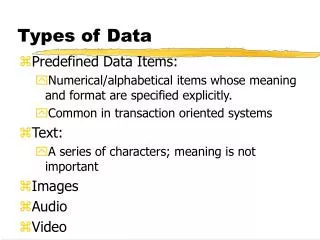
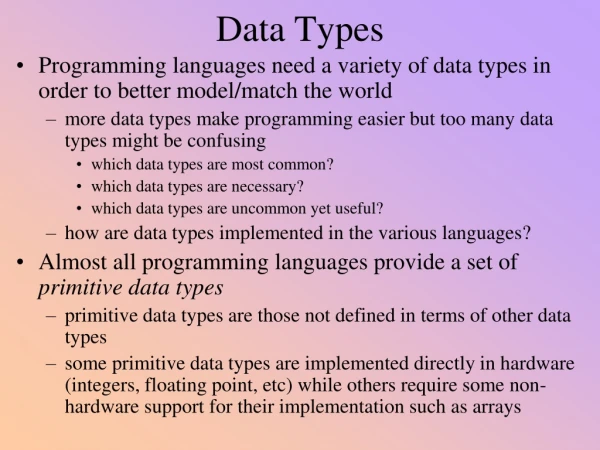
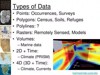
Types of Data • Points: Occurrences, Surveys • Polygons: Census, Soils, Refuges • Polylines: ? • Rasters: Remotely Sensed, Models • Volumes: • Marine data • 2D + Time: • Climate (PRISM) • 4D (3D + Time): • Climate, Currents marineemlab.ucsd.edu
Problems • Software/methods do not all support large datasets • Performance (i.e. time to develop methods and get final results) • Need to “reduce” the size of the data while maintaining the important information • Or, get a lot of computers • (more on this later)
File Formats • CSV, Txt: Points • Shapefiles • GeoDatabases • “Las” for LiDAR • HDF and NetCDF: • General hierarchical data formats • “CF” standard for NetCDF data • ArcGIS supports NetCDF
Data Reduction • Point Methods: • Clusters: group related data (spatially, temporally, categorically) • Gridding: find density, mean values • Windowing: moving a “window” over the data (does not reduce processing)
Polygons • Generalization/Simplification • Reduce resolution • Remove less critical polygons Soil Data for Czech Republic, eusoils.jrc.ec.europa.eu
Temporal • Group by: • Month, Season, Decade • Model “trends”
Software • ArcGIS will work up to a point • Then, we have to program • Python: • TXT and CSV files • Maybe for rasters, ND data • Java: • Effectively no limits • High performance
Databases • The simpler the data is, the faster it is to access: • Small, simple: • Text files • Small to Medium, complicated: • SQL Databases • Large: • Text and binary files • Avoid large, complicated data
BlueSpray • Java-based GIS application • Requires Java 7 • Built to be: • High-performance • Extensible • Portable • Takes advantage of RAM, processors • Easy to install and use • Owned by SchoonerTurtles, Inc. • Available at www.schoonerturtles.com • In early beta
Graphics 16 15 10 12 23 27 14 19 29 30 18 22 34 32 21 25