Download
1 / 4
40 likes | 195 Vues
Statewide Regional Evacuation Study Regional Planning Councils. Hurricane Evacuation Routes Arc or line data representing official County and FDOT designated evacuation routes. Selected from FDOT TeleAtlas (2008) street network.

E N D
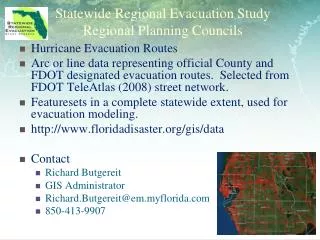
Statewide Regional Evacuation Study Regional Planning Councils Hurricane Evacuation Routes Arc or line data representing official County and FDOT designated evacuation routes. Selected from FDOT TeleAtlas (2008) street network. Featuresets in a complete statewide extent, used for evacuation modeling. http://www.floridadisaster.org/gis/data Contact Richard Butgereit GIS Administrator Richard.Butgereit@em.myflorida.com 850-413-9907
Statewide Regional Evacuation Study Regional Planning Councils • Hurricane Evacuation Zones (Levels) • Polygon based zone boundaries for the evacuation levels designated by the County Emergency Management staff. These are safety-oriented levels that are delineated from the Surge Zones created by the Regional Planning Councils. • Can be placed on FTP (contact FDEM) • Contact • Marshall Flynn • IT/GIS Manager, TBRPC • marsh@tbrpc.org • (727) 570-5151
Statewide Regional Evacuation Study Regional Planning Councils Small Area Demographic Data Polygon based data compiled from either TAZ or Census Block Group data interpolated using MPO and/or local government sourcing. Generated for use in Evacuation Transportation Model, includes vehicles and dwelling units. Featuresets in regional RPC extents with data-filled table to join. Can be placed on FTP (contact FDEM) Contact Richard Ogburn Assistant to the Director for Research and Budget, SFRPC rogburn@sfrpc.com (954) 985-4416
Statewide Regional Evacuation Study Regional Planning Councils Statewide Future Land Use Polygon based data depicting aggregated land use categories that is useable on a statewide level because of lowest common denominator classification. No dissolving performed to retain local government FLU delineations. Featureset in regional extents in a statewide geodatabase Can be placed on FTP (contact FDEM) Contact Tara McCue Regional Planner II tara@ecfrpc.org (407) 262-7772