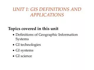
UNIT 1: GIS DEFINITIONS AND APPLICATIONS
260 likes | 399 Vues
This unit provides a comprehensive introduction to Geographic Information Systems (GIS), exploring its definitions, technologies, and applications. Discover the key components of GIS, including hardware, software, and human expertise, that enable the effective management of geospatial data. Learn about the evolution of GIS, from early thematic mapping to modern applications in government, industry, and academia. With a focus on spatial and thematic data, this unit examines the critical role of GIS in decision-making and problem-solving across various fields.

UNIT 1: GIS DEFINITIONS AND APPLICATIONS
E N D
Presentation Transcript
UNIT 1: GIS DEFINITIONS AND APPLICATIONS Topics covered in this unit • Definitions of Geographic Information Systems • GI technologies • GI systems • GI science
Geographic Information • what is where on the Earth's surface
Digital information • Why use computers to store information? • easy to store, retrieve, query, manipulate, send, receive, copy, display... • faster • can store various kinds on information: text, pictures, tables, music etc...
Information technologies Technologies for collecting and dealing with geographic information: • Global Positioning System (GPS) • Remote sensing • Computer Aided design (CAD) • Land Information System (LIS) • Geographic information system (GIS)
What is Geographic Information System? • Geographic • relates to places on the Earth's surface where something is what is at a given location • Information System • manipulate, summarize, query, edit, visualize • work with information stored in computer databases
Definitions of GIS • A system of hardware, software and procedures • used to input, storage, manipulate, analyze, model and display georeferenced data • to solve complex problems about planning and managing of resources
Components of a GIS • Hardware: • computer, [+digitizing board, scanner..] • Software • various, price ranges from $ 0 - $50,000 • developed by software companies, eg. ESRI (ArcGIS) • People • human expertise required for processing and decision making
GIScience • is the science behind the technology • is a multidisciplinary field
Overview of GIS Spatial data are organized into layers
Geo-spatial data • Two main components: • spatial component: • helpful to conceptualize as maps • thematic component: attributes • helpful to conceptualize as tables (and metadata too…)
How old is GIS? • 35,000 years ago: caves of Lascaux (France) • animal drawings • migration lines • in GIS: • graphic objects • linked to attributes
1950s:The quantitative revolution • Major crisis in geography • paradigm shift needed • introduction of computers
1960s: Canada GIS (CGIS) • earliest GIS developed • Department of Energy, Mines and Resources - developing land management plans • mapping information about soils, agriculture, recreation, wildlife, waterfowl, forestry, and land use
Mid 1960’s: • Harvard Laboratory For Computer Graphics And Spatial Analysis • general-purpose mapping packages/GISs: • SYMAP • CALFORM • GRID • ODYSSEY • ESRI: founded in 1969
1970’s • Bureau of the Census • first geocoded census developed • USGS
1980’s-1990s: • Development of GIS industry • micro-computer hardware • 1980: ArcInfo released • command-driven, product-oriented user interface • Commercial vendors: ESRI, MapINFO, etc..
2000 and beyond... • geospatial technologies • open-source GIS: • GRASS GIS, Google maps... • viewing GIS data over the Internet • fusion of remote sensing, GPS with GIS...
What is GIS used for? What: Who? • Government • Industry • Academics Transportation Hydrology Geology Demographics Crime Health …
“Doing” GIS • using the tools of Geographic Information Systems to solve a problem
GIS applications • mapping locations • mapping quantities • mapping densities • finding distances • mapping and monitoring change
Functions of GIS • Data entry • data display • data management • information retrieval • Analysis • Decision making
StagesinGISproject And don’t forget to HAVE FUN!!
Lecture 1 : Review • define basic terms associated with geographic information: technologies, systems, science, studies • explain why ge • ographic information systems are important • explain why a science of geographic information is needed