Download
1 / 47
701 likes | 1.63k Vues
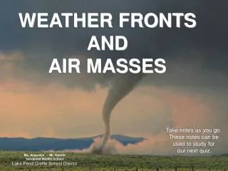
WEATHER FRONTS AND AIR MASSES. Take notes as you go. These notes can be used to study for our next quiz. Ms. Augustyn - Mr. Swerin Sandpoint Middle School Lake Pend Oreille School District. Weather Fronts.

E N D
WEATHER FRONTS AND AIR MASSES Take notes as you go. These notes can be used to study for our next quiz. Ms. Augustyn - Mr. SwerinSandpoint Middle SchoolLake Pend Oreille School District
Weather Fronts This first part of the slide show takes you through several types of weather fronts. Note the different kinds of clouds that accompany each front. Please study each type of front and take notes, as well as draw pictures and label as you view the slides. Use your notes to study for the test. Know: Weather map symbols, how air masses move or combine to form each type of front, what kind of weather each front brings, and the type of clouds that will be found as each front moves into an area.
WARM FRONT Weather map symbol for warm front • Fast moving warm air over takes cold air. • The warm air moves over the cold air because it is less dense. • Clouds, storms and rain accompany a warm front • Warm fronts move more slowly than cold fronts • In winter, warm fronts bring snow.
WARM FRONT Study this diagram, the picture, and the weather map symbol. Weather map symbol for warm front First clouds that you would see would be cirrus, then they would develop into cirrostratus as the front moves in. The clouds thicken and form altostratus, then eventually nimbostratus clouds form. This warm front will first be seen in St. Louis. Picture of cirrus clouds Weather map details showing a warm front moving towards St. Lous
WARM FRONTCLOUDS Weather map symbol for warm front CIRRUS clouds form first and are seen before other clouds when a warm front begins moving in. Cirrus clouds are followed by CIRROSTRATUS, ALTOSTRATUSand then NIMBOSTRATUS which brings rain and warm temperatures (except in the winter it will bring snow.) Remember, the warm air moves up and over the cooler air because it is less dense then the cool air
WARM FRONT • The air pressure drops when a warm front moves in. • If the warm air is humid, showers and light rain will fall along the front where the warm and cold air meets. • If the warm air is dry, scattered clouds will form. • Because warm fronts move more slowly than cold fronts, the weather may be rainy or foggy for several days.
Warm FrontsPlease answer these questions in full sentences • If a warm front were moving into Sandpoint, what kind of clouds would you see first? • Do warm fronts move faster or slower than cold fronts? • In a warm front, what does the warm air do? a) replaces the cold air, b) moves over the cold air, c) sinks below the cold air • What happens to the air pressure when a warm front moves into an area?
Cold Front Facts • Cold front: Cold air moves into an area • Cold air is dense and tends to sink, warm air is less dense and tends to rise but cools as it rises and the moisture in the warm air will condense into droplets of liquid and creates clouds • If there is a lot water vapor in the warm air, heavy rain or snow may fall • If the warm air is dry, then there will be cloudy skies with no precipitation. • Cold fronts move quickly, so abrupt weather changes can occur • After a cold front, clear skies and cooler temperatures follow.
COLD FRONT Weather map symbol for cold front The first clouds that a cold front brings are small clouds that eventually form the towering cumulonimbus clouds Cold air moves into St. Louis first The leading edge of a cold front moving into an area This shows what a cold front looks like on a weather map
COLD FRONTS Weather map symbol for cold front Fast moving cold air overtakes warm air. Warm air is pushed up creating CUMULONIMBUS CLOUDSwhich bring heavy rain followed by clear weather. Remember the last clouds to develop are the large cumulonimbus clouds
COLD FRONTS Often bring VIOLENT THUNDERSTORMS in the spring and summer. (Tornadoes in the mid-west) The AIR PRESSURE RISES after a cold front passes.
Cold Front QuestionsPlease answer these questions in full sentences • What kind of air does a cold front bring? • What happens to the air pressure after a cold front passes? • What is the major type of cloud associated with a cold front? • How does the cold air in a cold front affect the warm air? • Do cold fronts move faster or slower than a warm front? • What situation would cause a cold front to have no precipitation?
STATIONARY FRONT Occurs when warm and cold air meet and neither one of them is strong enough to move the other one out. Weather map symbol for stationary front
Weather map symbol for stationary front STATIONARY FRONT Where the warm and cool air meet, water vapor in the warm air condenses into rain, snow, fog, or clouds. If the two fronts stall, NIMBO-STRATUS or CUMULO-NIMBUS clouds may form and it may rain/snow for extended periods of time.
OCCLUDED FRONT A warm air mass is CAUGHT BETWEEN two cold air masses. The warm air mass is pushed upward by the more dense cold air. The temperature near the ground is cooler.
An INVERSION is formed where the temperature is warmer higher up and colder down below. Temperature inversions usually are unhealthy, and the air becomes stagnate from auto exhaust, and pollution. Inversions can often last up to a month or more.
OCCLUDED FRONT NIMBOSTRATUS CLOUDS may form and bring rain or snow or freezing rain.
Weather Front Questions Please answer these questions in full sentences • What is a front? • Name and describe four types of fronts. Draw the weather symbol for each. • What happens when warm air is stuck between two layers of cold air? • Why are temperature inversions dangerous for people with respiratory illnesses? • Which type of front moves the fastest? • What kind of front forms when two air masses meet and neither can move?
Air Masses This next section reviews air masses. Study each slide carefully and answer the questions at the end of this section
AIR MASSES • Air masses are classified based on TEMPERATURE and HUMIDITY. • Temperature and humidity are dependent upon where the air masses form. Air Masses in the United States move from west to east by the PREVAILING WESTERLIES.
There are FOUR air masses that influence the weather in the United StatesThey occur in combinations of temperature and humidity • POLARCold with high pressure • MARITIMEHumid (develops over ocean) • CONTINENTALDry (develops over land) • TROPICALWarm with low pressure
ORIGIN OF AIR MASSES WEATHER IS DETERMINED BY WHERE AIR MASSES FORM
AIR MASSES Notice that abbreviation for each type of air mass
MARITIME TROPICAL • Forms over the Tropics in the Pacific, Atlantic and the Gulf of Mexico. • Associated with warm, humid air. • Atlantic Ocean and the Gulf of Mexico influence the central and eastern parts of the US. • Pacific Ocean influences the weather on the west coast. • Summer = Hot humid weather that brings thunderstorms and showers, as well as tornadoes. • Winter = Heavy rain or snow. (PINEAPPLE EXPRESS)
MARITIME POLAR • Forms over the cold north Pacific and Atlantic oceans. • Usually cool and moist air. • Affects west coast more than east coast. • Cool rainy weather in the summer and snow in the winter. • Sometimes called Maritime Arctic or Arctic Maritime.
CONTINENTAL TROPICAL • Forms over dry areas in the southwest of the US and Northern Mexico. • Hot, dry air masses. • Affects a very small area. • Hot, dry weather to southern plains.
CONTINENTAL POLAR • Forms over central and northern Canada and Alaska. • Sometimes called Continental Arctic air mass • Cold dry air. • Bitter cold air to the central US during the winter (Artic Express) • Tornado Alley in the central US in the summer when the air mass meats the maritime tropical air mass from the gulf of Mexico.
Each arrow points to different air masses. For questions 17-22, write the name of the air mass and describe what kind of air is flowing in that direction. 18. 17. 19. 20. 21. 22.
Air Mass QuestionsUse full sentences as you answer • What two main characteristics are used to classify air masses? • Why do maritime polar air masses have more effect on the west coast than the east coast? • Classify the four major types of air masses according to whether they are dry or humid. • What kind of air mass produces a “pineapple express” ??
Cyclones and Anticyclones This next section is about cyclones and anticyclones. Make sure you understand the difference between the two and can draw and diagram each. At the end of this section, please answer the questions in full sentences.
Cyclones and Anticyclones A cyclone is a storm or system of winds that rotates around a center of low atmospheric pressure. An anticyclone is a system of winds that rotates around a center of high atmospheric pressure. Cyclones (commonly known as lows) generally are indicators of rain, clouds, and other forms of bad weather. Anticyclones (commonly known as highs) are predictors of fair weather.
CYCLONES SWIRLING CENTER OF LOW PRESSURE
CYCLONES • LOW pressure area. • Represented with an L on a weather map. • Winds SPIRAL INWARD fed by cooler high pressure air blowing toward the lower pressure areas. • Spin COUTER-CLOCKWISE in the NORTHERNHEMISPHERE. • Associated with cloudy, storm weather. • Tornadoes, Monsoons and Hurricanes.
ANTICYCLONE An anticyclone is a system of winds that rotates around a center of high atmospheric pressure.
ANTICYCLONE • HIGH pressure areas • Represented with an H on a weather map. • Winds SPIRAL OUT from the center of high pressure moving towards lower pressure. • Spin clockwise in the northern hemisphere. • Sinking, dry air causes clear weather. • Hot in the summer and cold in the winter.
Cyclones and Anticyclones Questions Answer the following questions using full sentences • What is a cyclone? • What type of weather does a cyclone bring? • Winds that spiral inward towards a center of low pressure form what?
Word Review Make sure you understand the three types of heat transfer, isobars, isotherms, and the difference between evaporation and vaporization.
Conduction Transfer of heat through actual touching Example: A metal pan on the stove. The handle gets hot because the heat from the flame touches the bottom of the pan, and then each molecule transfer heat to its neighbor until the entire pan is hot.
Convection Transfer of heat through movement. Example: The air in this room is heated by the radiator. The air moves about the room. Remember, the air above the radiator is heated, expands, becomes less dense and rises. It is pushed across the room by hot air rising behind it.
Radiation The transfer of heat through space Example: A rock becomes warmed by the suns rays.
Electromagnetic Spectrum The spectrum of all light, which includes radio waves, tv waves, infrared, visible light, ultraviolet, x-ray, and gamma.
Isobars Lines on a map joining places that have the same air pressure
Isotherms Lines on a map joining places that have the same temperature
Evaporation Process by which molecules at the surface of a liquid, such as water, absorb enough energy to change to a gaseous state, such as water vapor. Example: The water in an aquarium sitting on the counter will need to replaced due to evaporation.
Vaporization The boiling of water causes the molecules within the water to absorb enough energy to escape. Vaporization is associated with boiling and the molecules escape throughout the liquid, whereas with “evaporation” the molecules are escaping from just the surface.