Minnesota Elevation Mapping Project
Minnesota Elevation Mapping Project. Public Meeting Presentation Willmar, Marshall, Worthington, Mankato September 24 th , 2009. Minnesota Elevation Mapping Project. Agenda for today’s meeting Introductions and Overview (10 minutes) An Introduction to LiDAR (15 minutes)
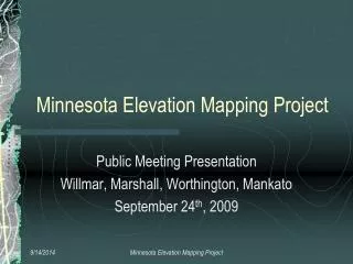

Minnesota Elevation Mapping Project
E N D
Presentation Transcript
Minnesota Elevation Mapping Project Public Meeting Presentation Willmar, Marshall, Worthington, Mankato September 24th, 2009 Minnesota Elevation Mapping Project
Minnesota Elevation Mapping Project • Agenda for today’s meeting • Introductions and Overview (10 minutes) • An Introduction to LiDAR (15 minutes) • The Southeast Minnesota Mapping Initiative • The Minnesota Elevation Project (15 minutes) • Goals • Timelines • Partnering Opportunities • Q & A (20 minutes) Minnesota Elevation Mapping Project
Minnesota Elevation Mapping Project • Steering Committee • Tim Loesch – MnDNR • Project oversight and technical guidance • Chris Cialek – MnGEO • State agency coordination and contracting • Pete Jenkins – MnDOT • Validation point coordination and technical guidance • Ron Wencl – USGS • Coordination with Federal activities Minnesota Elevation Mapping Project
What is LiDAR? • Light Detection and Ranging • Laser Rangefinder • Inertial Measurement Unit • GPS • On-Board Computer • Produces accurate and detailed land elevation data • Hydrologic analysis • Construction Pre-design • 1 – 2 Foot contours Source: Aero-Metric, Inc. Minnesota Elevation Mapping Project Slide courtesy of USGS
Minnesota Elevation Mapping Project • Advantages • Large areas can be gathered economically • Data has a wide variety of applications • Can penetrate some level of ground-cover • High level of accuracy and precision • <1 meter horizontal • <15 cm vertical • 3 cm vertical seperation Minnesota Elevation Mapping Project
Minnesota Elevation Mapping Project • Limitations • Limited window of opportunity to collect • Vegetation and snow free periods in the spring and fall • Flooding is bad too! • Cannot penetrate • Water • Heavy canopy cover • Rain, Snow, Clouds • Lots of data volume • New technology and data Minnesota Elevation Mapping Project
Minnesota Elevation Mapping Project • The typical LiDAR Project involves • Definition of Project Requirements • Accuracy, Extent, Projection, Delivery Formats • Mission planning & execution • Data Processing • Product Generation • Data Delivery/distribution • Validation and Acceptance Minnesota Elevation Mapping Project
Minnesota Elevation Mapping Project • Saturday August 18th – 2007 • Tropical Storm Erin • 24-hour rain totals • 15.10” Hokah • 17” – Caledonia • (unofficial) Minnesota Elevation Mapping Project
Minnesota Elevation Mapping Project • Towns Evacuated • Stockton, Houston, Elba, Minnesota City and portions of Winona • Whitewater State Park • 4,200 Homes Damaged • 7 Deaths • $67 Million Damage Minnesota Elevation Mapping Project
Minnesota Elevation Mapping Project • 7 Counties Declared Disaster Areas • Steele, Dodge, Olmsted, Wabasha, Winona, Fillmore, Houston • Special Session Legislation appropriated monies for flood relief and mitigation Minnesota Elevation Mapping Project
Minnesota Elevation Mapping Project • Great Example of Cooperation and Partnering • $625K – State of MN (flood recovery funds) • DNR – Project Management and oversight • DOT – Validation and project support • $75K – USGS Cooperative Agreement • $122K – Mower and Freeborn Counties • Shell Rock River Watershed District • Turtle Creek Watershed District • Cedar River Watershed District • County Governments • Surveyors • GIS Technicians Minnesota Elevation Mapping Project
Minnesota Elevation Mapping Project • Objectives • To support flood mitigation and prevention efforts • Produce a Highly Accurate Elevation Data set • FEMA specifications • Publicly available data – no restrictions Minnesota Elevation Mapping Project
Minnesota Elevation Mapping Project • Deliverables • Classified LAS Files • Vegetation, Buildings, Bare Earth, Bridges • Edge of Water Break lines • 2’ Contours – Break line Enforced • 1 meter DEM units in meters – Break line Enforced • Projection • UTM Zone 15 projection, NAD83 Datum • Vertical Datum NVD88 Minnesota Elevation Mapping Project
Minnesota Elevation Mapping Project Minnesota Elevation Mapping Project
Breaklines Minnesota Elevation Mapping Project
Coordination, Outreach, Communication Data Coordination TechnologyCoordination Training Guidance Web Services Consulting &Project Support New Geographic Information Office GEOSPATIAL COORDINATION Dr. David Arbeit - Minnesota’s Geographic Information Officer Data Services TECHNICAL INFRASTRUCTURE TECHNICAL SUPPORT www.gis.state.mn.us/committee/MSDI
Minnesota Elevation Mapping Project • Minnesota Statewide Projects • Digital Elevation Committee • Governor’s Council on Geographic Information • Working to achieve publicly available, high accuracy statewide elevation data • Federal, State and County representatives • Limited funding • Ensure data compatibility across collects via standards • Provided guidance and technical expertise Minnesota Elevation Mapping Project
Minnesota Elevation Mapping Project • Minnesota Clean Water Legacy Act • Citizens of the state have invested in water quality • High resolution elevation data can be used for all future water quality projects • Legislative leadership from: • Representative Rick Hanson (39A Dakota Co.) • Senator Ellen Anderson (66 St. Paul) Minnesota Elevation Mapping Project
Minnesota Elevation Mapping Project • Project Scope and Costs • 40,000 square miles to complete state • $8.5 million • Supported Funding • $2.8 Million FY10 • $2.8 Million FY11 • Return to Legislature for additional $2.9 million if necessary Minnesota Elevation Mapping Project
Minnesota Elevation Mapping Project • The Schedule • July Form steering committee • September Public Meetings • October Design RFP • November Post RFP • December Award contract(s) • Spring 2010 First acquisition flight • Fall 2010 Data delivery Minnesota Elevation Mapping Project
Minnesota Elevation Mapping Project • Three Phases • SOUTHWEST – including Minnesota River Basin • CENTRAL LAKES - Mississippi River Basin • ARROWHEAD – Lake Superior Basin Minnesota Elevation Mapping Project
Minnesota Elevation Mapping Project • Anticipated Project Deliverables • Point data – LiDAR LAS files • Edge of water break lines • 2’ Contours – Break line Enforced • 1 meter DEM units in meters – break line enforced • Projection and Datum • UTM Zone 15 projection, NAD83 datum • Vertical Datum NAVD88 • NO concurrent ortho-imagery Minnesota Elevation Mapping Project
Minnesota Elevation Mapping Project • Data will be publicly available • DNR and MnGEO • Actively exploring web delivery options • Web Services • Print a map with an Air Photo backdrop with 2’ contours? • Clip and Ship products • USGS • National Elevation Dataset (NED - http://ned.usgs.gov/) • Raster DEMs • Center for LiDAR Coordination and Knowledge (CLICK) • LAS Point Cloud Data (http://lidar.cr.usgs.gov/) Minnesota Elevation Mapping Project
SE Mn Users Group LiDAR Viewer - http://iwi.houstoneng.com/iwi_lidar/iwi.html Minnesota Elevation Mapping Project
Minnesota Elevation Mapping Project Data will be publicly available DNR and MnGEO Actively exploring web delivery options Web Services Print a map with an Air Photo backdrop with 2’ contours? Clip and Ship products USGS National Elevation Dataset (NED - http://ned.usgs.gov/) Raster DEMs Center for LiDAR Coordination and Knowledge (CLICK) LAS Point Cloud Data (http://lidar.cr.usgs.gov/) 9/14/2014 Minnesota Elevation Mapping Project
Minnesota Elevation Mapping Project • Partnering Opportunities • County and local government • County GIS Coordinator • Point of Contact for Data Delivery • Data conversion and distribution within the county • Survey/Engineering point of contact • Validation point collection • Sharing of existing high-resolution data • Federal • Cost sharing opportunities to stretch $’s Minnesota Elevation Mapping Project
Minnesota Elevation Mapping Project • Vertical Accuracy Validation • Surveyed points with x,y,z • 100 Points per County • 20 points in each of 5 cover categories • Help from county surveyors and other staff • Why do we need this? • Data Validation – we got what we bought • Data Integrity – we want people to trust the data Minnesota Elevation Mapping Project
Minnesota Elevation Mapping Project SE Minnesota 1,092 Surveyed Validation Points! Minnesota Elevation Mapping Project
SE Minnesota LiDAR Update Winona County Validation Report RMSE across cover Types Minnesota Elevation Mapping Project
Minnesota Elevation Mapping Project Winona County Validation Report Minnesota Elevation Mapping Project
Minnesota Elevation Mapping Project • Thank you for attending • Q&A Minnesota Elevation Mapping Project