Download
1 / 18
230 likes | 621 Vues
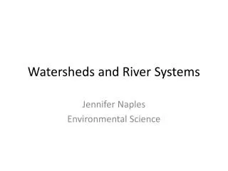
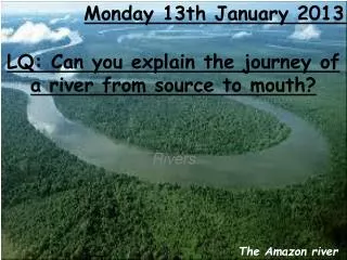
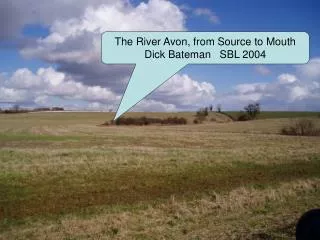
The River Avon – From Source to Mouth. The River Avon, from Source to Mouth Dick Bateman SBL 2004. Lesson Plan ideas. 00 min Learning Objectives for SBL 90 and Teachers at UWE conference. O n Whiteboard - Title How to sketch a river valley from a slide plus Date plus

E N D
The River Avon – From Source to Mouth. The River Avon, from Source to Mouth Dick Bateman SBL 2004
Lesson Plan ideas • 00 min Learning Objectives for SBL 90 and Teachers at UWE conference. On Whiteboard - Title How to sketch a river valley from a slideplus Date plus Learning Objectives 1. To learn how to sketch a river valley from a slide (using key words for valleys). 2. To develop the ability to think and work collaboratively putting photos in sequence 3. To visualise, describe and explain future developments within the valley. 05 min Starter (Review of prior learning) Using the Map of the River Avon Basin Students find the source, note the course and find the mouth of the River Avon. 9 students are asked to name the towns from source to mouth. 10 min Review/register completedActivities explained 1. 10 Students view slides. Students read captions aloud in register order. • 15 mins Teacher shows how to draw a sketch of Sherston slide [6]. Students draw their versions and create their own (share-writing) captions for slide 6 3. 20 mins Students resume viewing slides and reading out the captions. 4. 30 mins Students work in pairs to put photo laminates into likely sequence from source to mouth • 40 Stretcher Pairs discuss then choose the slide where you think there is most likely to be development [houses, roads, bridges, picnic area, woods] IN YOUR LIFETIME. • In exercise books draw slide as it is. Underneath write 3 bullet points to explain why it is likely to develop • 50 Plenary Two pairs review each others’ choices and think up objections. • Extended Work Students draw a second sketch in their books to show how landscape of their chosen slide is likely to develop, with 1 bullet point objection and 1 bullet answer.
The Cotswold Hills scarp slope falls steeply away from here to the west The River Avon starts here. Its source is a spring in the marshy land under these bushes, at about 180 metres above sea level (asl) This ridge on The Cotswold Hills is part of the watershed of the River Avon. On high places like this, snow stays longer. Even though it is high, the source of the river lies on a gentle dip slope. The ground slopes away to the East, so that is where the river flows. Height 180 metres Width 0.1metres Depth 20 mm © Dick Bateman 2004
It is a narrow stream called a rill, flowing through grass and bushes. It is narrow enough to step over and shallow enough just to get your socks wet if you step in it. 0.1 km Height 170 metres Width 0.5 metre Depth 200 mm
There is a farm downstream from where the river starts. This field is used as pasture, probably for cattle, because it is likely to be wet. 1 km from source Height 160 metres Width 2 metres Depth 200 mm The stream has been dammed back into a pond, possibly so that cattle can drink here. After 1 kmthe stream broadens out as it goes under a road bridge.
This village is called Sherston. Steep valley sideThe valley side is too steep to farm, so it is left for woodland The river starts bending around corners. Each bend is called a meander 5 km from source, at Sherston Height 150 metres Width 3 metres Depth 800 mm The Avon now has a flat flood plain on one side of its valley Gentle valley side, used for cattle pasture like the flood plain.
Downstream from Sherston, this building looks new. It was an old mill, using water power to grind corn. It has been renovated into expensive flats Where two rivers meet is called a confluence. The river is now wide enough to need a footbridge 6 km from source Height 150 metres Width 4 metres Depth 900 mm
Upstream from Malmesbury, the river shows rapids and pools. In flood time the river breaks off bits of rock, rounds them off, then dumps them as pebbles in its bed The rapids are where the river flows over rock outcrops. 9 km from source Height 110 metres Width 5 metres Deepest Depth 1.2m The pool is where the river is dammed back behind the rock outcrop.
At Malmesbury this large mill has also been converted into flats. 10 km Height 100 metres Width 10 metres Deepest Depth 3 metres Willow trees are managed by their branches being “pollarded” (cut back so new small shoots grow)
Near Sutton Benger, people like fishing in the river Avon for the peace and quiet. Notice how lines of trees follow the river. The river is now meandering with wide bends. 20 km from source Height 60 metres Width 10 metres Deepest Depth 3 metres This black dot was a mink. It is a very fierce little animal
In Bath. Some businesses take tourists for cruises on the River Avon. Some people live on their boats This is Pulteney weir in Bath. It was designed in a beautiful curve to be an ornamental feature in the centre of Bath. 50km from source Height 15 metres asl Width 20 metres Deepest Depth 4 metres
People like to sail in peaceful places, like the Avon at Saltford. Sometimes people litter in the river. This is polystyrene. 55 km from source Height asl 10 metres Width 25 metres Deepest Depth 4 metres
The River Avon from near Willsbridge Hill. Notice the wide flood plain. The hedge marks the edge of the river terrace which is above the flood plain. Hanham woods are left on the valley sides where it is too steep for farming. The wide flood plain downstream from Keynsham and the Cadbury’s chocolate factory. 58 Km from source Height 7 metres asl Width 30 metres Deepest Depth 6 metres
River Severn Satellite image of the lower course and mouth of the River Avon Avonmouth - mouth of the River Avon
In Clifton Wood, slave traders built large mansions from their profits. This is Hotwells. Some homes here used to be warehouses for trade along the river. 65 km Height 1 metre asl Width 50 metres Deepest Depth 10 metres Narrow boats are now used to live on and as river taxis.
The River Avon flows through its gorge underneath the 50 metres high Clifton Suspension Bridge. 68 km from source Height 1 metre asl Width 40 metres bank to bank Deepest Depth 10 metres [high tide] Its very muddy where it drops all the mud from up stream.
75 km from source Height asl 0 metres Width 50 metres Deepest Depth 30 metres Huge cranes lift containers from the freighter ships Each container can hold 100 tons of goods This dock is near the mouth of the River Avon.
Ideas for further Innovation • Flash for place names e.g. Sherston and geographical features, e.g. meander • Audacity for relevant music, e.g. river sounds, birdsong • Animation where relevant possibly from timelapse photography, e.g. boat being loaded with containers • Link to other activities eg websites, worksheets. • Please add other ideas.