GROUNDWATER
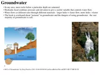
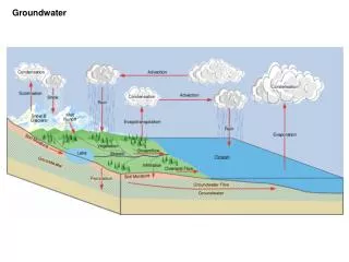
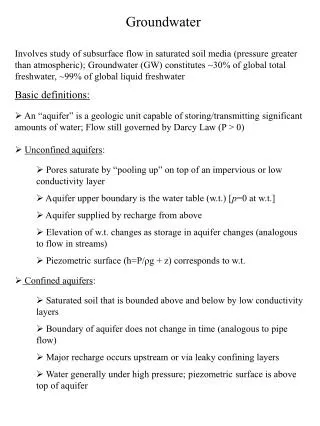
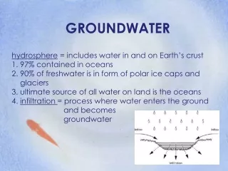
GROUNDWATER. GROUNDWATER. Groundwater is subsurface water that fully saturate pore spaces of bedrock The rate of movement of groundwater is gravity driven, varying between 0.6 inches per day (in sandstones) to several inches per year (in granitics)

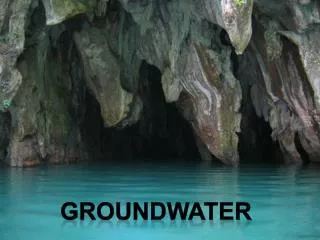
GROUNDWATER
E N D
Presentation Transcript
GROUNDWATER • Groundwater is subsurface water that fully saturate pore spaces of bedrock • The rate of movement of groundwater is gravity driven, varying between 0.6 inches per day (in sandstones) to several inches per year (in granitics) • The source of groundwater is rain and melt water infiltrating and percolating through fractures/pores in soil and bedrock
How much groundwater is there? • Estimates of up to 4 million km3 for groundwater • Surface water – 160,000 km3 • Extraction of groundwater measured in ‘acre-feet’ (the amount of water that covers one acre of land, one foot deep) • California extracts 17-20 million acre-feet (maf) per year • The Ogallala Aquifer in central United States produces 110 maf per year (317 billion gallons of water per year)
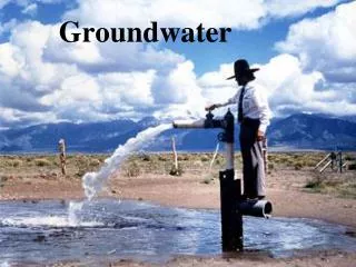
WHO USES GROUNDWATER? • Almost all humans will use groundwater – either directly pumping it into their own cistern or through major metropolitan water transportation systems.
Where is Groundwater Stored? • Groundwater is stored in rock bodies called aquifers. • A good aquifer provides both storage and transmittal of groundwater • Characteristics of aquifers: • Porosity • The number and size of pore spaces, fractures, joints, in bedrock • Provides Storage for groundwater • Permeability • The connectedness of pore spaces, fractures, joints in bedrock • Provides Transmittal for groundwater
What Bedrock makes a Good Aquifer? • Any bedrock with both good porosity and good permeability • Unconsolidated sedimentary rock • Sandstones • Fractured igneous rocks (basalt) or jointed limestone
POROSITY and PERMEABILITY POROSITY PERMEABILITY
What if bedrock only has good porosity or only permeability? • Bedrock with good porosity but poor permeability are call aquicludes or aquitards • These types of bedrock may store water, but cannot transmit it. • Unfractured igneous rock • Metamorphic rock • Bedrock with high amounts of clay • Shales, claystones, mudstones, siltstones
What Is An Unconfined Aquifer? • An unconfined aquifer has little to no overlying sedimentary layers. • There is no confining layer of clay or other impermeable sedimentary layers • The largest unconfined aquifer in the United States is the Ogallala Aquifer which extends from Texas through Oklahoma, Kansas, Nebraska and North Dakota, plus parts of Wyoming, Colorado and New Mexico.
What is a Confined Aquifer? • Confined Aquifers are usually sandwiched between two non-permeable layers. • The confining layers provide pressure on the aquifer, allowing the groundwater to rise to the surface under its own energy – no pumping required: Artesian Wells • Largest Artesian well in United States is the Big Spring in Missouri • Produces 300-400 million gallons of water/day
Decorative Waterwheel placed over original Artesian Wells in SFV (Sportsman’s Lodge) Historic springs exist many places along Ventura Boulevard. This is why the Spaniards established California's first highway, El Camino Real, along this long used pathway. Photo in Archives of The Museum of the San Fernando Valley -2008 - Photo by Gerald Fecht
AQUIFER ZONES • The Vadose Zone: Zone of Aeration • This is the upper zone of an aquifer • Between each pore space and within each joint or fracture, both air and water can be stored • The Phreatic Zone: Zone of Saturation • This is the lower zone of an aquifer • Between each pore space and within each joint or fracture, only water is stored. • Represents the zone within the aquifer designatedas ‘true groundwater’ • Water Table • This is the upper limit of the Phreatic Zone within an aquifer • This is the boundary between the Vadose and Phreatic Zone • Depth of water table determined by wells – they will fill to the level of the water table • Lakes, springs, streams are ‘surface expressions’ of the water table
VADOSE AND PHREATIC ZONES Phreatic zone
California Statewide Aquifers
GROUNDWATER MANAGEMENT CHALLENGES • Laws • Water Table Depletion • Ground Subsidence • Contamination
Laws on Groundwater Usage • Only two states of USA have no laws regarding the use of groundwater: Texas and California • The only requirement for the water to be of “beneficial use” • Recent attempts in California’s Legislature to regulate groundwater have been met with strong resistance from many groups: farmers, municipalities included • Most recent ‘water bill’ passed has some restrictions, but groundwater still not regulated
WATER TABLE DEPLETION • Water table depletion can be the result of natural droughts as well as human activity • Over-pumping wells can result in temporary and permanent lowering of the water table
DRAWDOWN – NO RECOVERY lowered
GROUND SUBSIDENCE • Over pumping groundwater can result in the sinking of overlying layers. • Groundwater acts to ‘buoy’ up overlying sedimentary layers – remove the water and all the pore spaces, fractures, and joints can collapse
SUBSIDENCE Picture from the San Joaquin Valley showing the amount of land subsidence since 1925 due to aggressive groundwater pumping
CONTAMINATION • Groundwater contamination comes in several ways • Landfills and septic tanks • Agriculture • Industrial • Urban • Toxic wastes • Salt water intrusion
AGRICULTURE CONTAMINATION • Pesticides • Insecticides • Herbicides • Fertilizers • Animal Waste
San Fernando Valley/San Gabriel Valley Groundwater contamination