Download
1 / 13
160 likes | 389 Vues
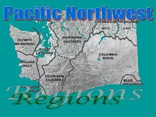
LANDSLIDES IN THE PACIFIC NORTHWEST Recent Advances and Ongoing Challenges West of the Cascades.

E N D
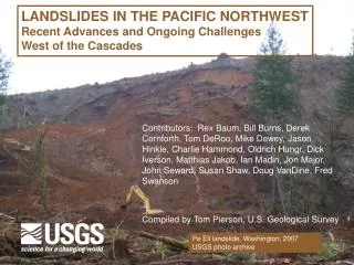
LANDSLIDESIN THE PACIFIC NORTHWEST Recent Advances and Ongoing Challenges West of the Cascades Contributors: Rex Baum, Bill Burns, Derek Cornforth, Tom DeRoo, Mike Dewey, Jason Hinkle, Charlie Hammond, Oldrich Hungr, Dick Iverson, Matthias Jakob, Ian Madin, Jon Major, John Seward, Susan Shaw, Doug VanDine, Fred Swanson Compiled by Tom Pierson, U.S. Geological Survey Pe Ell landslide, Washington, 2007 USGS photo archive
Fundamental advances over last 15 – 20 years? • In predicting the location and timing of landslides • In understanding initiation mechanisms and mechanics of movement • In mitigation of landslide hazards Hwy 229, Oregon, 1998, USGS photo archive
Advances: In predicting the location and timing of landslides--- New landslide imaging and detection technologies • LiDAR (Light Detection and Ranging) imagery for constructing “bare earth” DEMs • InSAR (Interferometric Synthetic Aperture Radar) for detecting small vertical movements of ground surface over variable time intervals • CRTDP (Close-Range Terrestrial Digital Photogrammetry) for mapping natural and engineered rock slopes • TLS (Terrestrial Laser Scanning) for measuring the 3-dimensional coordinates of complex target surfaces using a ground-based instrument
Advances: In predicting the location and timing of landslides--- New or improved models for predicting slope instability and run-out areas • SHALSTAB, a digital terrain model for mapping shallow landslide potential • SINMAP, a stability index model for mapping terrain stability • SCOOPS, a 3-D model that quantifies relative stability of all part of a digital landscape • TRIGRS, a model to analyze time-dependent rainfall infiltration and slope stability • LAHARZ, a semi-empirical method to delineate inundation limits and run-out distances LAHARZ output used in hazard map
Advances: In predicting the location and timing of landslides--- Improved mapping, analysis, and monitoring capabilities • GIS (Geographic Information Systems) – new capabilities in layering, synthesizing, analyzing, presenting spatial data • GPS (Global Positioning System) – portable devices for accurate field locations and mapping • Development of “cheap” automatic instrumentation for real-time monitoring and telemetry of ground movement, precipitation, and ground water • Improvement and wider availability of quantitative precipitation forecasts • Advancement in computer technology High-precision GPS determining location on surface of a landslide Photo: T. Pierson
Advances: In predicting the location and timing of landslides--- Development of debris-flow warning systems • Based on precipitation monitoring and using empirical rainfall and antecedent moisture thresholds (Oregon and Seattle-area systems) • Based on flow detection using acoustic flow monitors or AFMs (lahar warning system in Puyallup and Carbon River valleys at Mount Rainier) Diagram of AFM station installed to detect ground vibrations from passing debris flow
Because lahars can occur without warning, a lahar detection and warning system has been deployed on the west side of Mount Rainier - Seven detection sites on each river -two repeaters -five AFM Sites Tacoma Fife LESA Puyallup Sumner Camp Murray Orting South Prairie Wilkeson Carbonado Carbon River Yelm PuyallupRiver Eatonville Pierce County, Washington Elbe Ashford
Advances– In understanding initiation mechanisms and mechanics of movement • Experimental studies and modeling of field-scale debris flows at USGS Debris-Flow Flume near Eugene, Oregon • One result: recognition of effect of initial soil porosity (and subsequent contraction or dilation during failure) in determining whether slide mass will liquefy to form a debris flow • Numerous long-term, real-time monitoring studies of landslides and other focused field studies • One result: recognition of effects of canopy removal in triggering debris flows in steep forested terrain Experimental debris flow at USGS flume on 14 Jun 2007 Photo: R. Iverson
Advances: In mitigation of hazards (in addition to those already covered) • Landslide inventory maps – increased production, wider availability • Oregon Senate Bill 12 – a step toward putting hazard maps to work • Some improved awareness of landslide hazards among agencies • Interagency partnerships • Improved mitigation engineering practices Debris flow on Oregon highway, 2007 USGS photo archive
Outstanding problems and issues? • Limited understanding of inherent complexity of natural slopes and precipitation variability • Limited ability to accurately predict location and volume of landslides • Inadequate coverage of landslide inventories • Uncertain effects of climate change on landslide hazards • Limited funding for landslide investigations • Perceived disconnect between academic researchers and geotechnical practitioners • Lack of regional systems for documenting landslide occurrence in real time • Reluctance of regulatory agencies (in the face of development and “property rights” pressures) to fully utilize landslide studies and maps to regulate development Debris-flow tracks, Oregon Coast Range USGS photo archive
Informing the emergency managers, land managers, elected officials, and the public about landslide hazards: How are we doing? • Difficult to assess • Many emergency managers have a relatively good understanding of landslide hazards, especially if jurisdictions recently affected. • Some elected officials, high-level agency managers, and residents in high-risk areas have only a minimal awareness or understanding of landslide hazards School in potential lahar path, Orting, Washington Photo: D. Wieprecht
Possible solutions for more effective mitigation: • More (and more effective) educational outreach, including more use of the media • More interaction and information transfer between academic researchers and landslide practitioners • More exposure of agency heads and elected officials to landslide issues • More government support for application of landslide hazards maps Magnolia area, Seattle, 1997 USGS photo archive Most scientists (and engineers?) don’t want to bother with outreach . . .
But it’s worth the effort. Home at head of landslide, Stevenson, Washington, 2007, soon to be lost to retrogressing head scarpPhoto: T. Pierson