Download
1 / 45
450 likes | 525 Vues
Study on flash floods linked to cutoff cyclones in Northeast. Analysis, methodology, case study, and conclusion presented with data from 2003-2009. Findings emphasize meteorological conditions leading to flash floods.

E N D
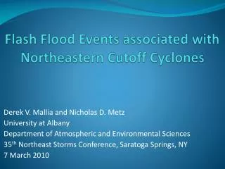
Flash Flood Events associated with Northeastern Cutoff Cyclones Derek V. Mallia and Nicholas D. Metz University at Albany Department of Atmospheric and Environmental Sciences 35th Northeast Storms Conference, Saratoga Springs, NY 7 March 2010
Outline: • Methodology • Climatology of flash flood (FF) producing cutoff cyclones • monthly distribution • mean location relative to moisture transport • forcing mechanisms • Case Study • 250-hPa wind analysis • 500-hPa height and vorticity analysis • 850-hPa wind and precipitable water analysis • Conclusion
Data Sources • Earth System Research Laboratory (ESRL) daily composites • Rapid Update Cycle (RUC20) • Advanced Weather Information Processing System (AWIPS) • Weather Event Simulator (WES) • Geostationary Operational Environmental Satellite (GOES) • Albany Radar (KENX)
Methodology • Examined warm season FF events that were associated with convection (May through September) • FF event defined as one or more days under a similar weather feature with at least one FF report verified by the National Weather Service • A widespread FF event is defined as multiple FF reports that are separated by at least 40 km • An isolated FF event is defined as a one or more FF reports that occur within 40 km
Methodology (cont.) • Only events with a closed height contour at the 850 & 300 hPa levels were considered for the FF cutoff cyclone climatology • Cutoff cyclones had a minimum depth of 30 meters at 850 hPa and were cutoff for at least 24 hours
Methodology (cont.) • Dataset consists of FF and cutoff cyclone events that affected the Albany County Warning Area (CWA) between the years 2003 and 2009 that meet previous criteria listed
FF-Producing Cutoff Cyclone Climatology • Out of the 39 FF days in the Albany CWA between 2003-2009, 11 were the result of cutoff cyclones • Out of these 11 FF days that resulted from a cutoff cyclone, 8 were considered widespread incidents while 3 remained isolated • Out of the 7 cutoff FF events, 3 resulted in multiple days of FF reports
Frequency of Cutoffs and FF Producing Cutoffs that affect the Albany CWA (2003-2009) - Cutoffs - FF Producing Cutoffs Number of Cutoffs Months
Precipitable Water Normals and Departures for Albany, NY Precipitable Water (mm) Months
Mean 500-hPa geopotential heights for FF producing cutoff cyclones Composite of flash flood producing cutoff cyclone events (m) N=11
Cutoff Cyclone Tracks Tom Wasula et al, 2009
Mean 250-hPa vector winds for FF producing cutoff cyclones Composite of flash flood producing cutoff cyclone events (m s1) N=11
Mean 850-hPa meridional winds for FF producing cutoff cyclones Composite of flash flood producing cutoff cyclone events (m s1) N=11
Anomalous 850-hPa meridional winds for FF producing cutoff cyclones Composite of flash flood producing cutoff cyclone events (m s1) N=11
Precipitable water anomalyfor FF producing cutoff cyclones Composite of flash flood producing cutoff cyclone events (kg m2) N=11
Mean 700-hPa vertical motion for FF producing cutoff cyclones Composite of flash flood producing cutoff cyclone events (Pa s1) N=11
Neutral Type A Tilt Tom Wasula et al, 2009
FF Producing Cutoff Cyclones: What to Look for… • Great Lakes track cutoff cyclone with a Neutral Tilt Type A • Anomalously strong meridional flow coming off the Atlantic Ocean which provides a sufficient moisture transport for storms • Forcing mechanism from either an upstream vorticity maximum, surface boundary, or favorable position in local jet max • Low to moderate amounts of instability and CAPE sufficient enough to cause a flash flood event
Synopsis of the 30 June–1 July 2009 FF Event • Widespread FF event • 13 reports total • Occurred in the following counties: • Albany • Columbia • Bennington • Montgomery • Rensselaer • Saratoga • Schenectady • Ulster • Washington • Multiple day event • Associated with cutoff cyclone over Lake Ontario
30 June (Day 1) • Consisted of 3 FF reports in the following counties (3 reports) • Bennington (1 report) • Montgomery (1 report) • Ulster (1 report) • FF reports occurred between 1700–2300 UTC • Significant severe weather event as there were multiple large hail and wind reports throughout the CWA
CAPE: 1,753 J/kg PWAT: 31.2 mm Dewpoint: 17 C K index: 32 Freezing level: 3,293 m
1200 UTC 30 June 2009 500 hPa Heights (dam), Absolute Vorticity (> 16 105 s1), and Wind barbs (kt)
1800 UTC 30 June 2009 500 hPa Heights (dam), Absolute Vorticity (> 16 105 s1), and Wind barbs (kt)
2100 UTC 30 June 2009 200 hPa Heights (dam),Wind Speed (kt), and Wind barbs (kt)
1800 UTC 30 June 2009 Precipitable Water (mm), and 850-hPa Wind barbs (kt)
2100 UTC 30 June 2009 Precipitable Water (mm), and 850-hPa Wind barbs (kt)
1 July (Day 2) • Consisted of FF reports in the following counties (10 reports) • Albany (2 reports) • Columbia (1 report) • Rensselaer (1 report) • Saratoga (2 reports) • Schenectady ( 3 reports) • Washington (1 report) • FF reports occurred between 1900–2200 UTC • Significant flash flooding
CAPE: 1,914 J/kg PWAT: 31.2 mm Dewpoint: 18 C K index: 32 Freezing level: 3,192 m
1500 UTC 1 July 2009 500 hPa Heights (dam), Absolute Vorticity (> 16 105 s1), and Wind barbs (kt)
1800 UTC 1 July 2009 500 hPa Heights (dam), Absolute Vorticity (> 16 105 s1), and Wind barbs (kt)
1500 UTC 1 July 2009 200 hPa Heights (dam),Wind Speed (kt), and Wind barbs (kt)
1800 UTC 1 July 2009 200 hPa Heights (dam),Wind Speed (kt), and Wind barbs (kt)
1500 UTC 1 July 2009 Precipitable Water (mm), and 850-hPa Wind barbs (kt)
1800 UTC 1 July 2009 Precipitable Water (mm), and 850-hPa Wind barbs (kt)
Conclusions: • FF producing cutoff cyclones generally occur during June, July, & August and track across the Great Lakes • Cutoff cyclone FF events often result in multi-day, widespread incidents due to slow progression of the cyclones and/or antecedent weather conditions • FF producing cutoff cyclones tend to occur near anomalously strong moisture transport with forcing for ascent associated with upstream vorticity maxima and upper-level jet stream • Neutral tilt Type A most favorable type of cutoff cyclone for flash flooding
Acknowledgements • Joe Villani; NWS Albany • Tom Wasula; NWS Albany • Neil Stuart; NWS Albany • Ross Lazear; University at Albany • Alan Srock; University at Albany • Jonas Asuma; University at Albany • Kyle MacRichie; University at Albany • Kyle Griffin; University at Albany • And my classmates!