Download
1 / 31
310 likes | 479 Vues
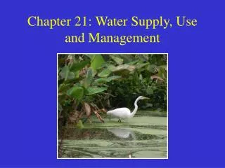
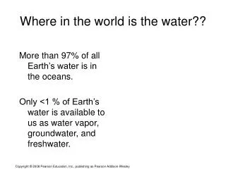
Where in the world is the water??. More than 97% of all Earth’s water is in the oceans. Only <1 % of Earth’s water is available to us as water vapor, groundwater, and freshwater. The Hydrologic Cycle ( Water Cycle). Earth’s waters are constantly circulating. The driving forces are:

E N D
Where in the world is the water?? More than 97% of all Earth’s water is in the oceans. Only <1 % of Earth’s water is available to us as water vapor, groundwater, and freshwater.
The Hydrologic Cycle(Water Cycle) Earth’s waters are constantly circulating. The driving forces are: • Heat from the Sun • Force of gravity
The Hydrologic Cycle Controls the circulation of water on Earth. Processes involved: • Evaporation • Condensation • Precipitation • Infiltration • Runoff
The Hydrologic Cycle Water makes a complete loop. The journey is not always direct. • Can flow as groundwater • Can be frozen in ice caps and glaciers
The Hidden Water Groundwater – Saturated zone—water has filled all pore spaces. Unsaturated zone—pores filled with water and air. The water table is the boundary between these two zones.
Water Table The depth varies with precipitation and climate. • Zero in marshes and swamps, hundreds of meters in some deserts. • At perennial lakes and streams; is above the land surface. • Tends to rise and fall with the surface topography.
Storage and Movement of Groundwater Factors: • Porosity: ratio of open space in soil, sediment, or rock to total volume of solids —the amount of open space underground. • Greater porosity equals more potential to store greater amounts of groundwater. • Particle size, shape, and sorting influence porosity. Soil with rounded particles of similar size has higher porosity than soil with various sizes.
Storage and Movement of Groundwater Permeability • Degree to which groundwater can flow through a porous material—higher permeability, greater potential for fluid flow. • Influenced by sediment packing and connectedness of pores. • Measured by hydraulic conductivity
Groundwater Darcy’s law: Groundwater flow rate = hydraulic conductivity cross-sectional area hydraulic gradient
Aquifers • Reservoirs of groundwater. • High porosity and high permeability. • Underlie the land surface in many areas; they are a vital source of fresh water. It is important to keep this vital source of fresh water clean and contaminant free.
A perched water table- discontinuous, low-permeability layers in an unconfined aquifer trap water that is percolating downward.
The Work of Groundwater Flowing groundwater can alter and change features at the surface: • Land subsidence • Caves and caverns • Sinkholes
Land Subsidence: • Extreme groundwater withdrawal by pumping from wells can result in lowering of the land. • Especially prevalent in areas underlain by sandy sediments and interbedded clays. The clays leak water to the sand, then when water is pumped out, the clays shrink and compact, causing subsidence.
Caverns and caves • The dissolving action of groundwater “eats away” at rock—limestone in particular. • Rainwater chemically reacts with CO2 in the air and soil, producing carbonic acid. • The acidified water seeps into rock partially dissolving it.
Surface WaterRivers, lakes, reservoirs Rivers sculpt and shape Earth’s surface: • Erosion—carves the landscape (fast water) • Deposition—shapes the land as sediment is deposited (slow water)
Surface Water Stream channels in high mountain areas cut into underlying rock. Fast-moving rapids and beautiful waterfalls are characteristic of V-shaped mountain stream valleys.
Streamflow Laminar flow—gentle, not impeded, often fast Turbulent flow—impeded, “White water” and often slower
Velocity factors • Gradient, or slope • Channel characteristics (shape and size) • Discharge—volume of water moving past a given point in a certain amount of time
Velocity Stream speed - usually not constant along the length of a stream. • As stream moves downslope, gradient decreases and the channel widens. • Discharge usually increases as tributaries add water. Average stream speed=discharge/cross-section (River speeds never go more than 4-5 mph)
The Work of Surface Water Stream erosion: • Loosely consolidated particles are lifted • Hydraulic action • Abrasion Stronger currents lift particles more effectively: • Stronger currents have “higher” energy • Lift and transport more and bigger particles • Turbulent flow most effective
Stream Sediment Load • Dissolved load- dissolved ions • Suspended load- clay-silt • Bed load- sand, gravel, pebbles, boulders
Speed varies within channel Slower along the stream bed Greater near the surface. Maximum flow speed occurs mid-channel.
Erosion vs. Deposition Stream speed plays a role • Fast water erodes the bank • Slower water deposits sediments
Floodplain Meandering streams create a wide belt of almost flat land: a floodplain. When a flood occurs, sediment is deposited in the floodplain. Large, coarse sediment creates natural levees.
Drainage Basin-the land area that contributes water to a stream. Drainage Divides- separate basins The largest drainage divides are continental divides. Drainage basins and divides
The Work of Surface Water A delta is where a flowing stream meets a standing body of water. The flow slows down and the stream dumps sediment. The result is a fan-shaped deposit of new land.
Glaciers and Glaciation Accumulation of snow and ice thick enough to move under its own weight • Two types: • Alpine • Continental
Glaciers and Glaciation Alpine glaciers develop in mountainous areas, confined to individual valleys. Cascades, Rockies, Andes, Himalayas Continental glaciers cover broad expanses . Antarctica and Greenland
When glacial ice melts, it drops a poorly sorted load of boulders, pebbles, sand, and clay. Poor sorting is the hallmark that differentiates glacial sediment from material deposited by streams and winds.
Growing or Retreating The mass of a glacier changes over time. As snow falls, accumulation makes the glacier grow. As ice melts, sublimates, or breaks off, ablation occurs.
The Work of Wind Wind blows everywhere, but its impact on sculpting the land is minor. Impact is greatest where: • Strong winds blow frequently • Vegetation is sparse or absent • Plant roots keep particles together • Plants deflect wind and shelter particles • Surface particles are small • Small particles are more easily lifted and transported