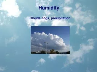
Clouds and Humidity
Clouds and Humidity. The Water Cycle. Three Requirements for a Cloud :. A cooling mechanism Moisture Condensation nuclei Clouds form by moist air cooling. Warm air can dissolve more water than cold. We cannot see dissolved water in air. Causes of cooling :.
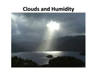

Clouds and Humidity
E N D
Presentation Transcript
Three Requirements for a Cloud: • A cooling mechanism • Moisture • Condensation nuclei Clouds form by moist air cooling. Warm air can dissolve more water than cold. We cannot see dissolved water in air.
Causes of cooling: • By rising: Adiabatic Cooling a decrease in pressure (in our lab) • By contact with a cold surface
There are three main types of clouds: Stratus Cumulous Cirrus
Stratus • Horizontal Layers, Sheet-like clouds (condensation is low to the ground) • Stratus clouds are grayish clouds that usually cover the entire sky. • Looks like fog.
Formation of Fog With some wind, the layer of cold air at the surface is mixed into the lowest few meters of the atmosphere. When the temperature drops below the dew point, the excess water vapor condenses on the ground as dew and also in the air as fog (tiny droplets of water).
Cirrus Clouds • Occur at high altitudes • Mostly ice crystals
Cirrus Clouds Cause a Halo around the moon. Folklore has it that a ring around the moon indicates bad weather is coming, and in many cases this may be true. The ice crystals that cover the halo signify high altitude, thin cirrus clouds that normally precede a warm front by one or two days. Typically, a warm front will be associated with a low pressure system which is commonly referred to as a storm.
Cumulous Clouds • Fair weather clouds • Created by vertical movement • Fluffy, flat-bottomed clouds
Cumulonimbus Clouds Indicates Heavy Rains
Hail can cause the most damage, especially if wind blow. It can damage crops or structures Hail forms in cumulonimbus clouds during a thunderstorm when water freezes in layers around a small nucleus of ice. Hailstones grow larger as they're tossed up and down by rising and falling air.
Thunderstorms can produce: http://upload.wikimedia.org/wikipedia/commons/d/d6/LightningCNP.ogg
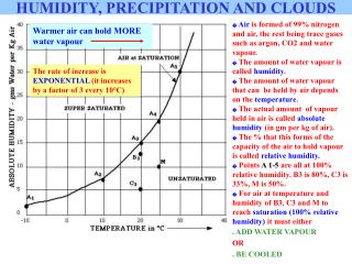
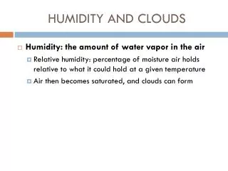
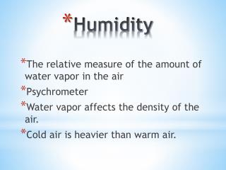
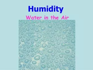
HUMIDITY: Amount of moisture in the air • RELATIVE HUMIDITY: Ratio of water dissolved IN air to the amount that COULD BE dissolved in the air • SATURATION: Air has all the water vapor it can possibly “hold” or dissolve.
As temperature decreases relative humidity increases when water vapor is constant.Warm air can dissolve more water!
Dry Bulb TemperatureThe dry bulb temperature is the air temperature measured using a standard thermometer. It is the temperature reported in daily weather forecasts and is sometimes referred to as the ambient air temperature. Wet Bulb TemperatureThe wet bulb temperature with a standard thermometer and a wet piece of cloth covers the bulb of the thermometer. As air passes over the wet cloth, the water in the cloth evaporates, drawing heat out of the thermometer.
Relative humidity using wet bulb and dry bulb temperatures. • If the air is very humid (moist), only a small amount of moisture will evaporate from the cloth. This means the wet bulb temperature will only be a little lower than the dry bulb temperature.Conversely, if the humidity of the air is low (dry), the moisture will evaporate from the cloth quickly. This means that the wet bulb temperature will be much lower than the dry bulb temperature.If it is raining or there is heavy fog, the air is saturated, and the dry bulb temperature will be equal to the wet bulb temperature.
Dew forms when the air in contact with the ground cools and can no longer “hold” all the water it had dissolved in it at a higher temperature. The air becomes saturated. This excess water vapor condenses and this liquid water appears as dew. The temperature at which this happens is the dew point. If the dew point temperature is below the freezing point, excess water vapor changes from the gas to the solid phase (deposition) forming frost. Dew and frost typically form overnight as temperatures decrease.
Adiabatic Cooling (from rising air)is different for dry vs wet air. Why does air cool slower in wet air?
Dry versus Moist-Adiabatic Process The moist adiabatic lapse rate is less than the dry adiabatic lapse rate because as vapor condenses into water (or water freezes into ice) for a saturated parcel, latent heat is released during condensation.
Dry and Moist Adiabatic Cooling For Chinook Winds the moist air cools at a slower rate on the way up then it warms on the way down on the other side.
Fronts • Boundary between contrasting air masses • Stationary front: boundary is stationary on the landscape • Cold front: cold air moves into a region occupied by warmer air • Warm front: warm air moves into a region occupied by colder air • occluded front: a cold front "catches up" with a warm front forcing all warm air off the ground
Source Areas for Air Masses In the Flathead Valley we are influenced by cold air masses from the North, Pacific air masses from the west and Continental tropic air masses from the Southwest.