Enhanced Web GIS Viewer with MapObjects Java for Cost Efficiency
Learn how we developed a dynamic Web GIS viewer using MapObjects Java to cut operating costs and improve user experience. Explore the challenges, benefits, and expanded functionality of our solution.

Enhanced Web GIS Viewer with MapObjects Java for Cost Efficiency
E N D
Presentation Transcript
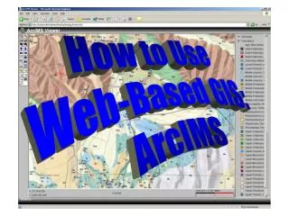
Developing a Web-based GIS Viewer using MapObjects Java to Reduce Operating Costs
Outline • Introduction • Why the need? • Alternatives • Our Solution • Challenges • Application Functionality
Introduction • ISA serves 16 Agencies, 5 Departments • Approximately 500 ArcView 3.x licenses • Upgraded to 175 ArcView 8.x licenses • Further refined to 31 single use and 48 floating licenses as IDV was developed • A large majority are casual users who: • View data • Add local data • Print • Find addresses • Save projects
Why the Need? • License maintenance costs • For a majority of our users, ArcView was too robust. • What are the alternatives to ArcView (2003)?
Our Initial Solution • Initial solution was to use ArcIMS Java Custom Viewer • Limitations encountered during development • Very limited object model • Not very flexible • Is based on MapObjects Java 1.0 • Limitations in selection capabilities. • Couldn’t view attribute table • No printing capabilities
Our Second Try • Discovered that ArcIMS Custom Java Viewer applets were built on MapObjects Java…therefore we decided to build our own applets on MapObjects Java • Switched to MapObjects Java 2.0+ • Access to more base objects • Much more flexibility
Challenges • Silent installation – 3 different vendors to work with (ESRI, Sun, Microsoft) • Rewriting/reinventing the wheel • Encountering intrinsic bugs due to the scale of this project
Benefits • Reduce license costs!!! • No desktop installations • All installations are silent behind the scenes over the Intranet • All ArcIMS Java Custom Viewer limitations were overcome • The wheel is now our own wheel to fix and extend
Key IDV functionality • Adding Data • Favorites folder • Geography Network • View metadata
More Functionality • Attributes Dialog
Functionality… Summarize Attributes
Functionality… Single geocoding Batch geocoding:
Functionality… • Manual Label/Annotation
Functionality… Custom Printing
Functionality… View Metadata
Functionality Context Sensitive Help Tutorials FAQ Known Bugs List