Download
1 / 48
480 likes | 567 Vues
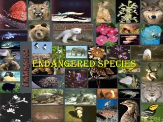
Explore the use of GIS technology for analyzing federally threatened and endangered species in Indiana, including data sources, analysis tools, and communication of results. Learn about species like the Bald Eagle, Gray Bat, and Indiana Bat, as well as habitat analysis methods and wildlife corridor evaluation. Discover how GIS can aid in conservation efforts and species management.

E N D
USING GIS FOR ENDANGERED SPECIES ANALYSIS • Federal TES (threatened and endangered species) in Indiana • Need for Analysis • Data sources • Analysis Tools • Analysis Examples • Communicating Results
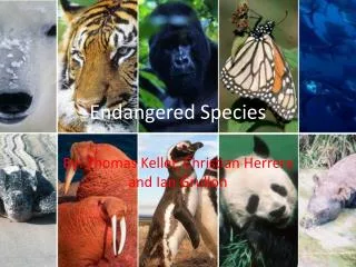
Federally Listed Birds Interior Least Tern Piping Plover Bald Eagle -- Delisted
Federally Listed Insects Karner Blue Butterfly Mitchell’s Satyr Butterfly Wild Blue Lupine Fen American Burying Beetle Hine’s Emerald Green Dragonfly
Federally Listed Bats Gray Bat Indiana Bat Indiana Bat Habitat
Federally Listed Reptiles Copperbelly Water Snake Eastern Massasauga Rattlesnake
Federally Listed Plants Lesquereux’s Mustard (Short’s Bladderpod) cliffs, calcareous rock Dune (Pitcher’s) ThistleGreat Lake Dunes Mead’s Milkweed tall grass prairie or glade Short’s Goldenrod glades, wood edges Running Buffalo Clover woodlots, parks, trails Prairie White-fringed Orchid prairies and fens
Need for Analysis • Research • Section 7 Consultation(Federally listed only) • Planning and Management of Development and/or Mitigation in Natural Areas
Data: Locating Species • Indiana Natural Heritage Database(IDNR, Division of Nature Preserves) • USFWS, Field Office • Investigators from universities or agencies listed in research literature • Local/Regional biologists, naturalists, and land managers • Suitable habitat (land cover layers, aerial photographs) • Field survey in coordination with USFWS
Data: Field Survey • GPS • Sampling locations • Digital photograph locations • Telemetry • GIS • survey planning • Random sample points • Results analysis • Accuracy Assessment
Data: Digital Base Layers Indiana GIS Atlas – (INDOT, BLA, IGS)
Data: Digital Base Layers Indiana Spatial Data – (IU)
Data: Digital Base Layers Indiana View – (GloVis)
Data: Digital Base Layers County/City Online Maps and Data – (IGIC)
Data: Digital Base Layers Geospatial Data Clearinghouses Forest Service U. S. Department of Agriculture Fish and Wildlife Service National Hydrography Dataset Information Data Agriculture Statistics Demographic Statistics
Creating Spatial Data • GPS Data Collection • Digitizing Hardcopy • Summarizing Tabular Information with a spatial component • Creating data from coordinates
Creating Spatial Data • Interpolating Grids from Sample Points • Photo Interpreting Aerial Photography • Remote Sensing • METADATA, METADATA, METADATA!!!!!
Movement Analysis & Home Range • Animal Movement Analysis • Home Range, Path Analysis, Location Analysis • Spatial Tools • Population Viability Analysis • creates life tables and evaluates the probability of extinction in the face of variation. • Oceanographic Analyst
Point Data Analysis • Stratified Interpolation • Generates Reference Map • Analysis of Map Similarity • Capture Point Value • Generate Random Points
Other Tools • Alternate animal movement routes • Nearest Features • Matched Features Distance/Azimuth • Random points • Weighted Means • Convex Hulls • Grid, Surface Area, Slope Tools • Mahalanobis Distances
Wildlife Corridors • Corridor Design [ArcCatalog] • HSI, Corridor Models, DEMs to slope position raster • Corridor Evaluation [ArcMap] • Compares widths and bottlenecks, distance between patches, statistics
Ovenbird Prairie warbler Henslow’s sparrow Hooded warbler Cerulean warbler Yellow-breasted chat Pine warbler Worm-eating warbler Wood thrush Wild turkey Ruffed grouse American woodcock Northern bobwhite Gray squirrel Black bear Bobcat Red bat Northern long-eared bat Indiana bat Red backed salamander Timber rattlesnake USFS – Northern Research Station http://www.nrs.fs.fed.us/pubs/1865 Journal of Wildlife Management. 2007. 71(2): 668-670 Landscape Habitat Suitability Models for 21 Species
Functional Linkage of Watersheds and Streams (FLoWS) • aquatic and terrestrial landscapes are hydrologically-linked • Functional Connectivity Tools (FunnConn) • landscape connectivity is examined from a functional perspective • Spatially balanced sampling • provides environmental managers a practical, useful GIS tool to generate simple, efficient, and robust survey designs for natural resource applications
R is a free software environment for statistical computing and graphics
Species Probability Distributions • Biomapper • Performs Ecological Niche Factor Analysis and outputs a habitat suitability model • GARP • Predict and analysis species distributions • openModeller • creates a fundamental niche model and projects the model into an environmental scenario
Biological Reach • Biological reach vs. Project Footprint • How far away will impacts from the project effect the species of interest both directly and indirectly?
Data Collection • DNR Databases • USFWS Recent Records • Field Data Collection • Small Scale Land Cover • Large Scale Land Cover • Photo Interpretation • Habitat Line Transects
1990 30m LULC 2003 5m Tree cover
Discuss Analysis Early and Often • Frequent, informal communication • GIS creates images for discussion • GIS quickly runs different tolerances to determine methods
Sharing Data • Email • ArcExplorer • METADATA – no data leaves home without it.
Confidentiality Issues • Digital data is easily shared • Use restricted folders • Place lots of notices in metadata • Use “confidential” in the filename • Work with regulatory agencies on the best ways to protect confidential hardcopy documents.
File Management • Detailed file management is a MUST • Archive old versions of maps and data • Fully describe methods in metadata or other documents.
Contact Information Cinda Bonds Wildlife Biologist Bernardin, Lochmueller & Associates cbonds@blainc.com Evansville, Indiana 812-479-6200 Indianapolis, Indiana 317-222-3880
Data References INDIANA ATLAS http://129.79.145.7/arcims/statewide_mxd/index.html INDIANA SPATIAL DATA PORTAL http://www.indiana.edu/~gisdata/index.html INDIANA COUNTIES / CITIES http://www.in.gov/igic/maps/index.html INDIANA VIEW http://www.indianaview.org/objectives.cfm FOREST SERVICE GEODATA CLEARINGHOUSE http://svinetfc4.fs.fed.us/clearinghouse/index.html FOREST INVENTORY AND ANALYSIS DATA http://www.fia.fs.fed.us/
Data References USDA SPATIAL DATA GATEWAY http://datagateway.nrcs.usda.gov/NextPage.aspx FWS GEOSPATIAL DATA INVENTORY http://www.fws.gov/data/datafws.html GEODATA.GOV http://www.fws.gov/data/datafws.html INDIANA AGRICULTURE STATISTICS http://www.nass.usda.gov/Statistics_by_State/Indiana/index.asp INDIANA DEMOGRAPHIC STATISTICS http://www.stats.indiana.edu/http://www.zipskinny.com/ NATIONAL HYDROGRAPHY DATASET http://nhd.usgs.gov/index.html
Software References CLEARINGHOUSE FOR ECOLOGY SOFTWARE – IL NATL HISTORY SURVEY http://nhsbig.inhs.uiuc.edu/ JENNESS ENTERPRISES http://www.jennessent.com/arcview/arcview_extensions.htm OPEN MODELLER http://openmodeller.sourceforge.net/ DESKTOP GARP http://www.nhm.ku.edu/desktopgarp/ BIOMAPPER http://www2.unil.ch/biomapper/ DUKE GEOSPATIAL ANALYSIS PROGRAM http://www.nicholas.duke.edu/geospatial/software/
Software References STARMAP http://www.nrel.colostate.edu/projects/starmap/ R PROJECT STATISTICS http://www.r-project.org/index.html PATCH ANALYST http://glash.lakeheadu.ca/~rrempel/patch/ FRAGSTATS http://www.umass.edu/landeco/research/fragstats/fragstats.html ANIMAL MOVEMENT / SPATIAL TOOLS / POPULATION VIABILITY ANALYSIS http://www.absc.usgs.gov/glba/gistools/index.htm CORRIDOR DESIGNER http://www.corridordesign.org/ LANDSCAPE HSIMODELS http://www.nrs.fs.fed.us/pubs/1865